GEONAFT-QI Dip Module
Features:
- Can be used to independently define the dip angles with high accuracy.
- Creates a geosteering model based on up-to-date technology using the Well Images (Images).
- Defines the trajectory of the well relative to the reservoir with high precision.
- Using the azimuth logging data, allows to define the angle of the well to the geological stratifications.
- Minimizes geosteering costs.
Short Technique Description
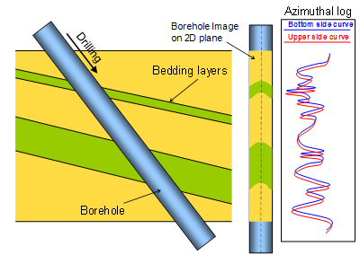
Using only the traditional logging while drilling is difficult. Such logs do not provide azimuthal direction of the measurements in the well. The result is that changes in lithology can be interpreted as drilling up the stratification or down the stratification. Azimuthal logging can help determining what sector of azimuth (top, bottom, left or right) starts changing lithology of rocks. That information can show the direction of the well’s trajectory in the bed.
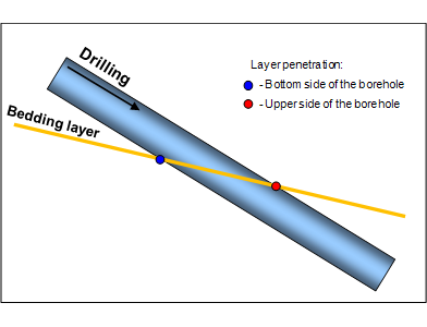
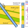
At the intersection of the well and strata down the stratification, the bottom sensor hits a interlayer first, then the right and left side sensors and the last of all the top sensor. When crossing the interlayer up the stratification, the order of the sensors detection will be reversed.
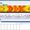
Well Image
With more azimuthal sensors, recorded data will be consistent around the borehole. If the recorded logs (with a gradient color fill) are presented on a 2D diagram, resulting image is called the Well Image.
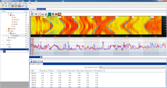
QI Dip Module (Quadro & Image dip)
An additional module «QI dip» can calculate the dip angles in two two different ways:
- using data from the well image
- using the azimuth logging data in quadrants
The user can perform the calculation separately for each of the the methods, or using both methods simultaneously.
Rating
Visits
779
Redirects
167
Don't Miss Out! Get the Best Deal on this Software - Email Us Now!