PathView - Well Path Visualization
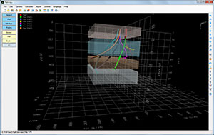
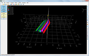
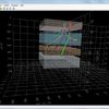
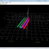
- True 3D-rendered wellpath visualization
- Anti-collision calculations
- Surface lease lines
- Lithology
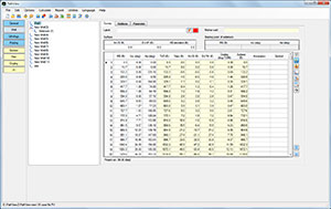
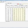
- Copies survey data from Microsoft Excel®
- Imports survey data from text or PDF file
- Up to 5,000 rows of survey data
- Plots specified wellbore range
- Up to 10 sidetrack levels
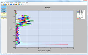
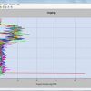
- Plots and prints detailed well profiles
- Plan view, Section view, 3D view and Dogleg
- Up to 5 kinds of parameters along the wellbore
- Up to 20 different wellbore sizes
- US oil field, metric or customized unit systems
- Generate Microsoft Word®, Excel® and PowerPoint® reports
Rating
Visits
1,328
Redirects
279
Don't Miss Out! Get the Best Deal on this Software - Email Us Now!