wellViz3D™ is a 3D down hole visualization tool, making the invisible visible, providing a better understanding of what is going on in and around the well. wellViz3D™ can be connected to a range of data sources, and can visualize the drilling operation in real time in a 3D scene, comprising formations, seismic and all existing and planned well trajectories. Team members can connect to the same session, and thereby share the same data and info, yet being able to navigate wellbore and information individually. Combining the wellViz3D with products like wellSim™ or wellAhead™ will give an advantage for decision makers in training, planning or during a real time operation. Using one 3D visualization tool for all parts of the well life cycle makes sure information is visualized the same way during all operations. This will help maintaining a high awareness during all operations during the well life cycle on the different operational tasks and the risks connected to them. Can be used standalone or with:
- wellSim™ product family
- wellAhead™
- wellBalance™
BENEFITS
- Reduce NPT by better decision support in planning and operations
- Quicker and better decisions as relevant multi-source info is available, visible and displayed in its context
- Multi-disciplinary, distributed teams share same info
- Improved risk management by risk visibility along wellbore/drill string
- Share status/simulations across distributed teams and disciplines (common visual risk register, visual navigator for well documents, simulation results, rationales, etc.)
- Multi-disciplinary collaborative sessions (problem solving, drill-well-on-simulator, design reviews, etc.)
- Unparalleled insight and understanding of well and field during operations
FEATURES
- Drilling console replica (drilling chairs, VR drill floor, BOP/Choke panel, CCTV, radio/intercom)
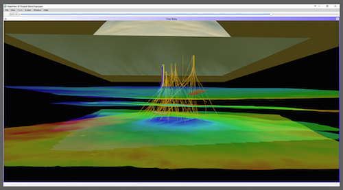
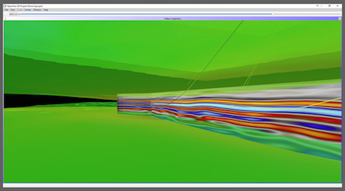
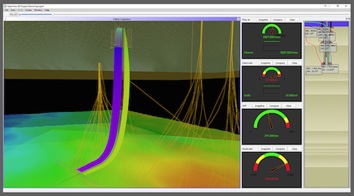
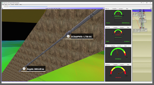
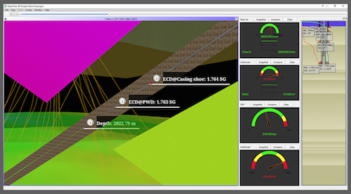
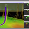
- 3D Visualization with risk/info messages, proximity wells, formations, etc.
- All information visualized in its context
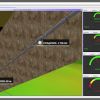
- Three flying modes
- Free flying
- Follow BHA item
- Follow trajectory
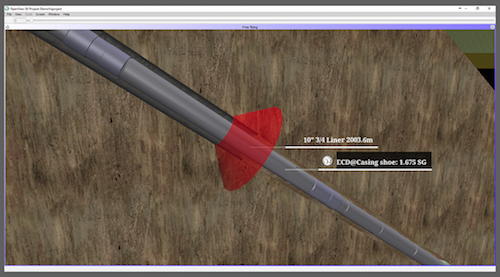
- Visualize info sources along BHA or well
- Sensors data
- Simulated data
- Info-tags with hyperlinks to data source
- Fluid positions
- Log data from .LAS-files
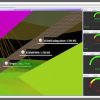
- User-configurable view setups
- User-levels with authentication
- Favorite places
- WOB and Drilling speed indicators
- Plotting capabilities
- Along well-bore
- In separate window
- Linear or logarithmic scale
- Color coding of values
- Gauges with sensor/simulated data
- Formation and seismic layers
- Proximity trajectories
- Near-reality BHA visualization
- Perforations
- Casing/Casing collars
- Whipstock&
Don't Miss Out! Get the Best Deal on this Software - Email Us Now!