GeoModeller

GeoModeller is software for building complex, steady-state 3D geological models, and performing forward & inverse geophysical modelling directly from your project
Comprising an intuitive editor, drill holes and grids/mesh managers, and modules for 2D/3D geophysical and geothermal modelling, and airborne EM inversions - you can manage and interpret your oil and gas, minerals, geothermal, hydrogeological or engineering projects with comprehensive functionality and import/export options.
Geological Editor
- Implicitly models 3D surfaces constrained by primary geological data (contacts and orientation data together) and/or drill hole intercepts
- Adheres to rule-based modelling of fault networks and relationships of the pile
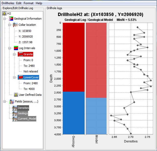
Drill hole & grids/meshes management
- Fully supports drill holes and attributed data
- Offers a range of interpolation methods including domain kriging (to mimic geology formation shape avoiding un-folding prior to kriging)
- 3D grids/meshes calculator
- 3D viewer and slicing tools
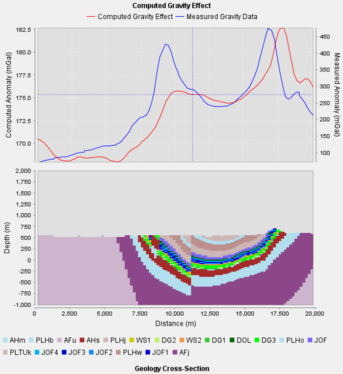
Forward & inverse geophysics modules
Using stochastic inversion techniques
- 2D profile modelling of gravity and magnetics and synthetic seismographs
- 3D forward modelling of gravity, magnetics (including remanence), full tensor gradiometry (FTG)
- 3D forward computation of temperature, vertical heat flow and geothermal gradient
- 3D litho-constrained stochastic geophysical inversion of gravity and magnetics (separately or jointly)
- Driven by comprehensive GUIs and wizards
- Modelling can commence from a GeoModeller model, or an imported lithology voxet
- Handles variable rock properties through look-up tables (probability distribution functions) or custom voxets
- Browses to reference geophysical grids
- Comprehensive post-inversion products including quantified uncertainty of geology-geometry and rock properties
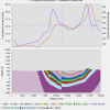
The GeoModeller inversion method is non-deterministic. Inversion continues beyond a satisfactorily low misfit level (referencing observed geophysics at set precisions) – exploring and keeping a range of allowable models, and presenting distilled statistics of these, in terms of probabilities of geology-geometries and rock properties.
Rating
Visits
1,703
Redirects
331
Don't Miss Out! Get the Best Deal on this Software - Email Us Now!