GeoScene3D-Simulation Extension

Simulation Extension
The Simulation Extension adds extra functionality to the Voxel Builder Module in GeoScene3D. The extension provides access to Multiple Point Statistics for property simulation in voxel models. This set of tools provides you with the functionality for working with the latest advancements in geological modelling, all wrapped up in a sequence of user friendly software Wizards, guiding you through the modelling workflow.
What is Multiple Point Statistics – and why use it?
When modelling geological heterogeneity, multiple point statistics (MPS) provide a statistical approach to modelling the geological variability. It is an alternate approach to Gaussian based geostatistics using a user defined Training Image (TI), instead of e.g. a variogram, to quantify expert knowledge about realistic geological features.
One Seamless Workflow
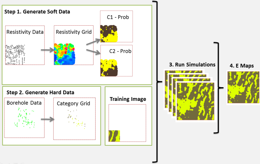
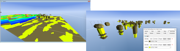
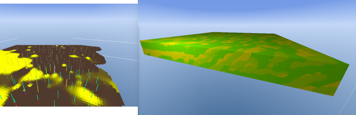
The Simulation Extension provides tools for transforming observed data, e.g. geophysical resistivity data or well data, into soft and hard data used by the MPS algorithm. As well as the actual tools for running the newly developed MPS algorithm, the software contains tools for inspecting the result in 3D, in cross sections and on GIS maps, plus tools for evaluating the results and generating derivatives such as E-Type Maps etc.
A Wizard Based Workflow
The software tools are seamlessly integrated into the existing GeoScene3D software, as a set of easy-to-use Wizards, guiding the user through the work process.
A New Implementation of MPS
In this extension, GeoScene3D utilize and extend, a new implementation of MPS algorithms developed in corporation by computer scientist at I•GIS, researchers at the Niels-Bohr institute, University of Copenhagen and geological researchers at the Danish Geological Survey, GEUS, as part of the large Danish geological modelling research project, ERGO.
Rating
Visits
1,007
Redirects
230
Don't Miss Out! Get the Best Deal on this Software - Email Us Now!