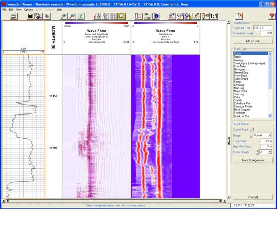
TerraStation II
TERRASCIENCES main product is the TerraStation II suite of modules. It is designed for use by geologists, petrophysicists and other technical earth scientists.The major modules are:
Base TerraStation (Mandatory)
The minimum system required. All other modules can be added to this basic platform.
- Provides project management.
- Provides data import and export capabilities, including LIS, DLIS, LAS, ASCII formats.
- Directional survey loading and computation, including TVD, TVT and TST .
- Curve editing, splicing, shifting, base line shifting, and other utility functions (interpolation, rescaling, etc).
- Environmental corrections.
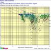
- Crossplotting, histograms, bar graphs, ternary diagrams.
- Curve normalizing.
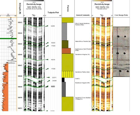
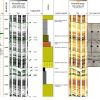
- Single well composite log display generation using the IMAGELog module.
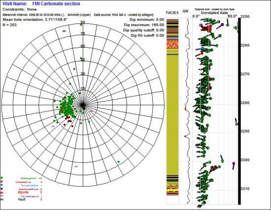
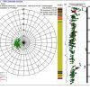
- Stereonet based Dip Analysis, including Azimuth Vector and Cumulative Dip capability.
- Pressure Modeling and stress analysis.
- Plot editing and plot montage creation.
- Creation of graphics output in various formats, including PDF, CGM, PostScript, EMF, BMP.
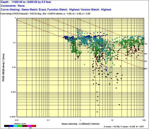
Petrophysical Analysis
A highly flexible suite of capabilities for analyzing wireline data. Includes:
- Loading from DLIS, LIS, LAS and other formats.
- Interactive data editing, depth shifting, curve splicing, along with many useful curve manipulation options.
- Pickett, Hingle, SP-Rwa, Thomas-Stieber, Zplots, pressure vs depth plots and many other crossplots.
- Full deterministic analysis including most Vshale, Porosity, and water saturation equations
- Probabilistic modeling option for complex lithology scenarios.
- CMR T2 analysis.
- Core data handled on true core depths, not interpolated to wireline depths.
- Netpay analysis including a probabilistic capability.
- Temperature gradient analysis.
- Coal Bed Methane Analysis.
A set of statistical analysis options including cluster analysis, Fourier analysis, multiple linear regression and more.
- Multi well, multiple zone processing. Can handle up to 10,000 wells and several hundred zones.
- A programming capability based on TERRASCIENCES own language (TCL) – no compilers or third party code needed.
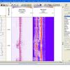
Borehole Imaging
For image processing and interpretation we provide the most comprehensive system available. Functionality includes:
- Handles all known imaging tools, both wireline and LWD/MWD by all logging companies.
- Speed corrections, button correlation, pad/flap correlation, swing-arm, dead/faulty button, and more.
- Quality control plots of magnetometers and acceleration information.
- Image depth shifting and splicing tools.
- User definable color maps.
- Image calibration to wireline curve.&
RatingVisits1,831Redirects371Don't Miss Out! Get the Best Deal on this Software - Email Us Now!