Geology Software
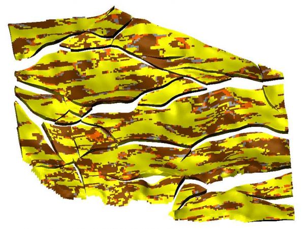
Geological Engineering include understanding and analyzing field depositional environment along with earth techtonic movements to create a reliable 3D model of underground reservoir structure (e.g., geological model). Geological models may be complicated depending on the number of oil bearing horizons and faults.
Plug-in Overview
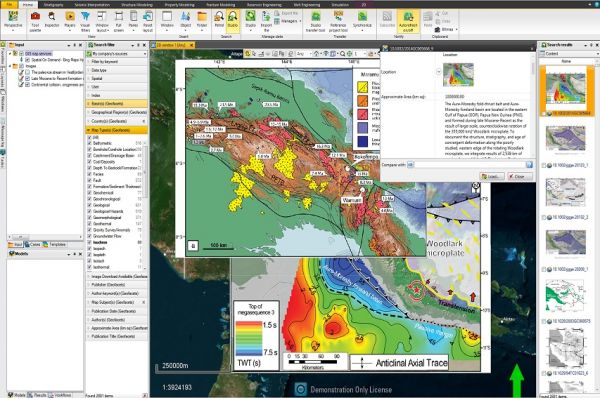
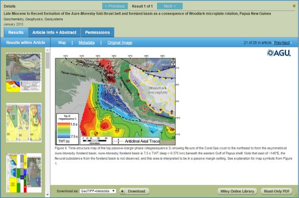
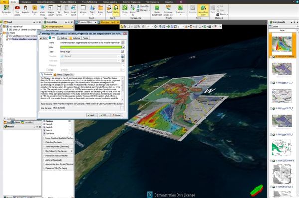
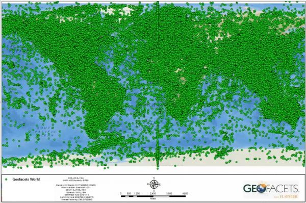
Accelerate your exploration workflow by quickly accessing hundreds of thousands of maps and articles, sourced from +100 market-leading journals and publications from 9 different publishers. Integration of information is challenging and time-consuming, but the Geofacets Connector al ...
Read More ...
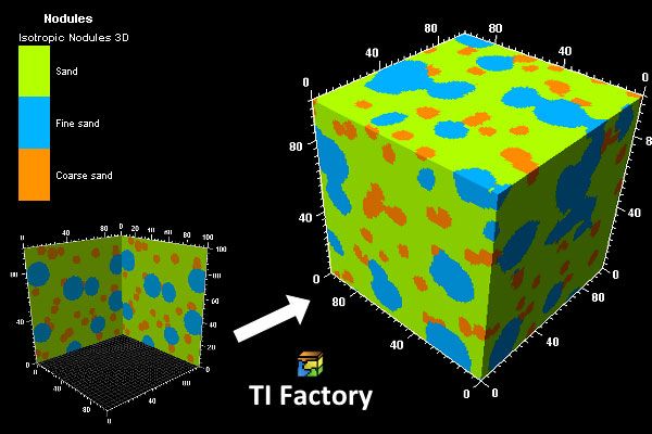
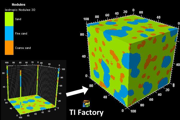
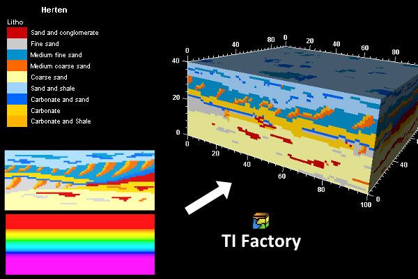
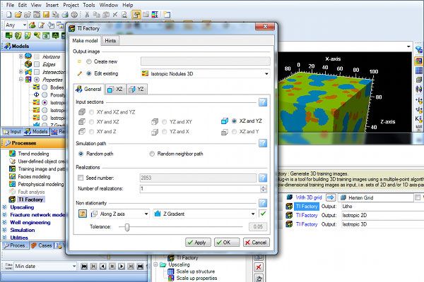
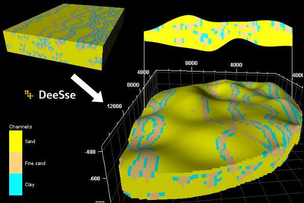
One of the main issues in the multiple-point simulation is the lack of suitable 3D training images. TI Factory builds 3D training images on the basis of low-dimensional training images, i.e. sets of 2D and/or 1D axis-parallel sections. The 3D training image is built by performing a low-dimensional m ...
Read More ...
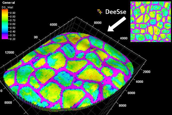
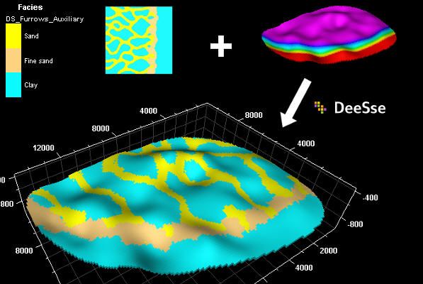
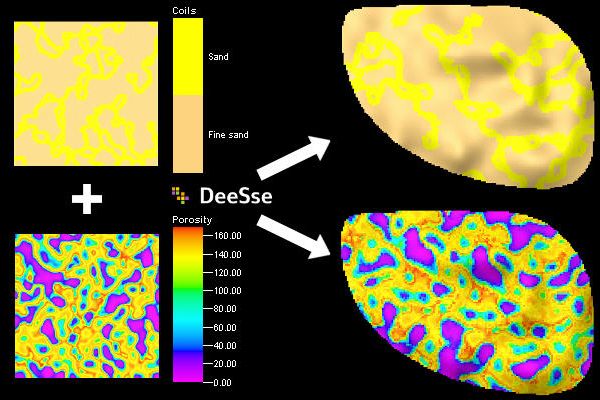
Simulation of continuous properties
DeeSse can perform multipoint simulation (using direct sampling strategy) not only on discrete properties, but also on continuous ones. The example shows a 2D continuous training image and the resulting simulation on a demonstration grid, using conditioning data. ...
Read More ...
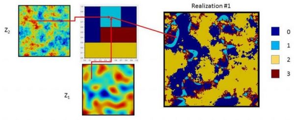
Pluri-Gaussian Simulation (PGS) is a widely used method for simulating facies properties.
The specificity of this method lies in its capacity to involve inter-facies relationships through a bivariate Gaussian truncation diagram (also known as the lithotype rule).
Two Gaussian variables are simulat ...
Read More ...
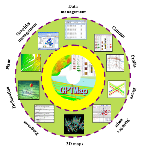
GPTMap Automatically reservoir mapping software
GPTMap is based on fine reservoir geological studies, can be automatic mapping 2-D plan and profile drawings, also compatible with interactive editing. Meet the need of the geological static and production dynamic maps, providing practical and easy to ...
Read More ...
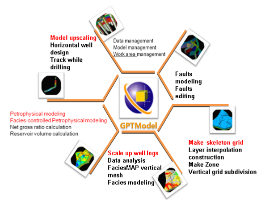
GPTModel Reservior geological modeling software
GTPModel is a corner mesh generation, geostatistics, 3D visualization technology-based reservoir geological modeling software, mainly based on detailed geological study, detain the 3D character of the reservoir structure, reservoir geometry and physic ...
Read More ...
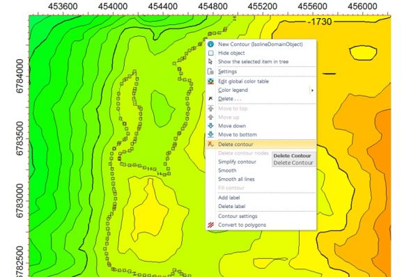

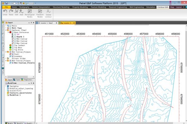
The edited contours can be exported for future usage.
With ContourEdit plug-in, the edited contours can be exported as polyline for further use, which is consistent with the general polyline in Petrel, and the exported polyline can be further processed by standard Petrel calculations and operations ...
Read More ...
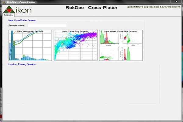
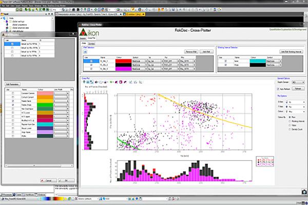
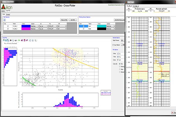
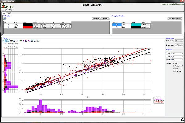
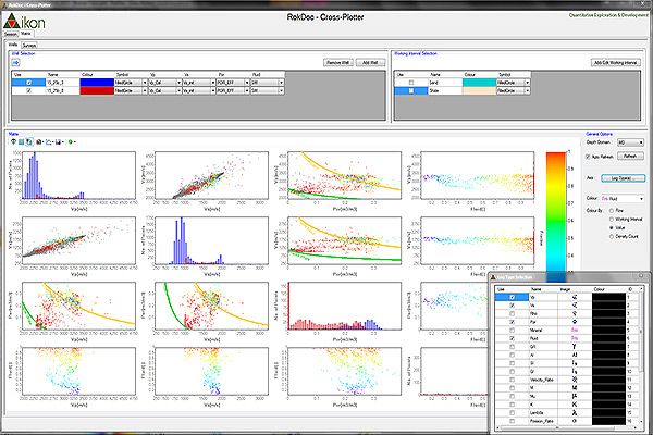
Matrix Cross-Plotter The Matrix Cross-Plotter can generate multiple cross-plots in a single view, enabling users to rapidly target the attributes that define their target best. Rock physics models and templates can be applied across the full range of cross plots and interactively modified to fit the ...
Read More ...
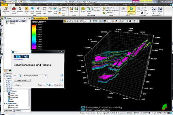
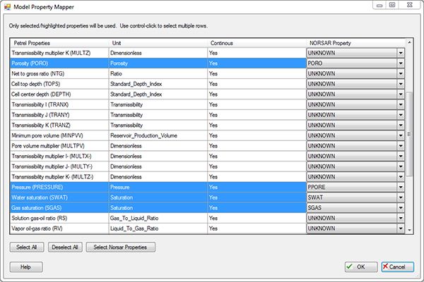
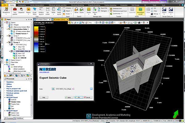
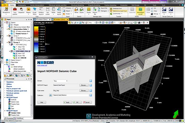
The NORSAR Data Link plug-in exports data objects from Petrel to NORSAR, and imports data objects from NORSAR to Petrel. The Petrel objects are exported to either an existing NORSAR Modelling Project, or a new project is created automatically based on the properties of the exported objects. The expo ...
Read More ...

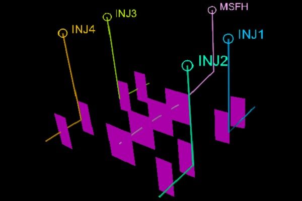
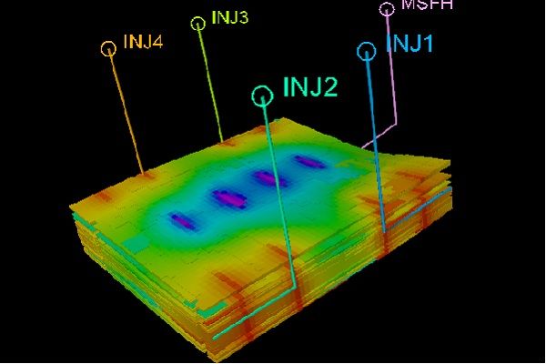

Parameters.
Hydraulic fractures are represented by a set of parameters that describe the geometry, permeability, attenuation and other parameters.
Plug-in Overview
This plug-in is designed to model hydraulic fracturing for large fields with many wells. It creates additional completions to represe ...
Read More ...