Geology Software
Geological Engineering include understanding and analyzing field depositional environment along with earth techtonic movements to create a reliable 3D model of underground reservoir structure (e.g., geological model). Geological models may be complicated depending on the number of oil bearing horizons and faults.

eXchroma SG Popular
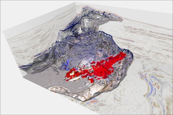
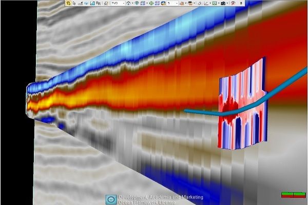
Delineation of karsts, Minagish Kuwait
Flattening the seismic cube on the top Shuaiba allows enhanced mapping of the karst features. Surface features shown in reddish tones and deeper vertical features marked in bluish tones. El-Emam et al. (SEG 2013)
Plug-in Overview
Designed for the interpretat ...
Read More ...
Saving of the results
You can select an object, in which the calculated parameters will be written, or create a new object (by default).
Plug-in Overview
Three-dimensional geological models are the basis for development control. An integral step in creating the digital equivalent of the productiv ...
Read More ...
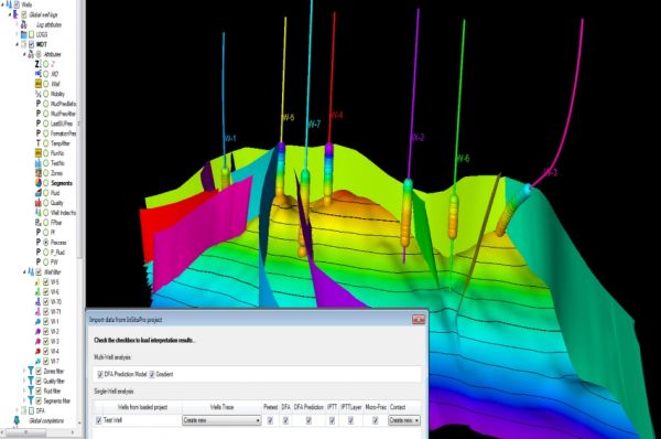
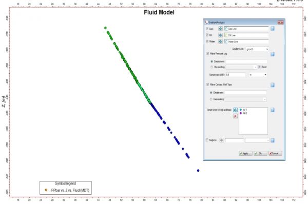
Establish the fluid contacts
The data analysis functionality enables a quick re-computation of contacts. The gradients and contacts can be visualized in both the well section window and the 3D window, juxtaposed against the structure and lithology of the reservoir.
Plug-in Overview
Formation Test ...
Read More ...
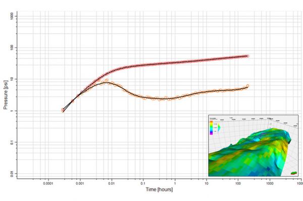
Design and interpret complex tests
GeoTesting enables well test information to be used to its full extent, providing seamless integration with the reservoir models and geologic information. Design and interpretation of complex tests are easily performed, providing deeper and more accurate insight i ...
Read More ...
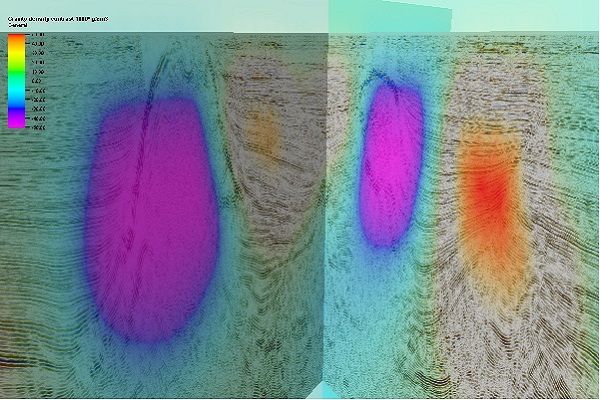
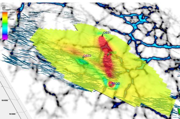
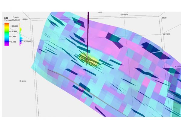
3D property modeling
3D property modeling allows initial models to be used, such as 3D property. Image 1 shows a “true” model. Image 2 show an initial model ( “paleo feature” removed). Image 3 shows standard deviation of the initial model. This model does not allow initial values to be changed clos ...
Read More ...
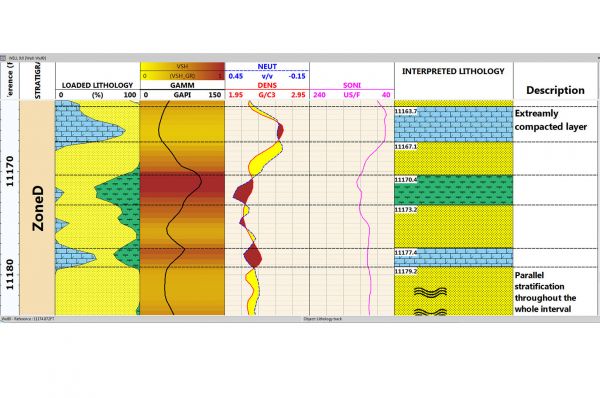
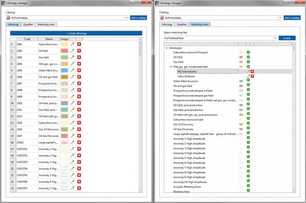
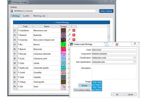
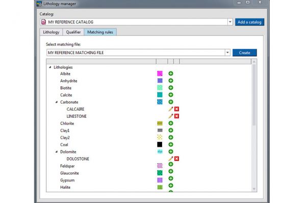
Imported and Interpreted Lithology in Techlog The plug in allows to import Lithology information and display it alongside of other wellbore data
Ensure Formatting and Compliance Editing capabilities allowing to solve quick problems related to format and local procedures.
Workflow Compatibility with Techlog
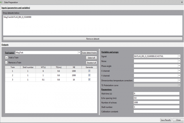
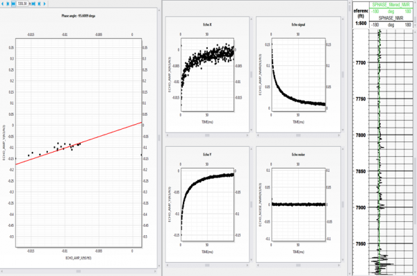
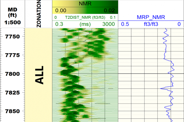
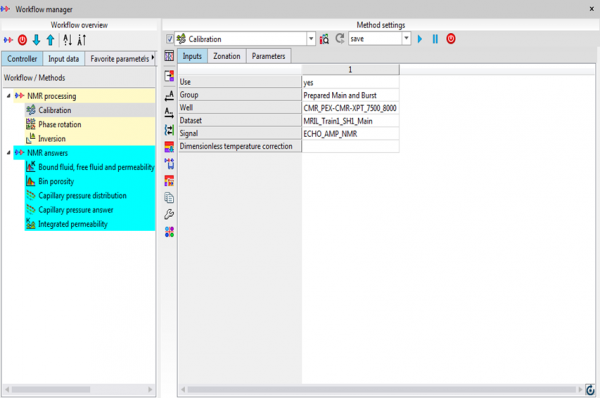
The functionalities of NMR Tool Processing are fully compatible with the NMR Answers methods already available in Techlog. Together they provide a complete workflow to process and interpret any NMR dataset.
Plug-in Overview
Vendor neutral NMR tool processing fo ...
Read More ...
Gravitas - The Integrated Operational Geology Software Suite
Gravitas comprises of a number of application modules, including Winlogng the world leading log drawing solution.
These fit together to provide a rich operations geology toolset to manage the geological workflow and seamlessly integrate ...
Read More ...
Gravitas Connector For Petrel*
Extends and enhances the software’s capabilities by connecting the Petrel user to operational geology data and interpretation via a direct link to Gravitas.
For the first time, asset geoscience can seamlessly integrate workflows with operations geology through the sh ...
Read More ...