Geology Software
Geological Engineering include understanding and analyzing field depositional environment along with earth techtonic movements to create a reliable 3D model of underground reservoir structure (e.g., geological model). Geological models may be complicated depending on the number of oil bearing horizons and faults.
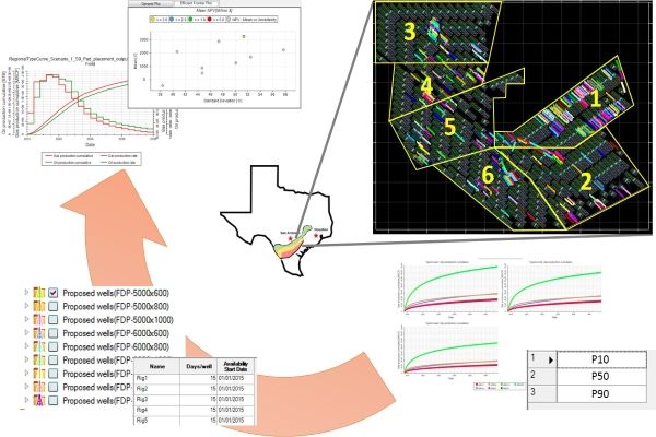
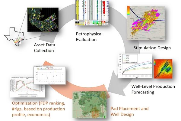
Link well-level production to field planning
Well-level production optimizations focus on petrophysical evaluation, stimulation design, and single well production forecasting. Petrel Pad Placement and Pad Well Design focuses on the field level and creates pads and wells, with an objective to maximi ...
Read More ...
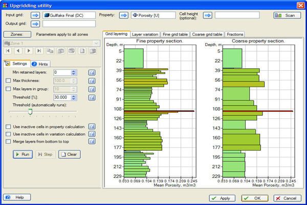
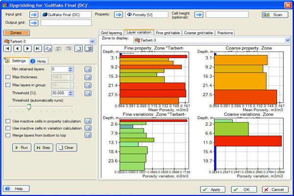
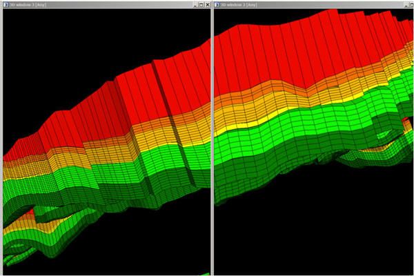
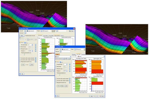
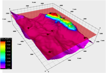
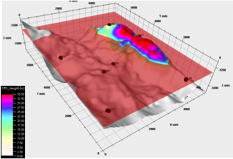
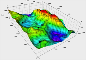
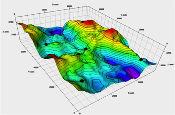
Before and After
Comparison of original and upgridded models.
Plug-in Overview
Having the right size grid is key to efficient runs of your simulator. The Upgridding Utility for Petrel allows you to group layers in a Petrel model into coarser layers for simulation, while preserving the flow charac ...
Read More ...
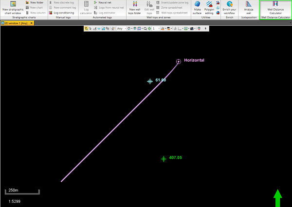
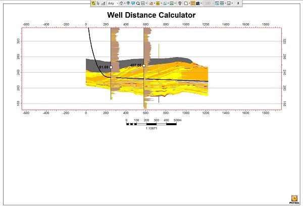
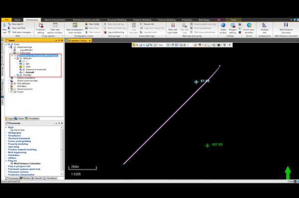
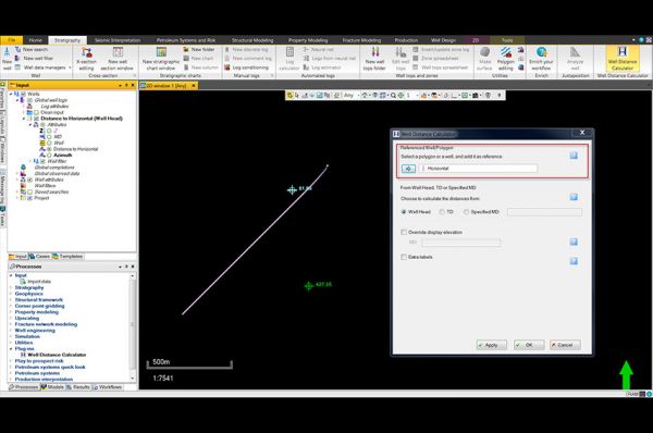
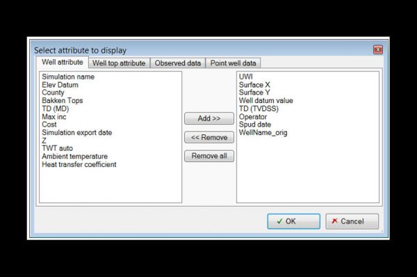
Distances calculated stored as point well data
After the reference well or polygon is selected and settings confirmed, a point well set is created and stored underneath the project’s global well logs folder. These points can be turned on and off in the desired window to display the distances measur ...
Read More ...
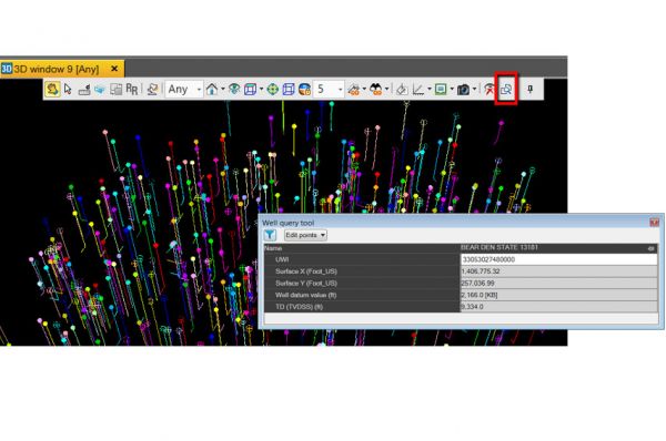
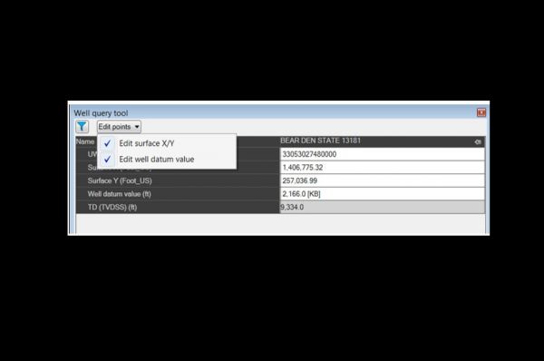
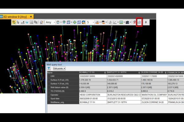
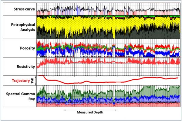
Well data comparison
Compare well data from up to four wells side-by-side.
Plug-in Overview
The Well Query Tool allows selection of wells graphically from any 2D/3D window and displaysrelated information. It also allows multiple well selection to compare the data in a tabular format.
Specificati ...
Read More ...
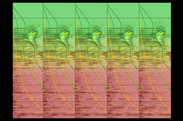
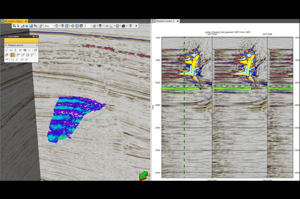
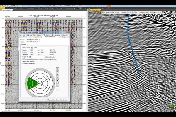
Interact and analyze specialized prestack volumes
The volume of data created by processes such as Vector Image Partitions or Offset Vector Tiles require specialized tools to help us rapidly analyze and interact with them. With the tool displayed you can rapidly view individual image partitions or, ...
Read More ...
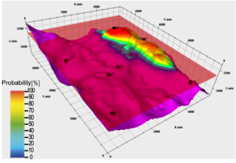
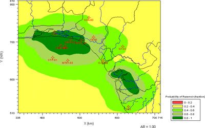
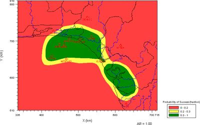
UDOMORE VOLUME
Instantly, simply and accurately generate multiple volumetric estimations and spill point detections for Multiple Targets.
Maximize Confidence
One single automated workflow including all uncertainties propagated from Spatial Conditioning to Volumetric Computations results in +/- 30 ...
Read More ...
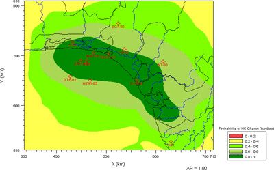
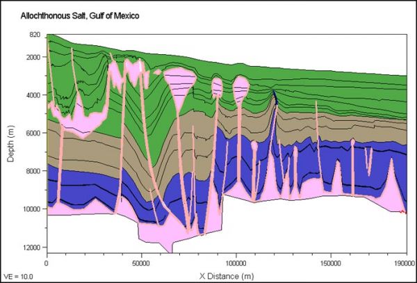
BasinView links the products in the Petroleum Systems Suite, including BasinMod, BasinMod Risk and BasinFlow. Multiple BasinMod well models as well as surface grids or isopachs can be imported and used to generate surfaces for a multitude of calculated values. Results can be displayed as maps, cross ...
Read More ...
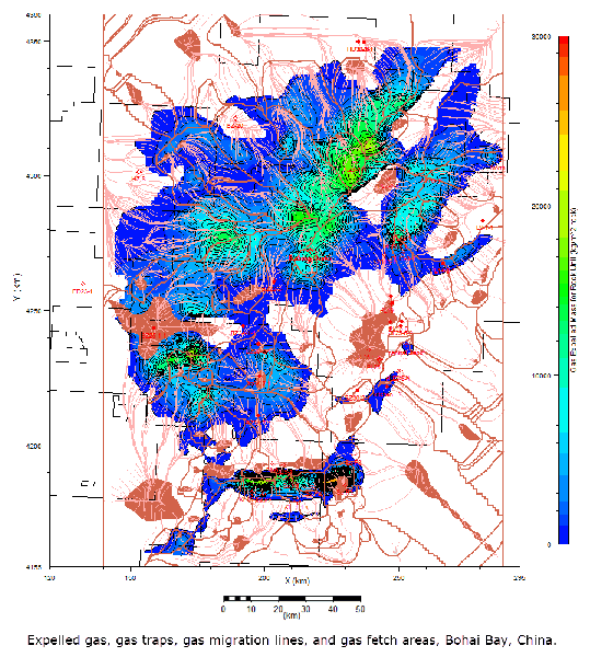
BasinFlow is a flow path modeling program (2.5-D) that combines source rock and carrier bed data with hydrodynamics to model oil and gas migration and entrapment potential at the prospect, play, or basin level.
BasinFlow:
Defines migration pathways and fetch areas.
Identifies structural, strati ...
Read More ...
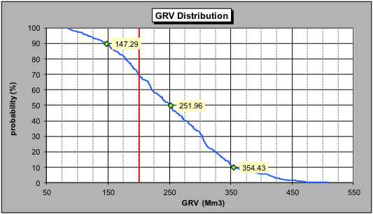
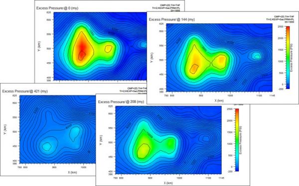
BasinMod Risk addresses those risks associated with the elements and processes of petroleum systems, plays and prospects. Unlike deterministic modelling programs, BasinMod Risk utilizes a stochastic approach to modelling which tests thousands of assumptions and produces a range, or probability distr ...
Read More ...
BasinMod 2-D models dynamic geologic conditions within a petroleum system, by examining hydrocarbon generation from source rocks through secondary migration and accumulation in traps.
Model building:
Easily handle complex stratigraphy, including complicated unconformities.
Vary surface temperat ...
Read More ...