Field Acquisition Optimization Specialists
Our Field Acquisition Specialists work side by side with clients offshore to manage surveys as safely, efficiently, and closely as possible to the agreed plan to ensure objectives are met.They play a vitally important role in managing software and operations to dynamically optimize marine acquisition at every step.
Towed streamer survey optimization services:
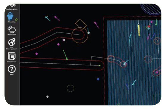
- Infield QC and survey optimization – Provides advanced towed streamer or seabed acquisition designs with experience in over 150 complex 3D, 4D, and wide azimuth (WAZ) projects
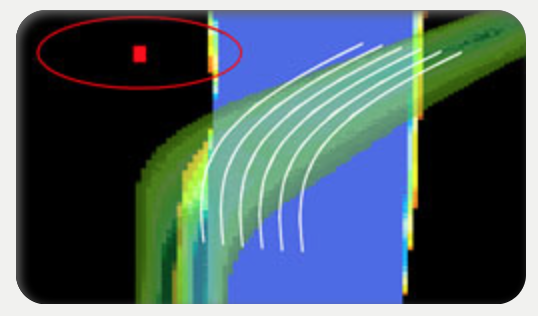
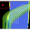
- Feather analysis and prediction – An intelligent model assesses feather predictions against actual current data to determine the level of predictability for line planning and the accuracy of feather prediction sources, and to improve trend analysis for better feather matching
- Feather aperture analysis – Evaluates the unique coverage contribution of each sail line to minimize the number of passes required to achieve the desired data quality or repeatability
- Line prioritization – Sail line priorities are established and constantly re-evaluated in the field based on unique coverage contribution and the importance of feather matching for each sail line. This enables the selection of 'large' or 'small' feather aperture lines depending on the confidence of the feather predictions and anticipated match quality.
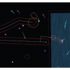
- Obstruction modeling – Evaluates data quality around in-field hazards and whether additional resources and undershoot strategies are required to overcome imaging limitations
- Additional line contribution – Evaluates the value and impact to data quality of adding additional lines during acquisition
- Shooting plan – Various shooting plan options are quantified based on simultaneous field events, such as FPSO operations, to ensure lines are prioritized and exclusion zones avoided when necessary
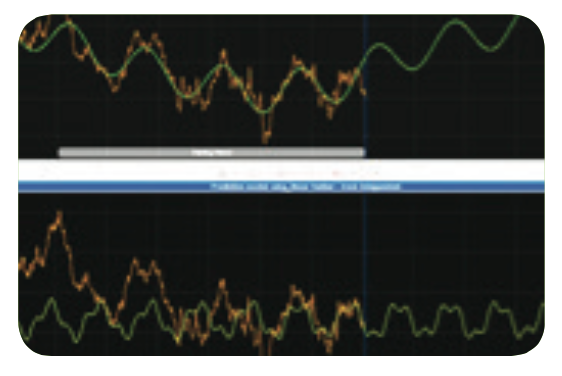
- Repeatability analysis – Provides rapid updates on the quality of repeatability in order to address concerns as quickly as possible in the field
Seabed survey optimization services:
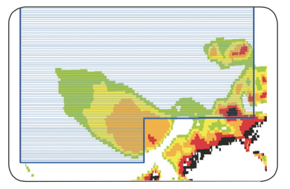
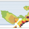
- Bathymetry analysis – Overlays field bathymetry with the source and receiver preplot positions to indicate respective source and receiver relationships Water depth analysis – Correlates tidal data to bathymetry data to visually show water depth variance over time
- Risk mitigation analysis – Provides safe shooting timeframes over the survey area to mitigate risks of obstructions and operational restrictions, such as bathymetry, tidal patterns, and water depths.
- Coverage analysis – Demonstrates the coverage that will be achieved from potential acquisition scenarios to aid the operational priorities
- Shooting plan – Indicates which receivers are active and which shot points are necessary with associated timelines to acquire them
- Acquisition analysis – Monitors th
RatingVisits988Redirects251Don't Miss Out! Get the Best Deal on this Software - Email Us Now!