g-Viewer
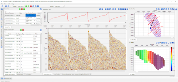
Interactive location map
Allows to visualize multiple data coordinates on interactive location map
Features related to visualization of multiple dataset locations available only in commercial version. The view includes following options:
- Interactive selection of seismic dataset
- Plotting all source,receiver, bin coordinates
- Plotting selected trace
- Plotting sources/receivers/bins visible on seismic view
- Interactive selection of source/receiver/bin
- Plotting traces related to selected shot
Rating
Visits
137
Redirects
1
Don't Miss Out! Get the Best Deal on this Software - Email Us Now!