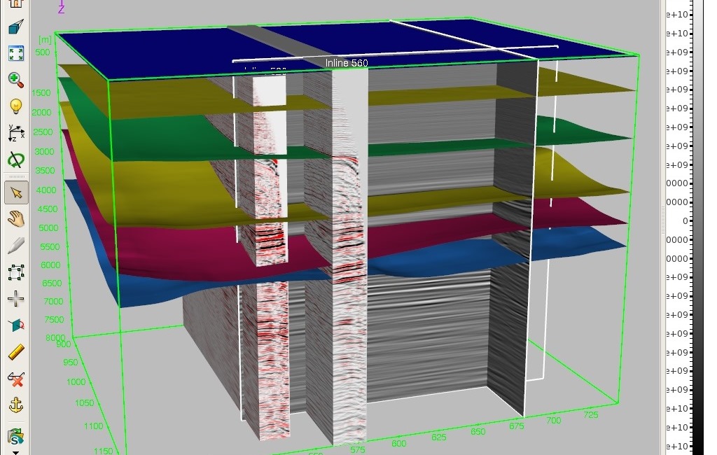
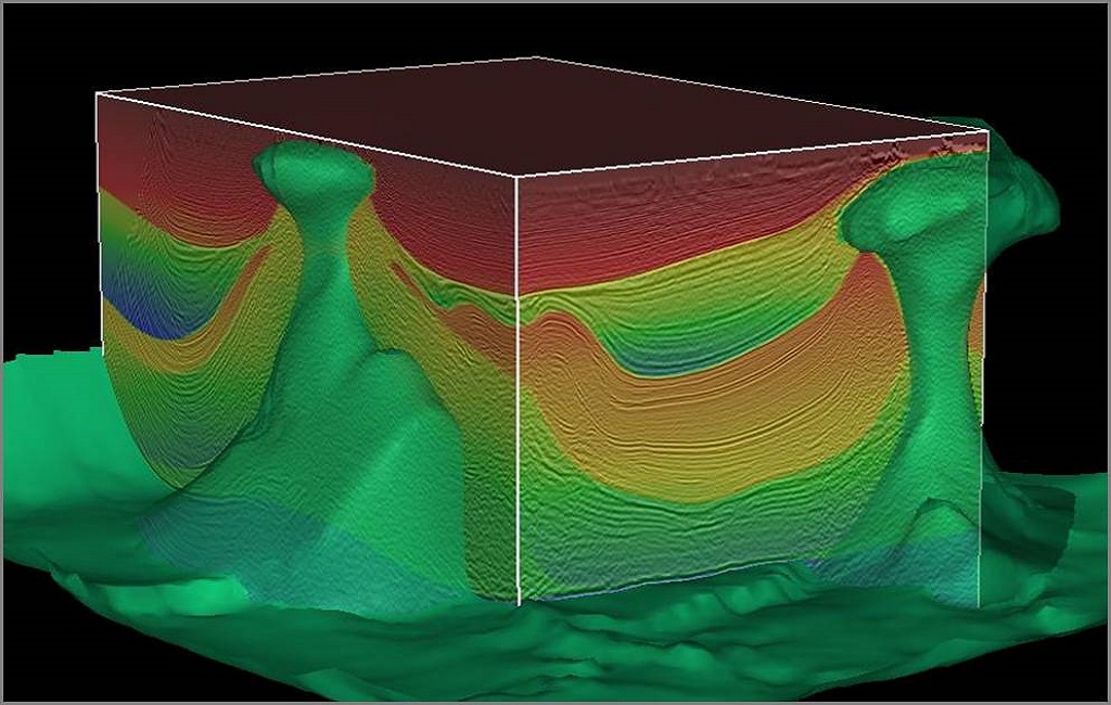
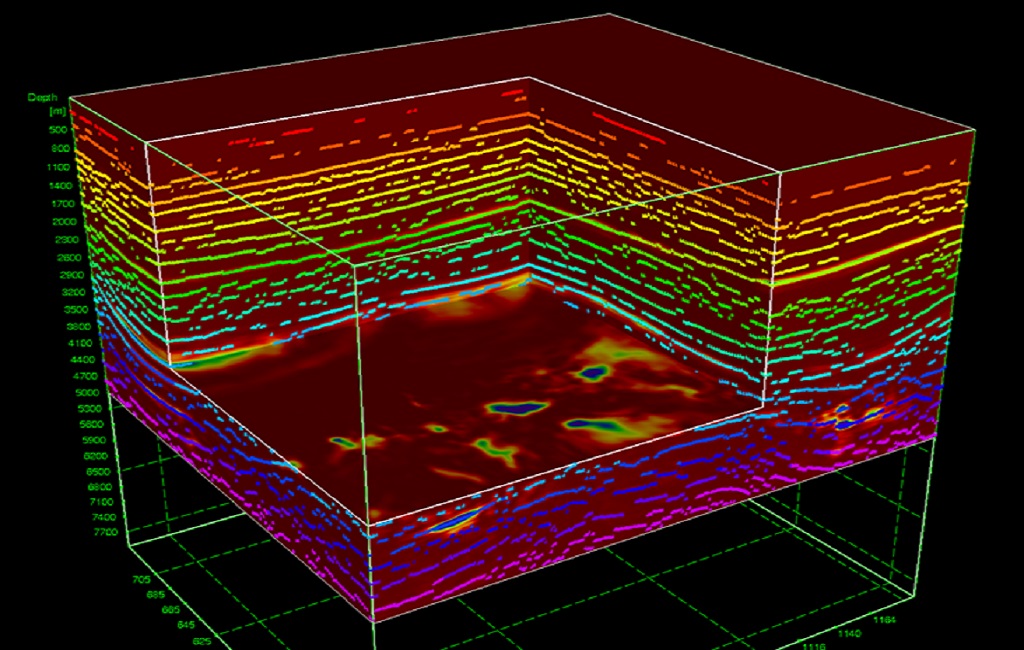
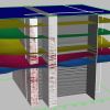
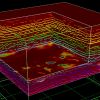
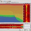
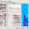
Reduce drilling risk through advanced velocity determination, modeling, and imaging. Explorationists rely on the Paradigm® GeoDepth® velocity determination and 3D/2D velocity model building system to create accurate seismic imaging in either time or depth. Through the integration of interpretation, velocity analysis, model building and updating, model validation, depth imaging, and time-to-depth conversion, GeoDepth provides the continuity needed to produce high-quality, interpretable images consistent with other available data, while preventing data loss and honoring geologic constraints. The complete set of interactive and batch velocity analysis tools available in GeoDepth handles the full range of seismic imaging problems encountered around the globe. GeoDepth supports seismic surveys for every type of geological structure in the world, from 2D and 3D marine and land surveys, to narrow and wide-azimuth acquisition geometries. The solution helps reduce drilling risk in subsurface geological structures like fault shadow, subsalt, sub-basalt, salt flanks, reefs, gas plumes, thrust faults and subtle lateral velocity variations.
GeoDepth features include:
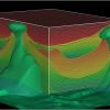
- A library of 2D and 3D, ray and wave equation-based isotropy and anisotropy models, for accurate simulation of wave propagation in complex subsurface areas
- Full support for anisotropic velocity model determinations, including vertical axis of symmetry (VTI) and tilted axis of symmetry (TTI). Enhanced anisotropy tools ensure accurate models and the best positioning for reservoir targets.
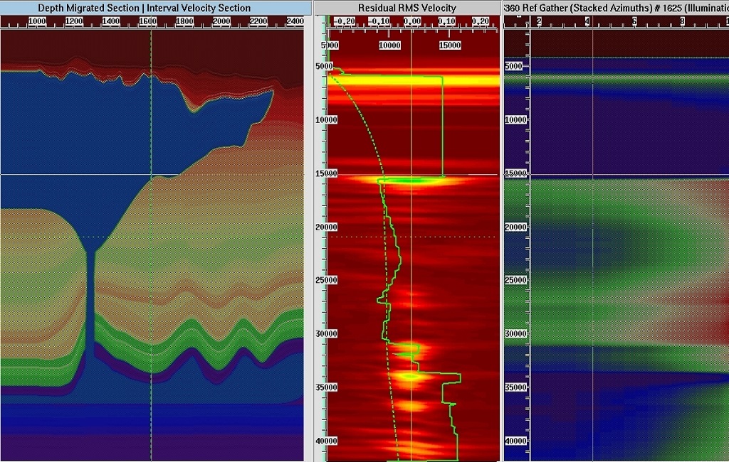
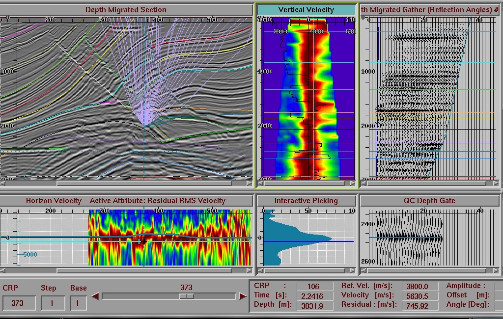
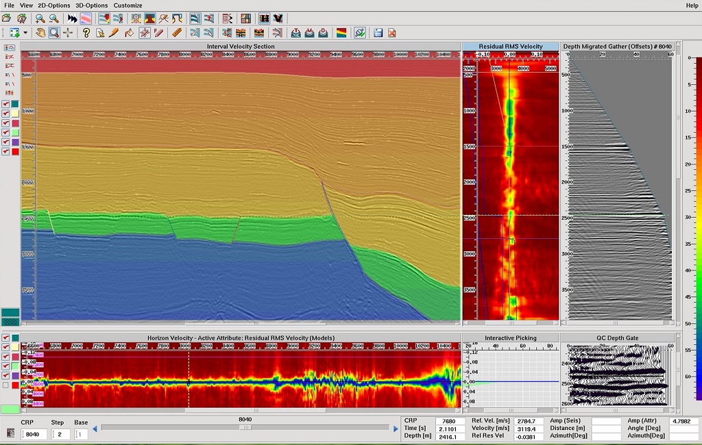
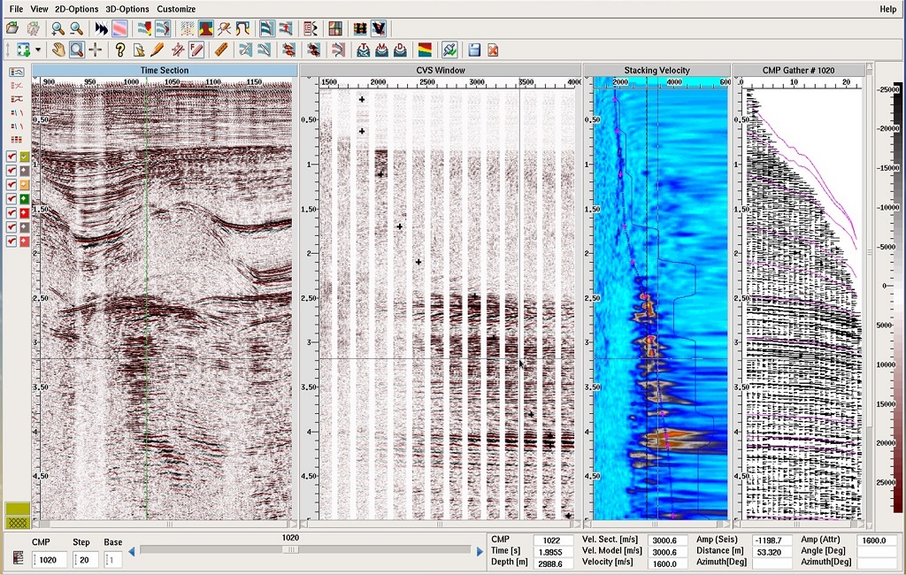
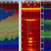
- Efficient, cluster-based gather processing that performs velocity determination in all geophysical domains. This includes semblance file creation for moveout analysis, automatic velocity and residual velocity picking, and automatic flattening and stacking.
- An intuitive, wizard-driven user interface that assures a short learning curve and full control over the velocity analysis process.
- Seamless access to third-party databases and the Paradigm product suite through the Epos interoperability integration framework.
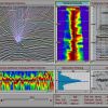
- Proprietary methods for RMO extraction, including vector-based, trace-by-trace, automatic RMO picking. Parabolic and higher order RMO parameters may be extracted by using semblance profiles or AVO attributes (the Paradigm FastVel add-on module).
- GeoDepth can use velocity volumes, geological formation volumes, and dip/azimuth volumes created in SKUA in illumination, grid tomography and migrations, and RTM modeling workflows.
- Interpretation data can be seamlessly shared between SKUA-GOCAD and GeoDepth.
- New 2D Canvas enabling simultaneous visualization of time and depth prestack and poststack data.
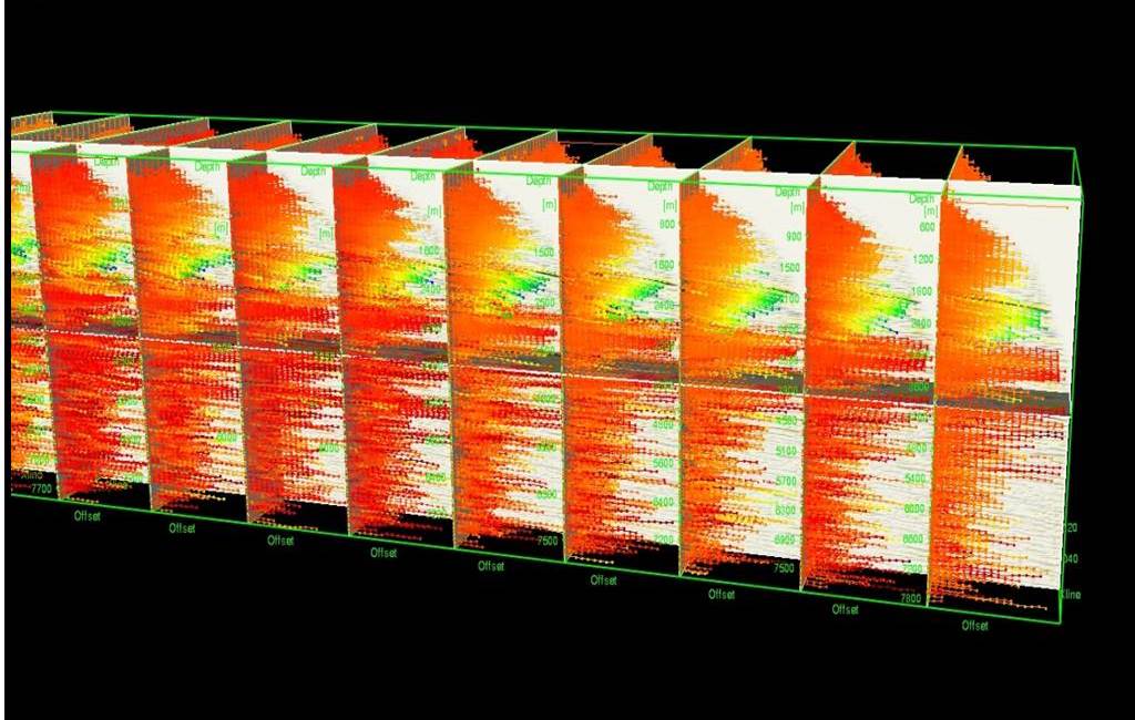
- Full workflow for Offset Vector Tile (OVT) gathers (prestack data), enabling sectorization of OVT gathers, imported or created using the Paradigm Kirchhoff migration, which can then be used as input t&
Don't Miss Out! Get the Best Deal on this Software - Email Us Now!