GS
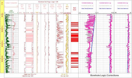
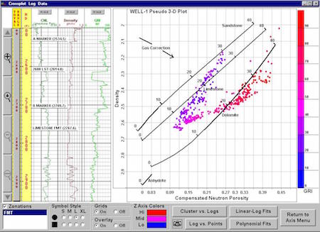
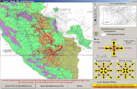
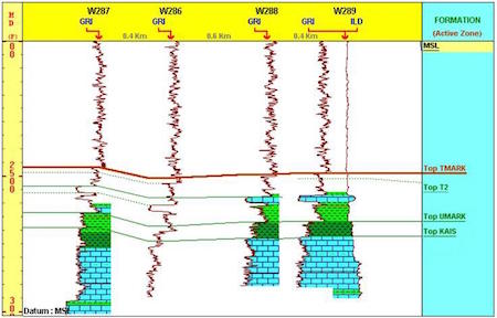
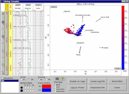
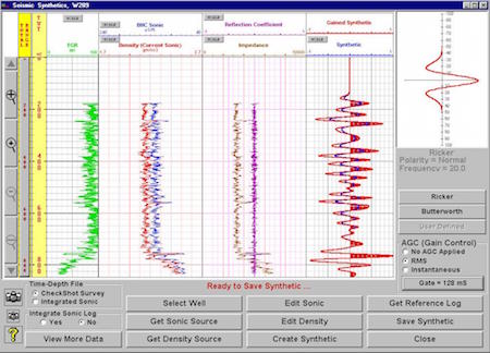
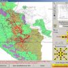
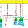
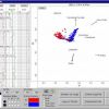
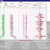
GS is a fully integrated PC-Windows based geological system whose primary features include interactive well correlations, cross sections (including raster log images), comprehensive petrophysical analyses, Pore Pressure and Fracture Gradient prediction, FIT Pressure Analysis, single or multiple well dipmeter interpretation, integration of mudlog data, seismic synthetics, quick mapping, and detailed composite log design. The GS interface has a centralized GIS theme utilizing ArcView/ESRI software controls.
Rating
Visits
1,092
Redirects
255
Don't Miss Out! Get the Best Deal on this Software - Email Us Now!