Because your interpretation shouldn't be compromised. Paradigm® SeisEarth® is a comprehensive yet flexible seismic interpretation and visualization system. This innovative multi-survey solution allows interpreters to perform structural and stratigraphic interpretation across many different vintages of 2D and 3D seismic data, while also integrating well data into their interpretation.
YOUR DAY-TO-DAY JUST GOT EASIER SeisEarth is designed to handle projects scaling from basin to prospect and reservoir, from exploration field to development field, and from a single user on a laptop to multi-disciplinary teams of geoscientists, petrophysicists, and drilling engineers. All of the day-to-day tasks of the seismic interpreter can be performed quickly and easily through the use of efficient volume roaming, evein in very large data volumes, automatic picking, and high levels of interactivity.
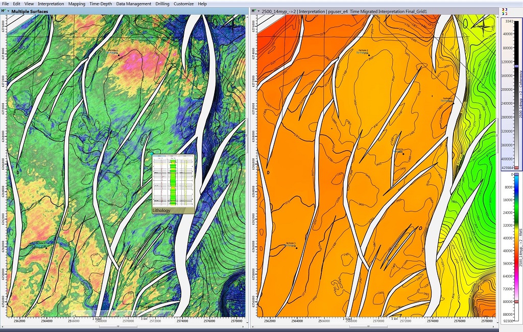
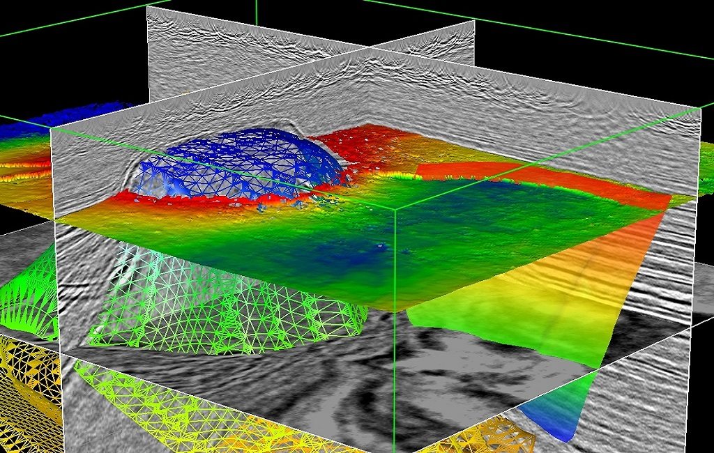
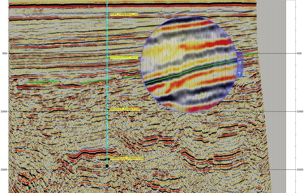
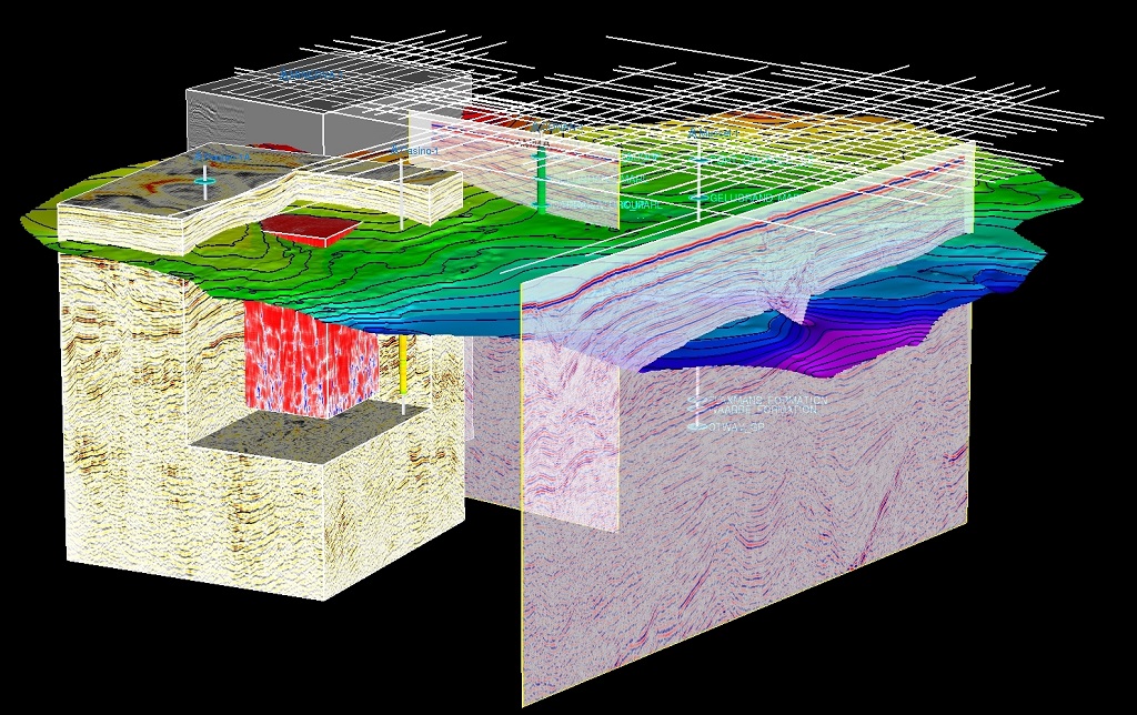
INTERACTIVE AND INTUITIVE INTERPRETATION A simple, intuitive user interface and a highly ergonomic design make SeisEarth easy to learn and even easier to use. Section, map, and 3D views share the same data, and allow the user to select the best view for the task at hand. 2D and 3D seismic datasets can be visualized and interpreted in both time and depth domains. The interactivity and consistency of use between the main windows accelerate the interpretation process and enable interpreters to easily perform comprehensive analyses involving many datasets. Designed as a multi-user tool, SeisEarth easily shares the same projects and data with other team members, with no duplication.
TAKE ADVANTAGE OF THE LATEST ADVANCES IN HARDWARE TECHNOLOGY SeisEarth has been designed to take full advantage of your existing hardware to maximize your efficiency, whether you’re a single operator working on a laptop or a team using modern workstations with high-speed 3D graphics (GPU), very large memory, and multiple CPUs.
SeisEarth benefits:
- Data sharing provides a framework for effective geoscience collaboration
- Regional scale interpretation allows insights that are not possible in multiple separate surveys.
- User interface customization makes workflows more efficient with less button clicking
- Computer assistance for repetitive tasks reduces fatigue, enhances productivity and decreases risk of injury
- Takes full advantage of the high-speed graphics, large memory, and fast connectivity of modern workstations, to enable the interpretation of large and numerous seismic surveys on a personal workstation.
- Volume roaming allows interpretation of multi-attribute surveys larger than workstation memory.
- Embedded well planning (Sysdrill® Designer® ) enables quick and easy well planning by the geoscientist.
Don't Miss Out! Get the Best Deal on this Software - Email Us Now!