Seismic Explorer for ArcMap
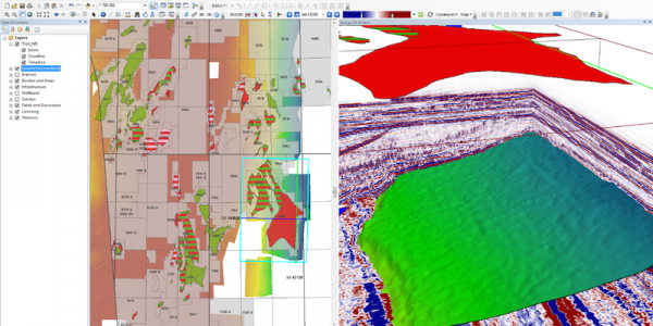
Seismic Explorer for ArcMap is an ArcGIS extension for managing and visualizing seismic data. It extends your ArcGIS desktop environment and brings your cultural data together with seismic data, bathymetry, interpretation, horizons and wells in an integrated 3D window inside ArcMap.
Features:
- Supports 2D and 3D SEG-Y formats
- SEG-Y file analyzer
- Create exact outline of live traces
- 3D visualization of 2D and 3D seismic
- Extract arbitrary seismic lines
Rating
Visits
1,009
Redirects
348
Don't Miss Out! Get the Best Deal on this Software - Email Us Now!