WesternGeco Seismic Survey Design
Integration with Petrel platform
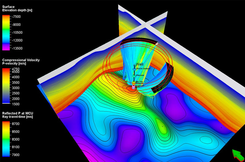
With the power of Petrel you can integrate additional data in the same display, for instance models, surfaces, wells and well tops and ray traces.
Plug-in Overview
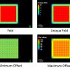
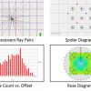
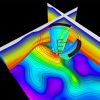
The Seismic Survey Design (SSD) plug-in is a powerful survey design tool fully integrated into the environment of the Petrel E&P software platform. SSD is used to plan, edit, execute, and analyze marine, land, OBC, and VSP surveys. Numerous acquisition geometries are supported including 2D and 3D narrow, wide, multi-, and full azimuth. The plug-in enables the creation of complex shooting scripts (source-receiver relationships) and the computation of survey attributes such as fold, unique fold, and minimum and maximum offsets and their visualization as color maps. Sophisticated survey design QC metrics such as rose diagrams, spider diagrams, histograms, and redundancy charts are also in the plug-in. For advanced workflows, the Petrel SSD plug-in can be combined with the Earth Model Building plug-in. The resulting access to the Earth Model Building plug-in’s ray tracing capabilities enables users to adjust seismic acquisition parameters to the address specific imaging challenges of complex geological models.
Specifications
Requirements
- Petrel 2016.x
- Petrel Geoscience Core
Optional
- Earth Model Building (EMB) plug-in suite – for more information on the EMB suite contact your local sales representative.
Applications
- Seismic survey design, analysis and QC
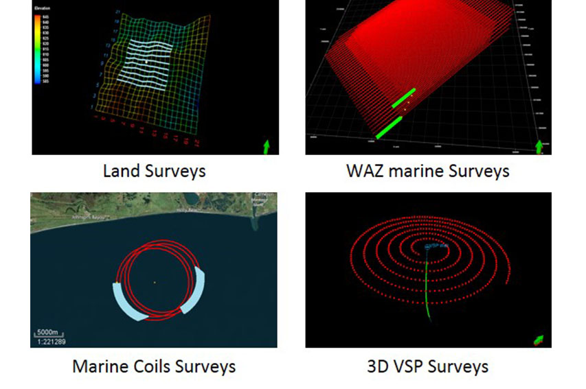
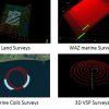
- Land, marine, OBC and VSP surveys
Key Features
- Import and export data in various formats (SPS, P190, SEGP1, and DIO), including seismic surveys created in OMNI 3D seismic survey design software.
- Quickly create complex acquisition geometries and shooting scripts using predefined layout and script templates, respectively.
- Modify stations using editing tools such as selection/toggle, include/exclude, delete, move, drag, and project.
- Create well-known shooting scripts such as pattern, area, circular, all live, VSP, streamer lines and coils, as well as customized shooting scripts with template roll.
- Employ sophisticated station and script filtering for import, export, and ray tracing as part of the Earth Model Building plug-in.
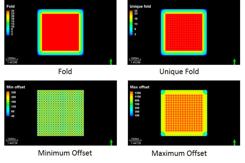
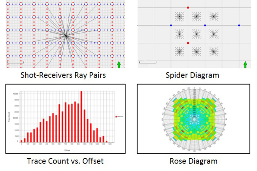
- Analyze seismic surveys by generating map plots (fold, unique fold, offset vector tile [OVT] single fold, and minimum and maximum offset) and statistical charts (rose plot, offset and azimuth histograms, and offset and azimuth redundancy plots).
Features
- Create complex seismic acquisition geometries and shooting scripts.
- Visualize and analyze seismic surveys by generating map plots and statistical charts.
- Execute advanced seismic modeling workflows whe
RatingVisits1,373Redirects276Don't Miss Out! Get the Best Deal on this Software - Email Us Now!