geotomo

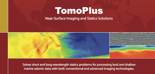
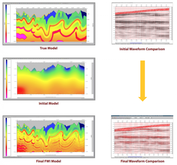
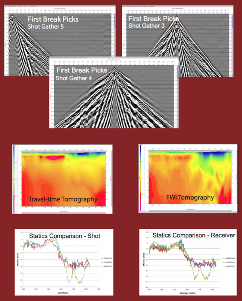
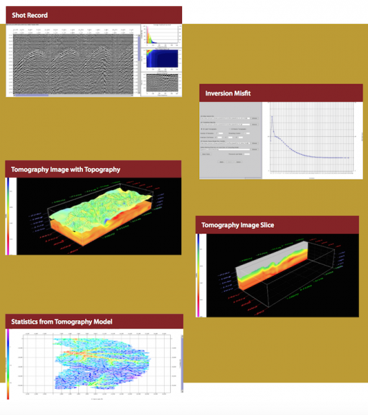
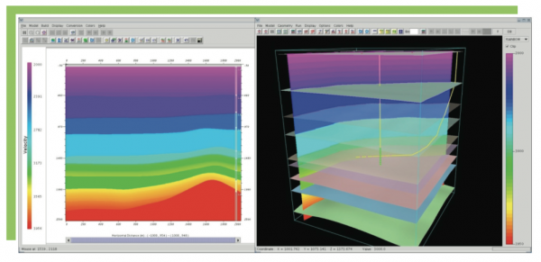
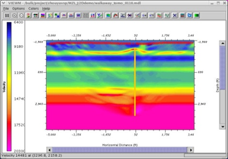
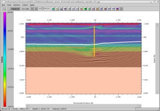
TomoPlus is a comprehensive near-surface solutions package. It is designed to obtain an accurate near-surface velocity model , and derive accurate long and short wavelength statics solution to help seismic data processing.
TomoPlus offers both conventional and high-end near-surface refraction solut ...
Read More ...
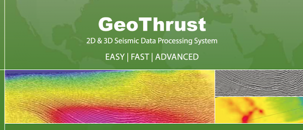
GeoTomo's 2-D & 3-D Seismic Data Processing System
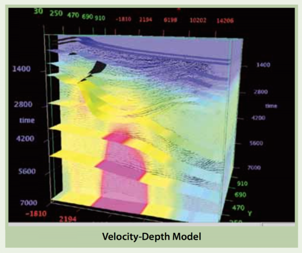
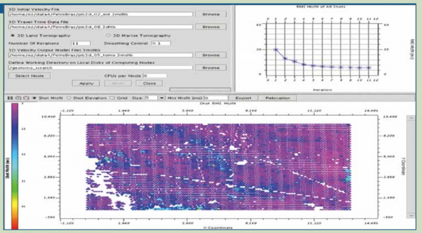
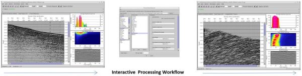
GeoThrust has been designed with a workflow architecture to obtain an accurate earth model and earth image in time and in depth from data recorded with irregular geometry in areas with rough topography, complex near-surface, and complex subsurf ...
Read More ...

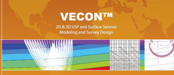
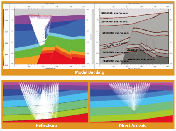
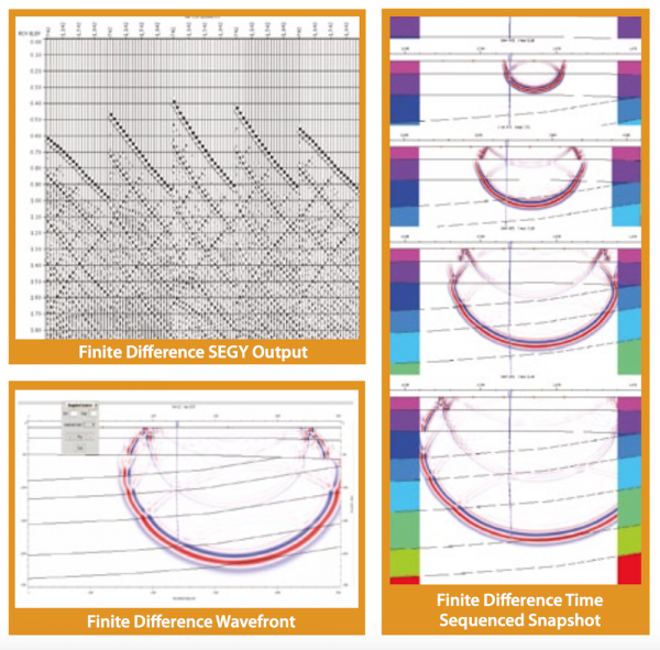
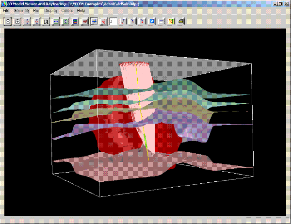
VECON is a powerful 2D/3D VSP and surface seismic survey design and modeling system that makes completion of a variety of difficult jobs extremely efficient. Designed for any level of geoscientists, VECON features a fast, accurate, intuitive and easy-to-use toolkit for working on site, remotely thro ...
Read More ...
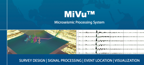
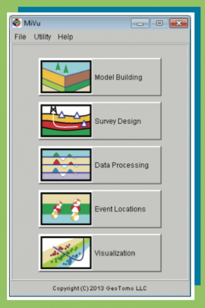
MiVu Popular
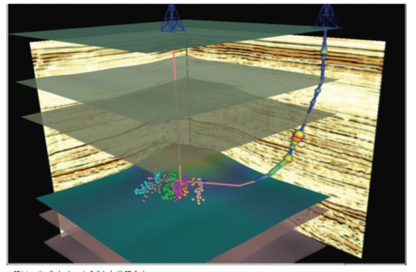
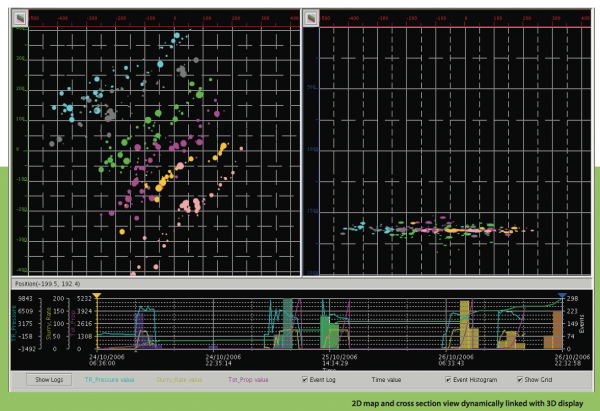
MiVuTM is a software package designed to perform microseismic monitoring during hydraulic fracturing.
MiVuTM offers capabilities for building simple and complex geologic models interactively, designing optimal microseismic monitoring geometry, processing data with user-defined workflows, imaging ev ...
Read More ...
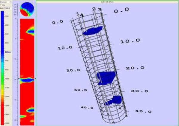
TomoSonic is designed to process Crosshole Sonic Logging (CSL) data and help you identify bridge shaft defects in real time.
TomoSonic includes six modules for CSL tomographic imaging. Time Picker is designed to pick traveltimes from CSL waveform data automatically or manually. Model Builder helps ...
Read More ...

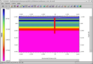
TOMOXPro is the only commercial crosshole software package in the seismic industry. This software package includes crosshole survey design, model building and modeling, data preprocessing, CDP transformation, tomography, wave-equation migration, and post-processing. It simply offers the entire range ...
Read More ...

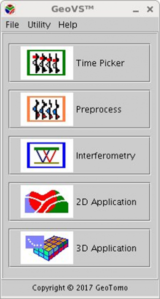
GEOVS™ 2D/3D VSP DATA PROCESSING AND IMAGING
GeoVS™ is a 2D/3DVSP data processing and imaging software program. GeoVS™ offers capabilities including building geometry, picking first breaks, particle motion analysis, orientation, signal processing for 2D and 3D wave field separation (parallel comput ...
Read More ...
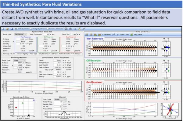
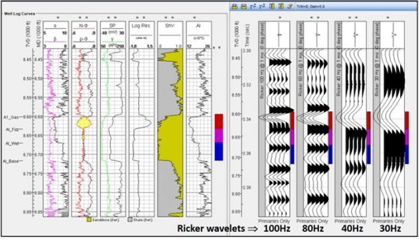
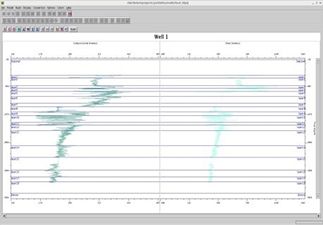
TIPS™ TOOLKIT FOR INTEGRATING PETROPHYSICS TO SEISMIC TIPS™
WELL LOG MODELER
Full suite of well-log editing and modeling of 1D and AVO synthetics, wedge models and seismic attributes. Quickly perform seismic well ties with the synthetics generated by TIPS. Understand within minutes the impact of i ...
Read More ...
GeoCT-I is a fully automated refraction traveltime tomography application for Windows. It presents a new way to image the Earth. After you activate the software, point the program to the folder where the data will be recorded. As each new shot is recorded, the program will automatically load it and ...
Read More ...
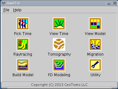
GeoCT-II is a 2D seismic modeling and imaging software package designed for geophysical engineering applications. It includes an advanced model builder, finite-difference full wavefield calculation for acoustic, elastic, and anisotropic media, raytracing and tomography for refraction, reflection, cr ...
Read More ...