DI GEODATA


- Multiple Formats: DI GeoData Services maps are available in multiple formats, ensuring compatibility for all Drillinginfo customers
- ESRI Compatibility: Compatibility with Environmental Systems Research Institute (ESRI);
- Map and Feature Services are available based on ESRI protocols OGC Compatibility: DI GeoData Services is compatible with Open Geospatial Consortium (OGC) standards; Web Map Service (WMS) and Web Feature Service (WFS) solutions are configured to OGC protocols
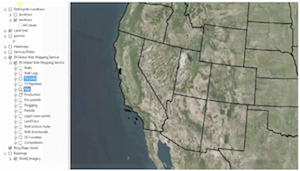
- Real-Time Data: Hundreds of map layers that are updated daily or in real-time
Rating
Visits
1,281
Redirects
319
Don't Miss Out! Get the Best Deal on this Software - Email Us Now!