GeoWiz


An Integrated Coordinate Solution
GeoWiz is a mapping application that enables you to translate field survey measurements into grid coordinates as well as perform localized project mapping, and seismic coordinate analysis. Use GeoWiz to quickly generate the essential information required by your office and field personnel, including seismic positional data, well site locations, and township and datum coordinate shifts.
GeoWiz Strengths:
- Instantly view township version differences and NAD datum shift information
- GeoWiz includes all of the major DLS grids used in the WCSB
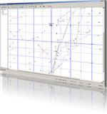
- Plot and print local maps of your project
- Profile and spread-check proprietary seismic lines
- Create directional well displays with spacing targets and directional survey reports
- Create 3D bin displays with township grids and spacing units
- Import and export data in custom text formats and reports
- Provides accurate geographic coordinate transformations and geodetic calculations
- Converts coordinates between an extensive set of worldwide coordinate systems
- Calculates interactive (single) coordinate conversions, database/spreadsheets and multiple file conversions
Rating
Visits
1,076
Redirects
302
Don't Miss Out! Get the Best Deal on this Software - Email Us Now!