JetStream
YOUR DATA, ANYTIME, ANYWHERE
JetStream is a fast & secure data delivery system with a spatially searchable data catalogue enabling your geoscientists to quickly assess coverage, type and vintage of georeferenced data in your archives - and then download (with optional cookie-cutting, re-projection and gridding) !
JetStream stores your data in a centralised location. Its semi-automated catalogue maintenance scheme harvests spatial information from any new data set and updates your catalogue accordingly, saving you time and money. Coupled with Intrepid tools, JetStream also perform simple tasks on-the-fly such as re-projection, sub-sampling and gridding.
Along with geophysical survey data, you can archive reports, drill hole data, geology observations, surface geochemistry and assay data - any data which is geolocated (or can be scanned and geolocated).
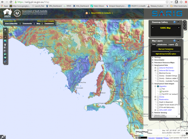
JetStream deploys a standard web-browser or intranet to search for datasets in a given area. A user (subject to password-protected levels of access) may choose subsets of data as required. JetStream then extracts the data and zips it for further compression and download. On-the-fly bitmap representations of the underlying data are presented via the web, so the user can preview selections prior to their download.
“How can JetStream help my business?” If you have a large number of georeferenced data sets, covering several regions, and requiring an archive management system - then JetStream may be the solution for you !
Rating
Visits
915
Redirects
235
Don't Miss Out! Get the Best Deal on this Software - Email Us Now!