Directory: Random Listings
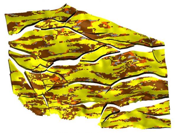
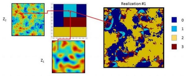
Pluri-Gaussian Simulation (PGS) is a widely used method for simulating facies properties.
The specificity of this method lies in its capacity to involve inter-facies relationships through a bivariate Gaussian truncation diagram (also known as the lithotype rule).
Two Gaussian variables are simulat ...
Read More ...
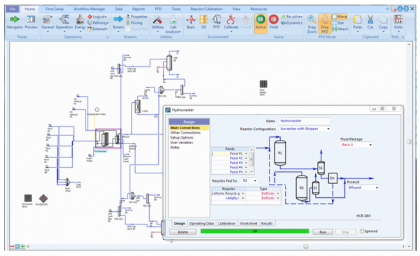
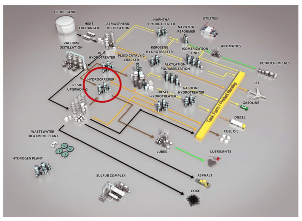
Are you wondering what the optimum severity to run your hydrocracker is given changes in final product demands? Are you trying to balance severity against desired run lengths? Are you hydrogen constrained and need to understand the real hydrogen demands within your refinery? Are you trying to balanc ...
Read More ...
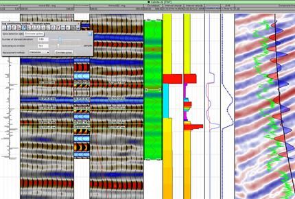
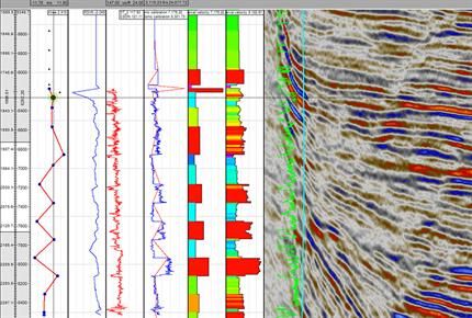
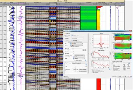
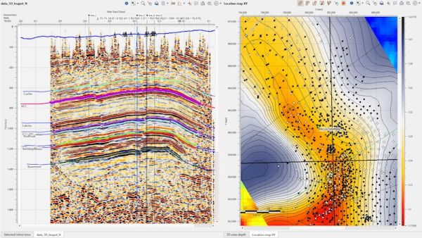
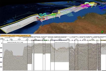
Petrel Seismic Well Tie Popular
The Petrel Seismic Well Tie module allows interactive checkshot calibration of sonic log data, analytical wavelet creation, statistical and deterministic wavelet extraction, and synthetic seismogram generation for 2D and 3D seismic data.
Integrated synthetic seismogram workflows unify, within the s ...
Read More ...
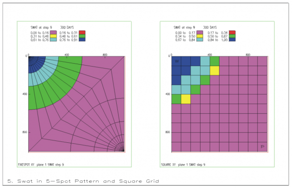
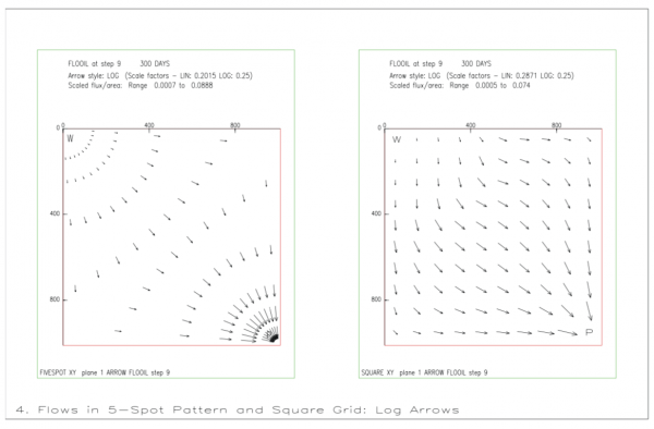
GRAF is a general post-processing package for the ECLIPSE simulator. It provides facilities for displaying simulation results and user data in graphical form. Various types of plots are available, including line graphs, colour-filled grid solution displays, contour displays, arrow diagrams, transmis ...
Read More ...
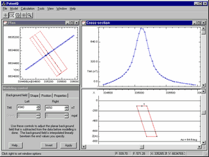
PotentQ is a simplified and streamlined version of Potent, our mainstream potential field modelling tool.
PotentQ is designed for rapid semi-automatic modelling of a single magnetic and/or gravity anomaly using up to three bodies chosen from seven possible geometries. Modelling speed is achieved th ...
Read More ...
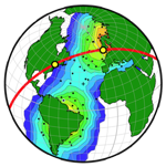
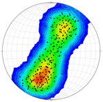
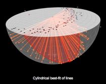
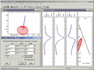
Stereonet3D (previously OSXStereonet) plots lines and planes in spherical, equal angle or equal area, projections. The program can produce various types of plots such as scatter plots, great or small circles, arc segments, contours, rose diagrams, stereonets from any view direction, latitude-longitu ...
Read More ...
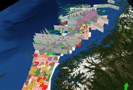
Seismic Interpretation Software
Dynamic synchronization between all views
Horizon picking and management
Simultaneous horizons interpretation on 2D, 3D or arbitrary line view
Interactive picking in time or depth domains
Import/export horizons in ASCII and some other formats
Horizon map creat ...
Read More ...
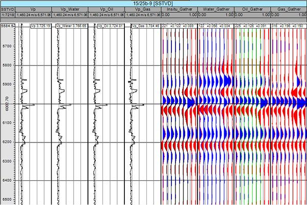
Gather Displays
Not all changes in seismic amplitude are due to fluid effects, this powerful workflow tool will not only allow interpreters to determine the effects they may see at different angles/offsets in the presence of oil & gas it will also help them to avoid false effects caused by tuni ...
Read More ...

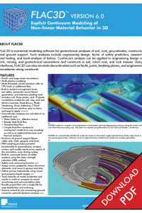
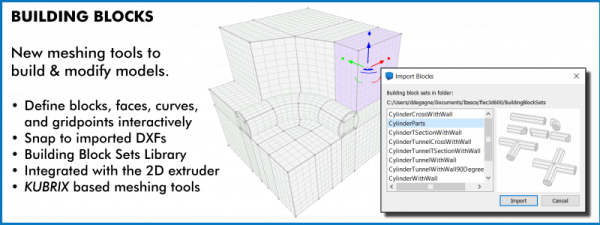
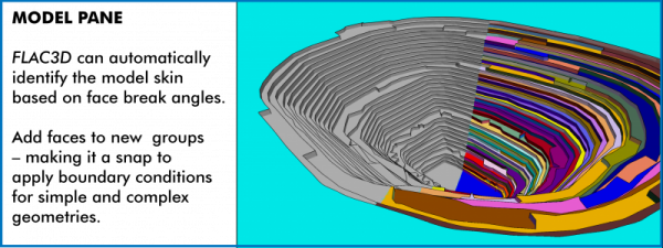
FLAC3D (Fast Lagrangian Analysis of Continua in 3 Dimensions) is numerical modeling software for geotechnical analyses of soil, rock, groundwater, constructs, and ground support. Such analyses include engineering design, factor of safety prediction, research and testing, and back-analysis of failure ...
Read More ...

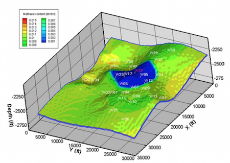
SIMEDWin is a coal seam methane reservoir simulator, which can be used to investigate the relationships between reservoir properties, well operating procedures and gas production. SIMEDWin is used to optimise well field design, reservoir management and production forecasting.
Capabilities
SIMEDWin ...
Read More ...
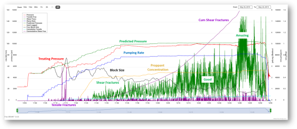
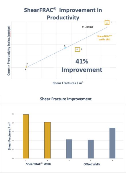
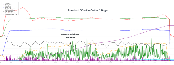

ShearFRAC® provides the missing link between geology and reservoir engineering through unique completion measurements. Our live streaming technology platform, FracBRAIN®, uses pumping pressure data, rate, proppant concentration, and frac chemicals, among other channels from your wells, to count the ...
Read More ...

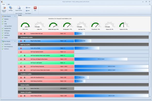
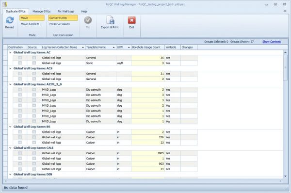
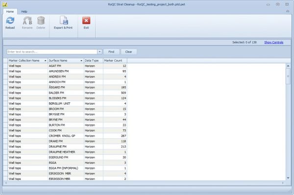
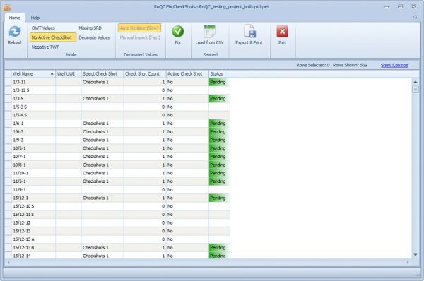
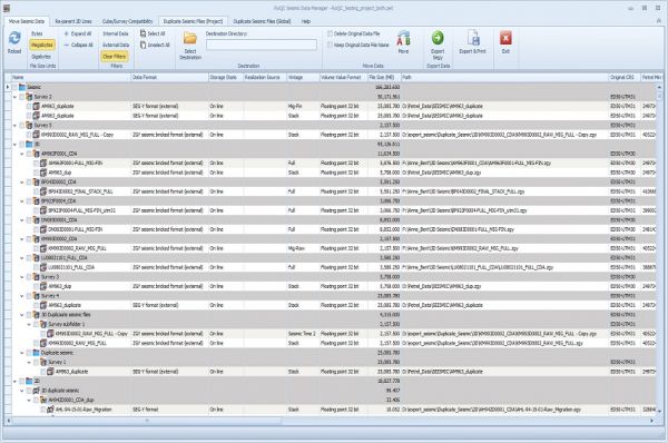
RoQC Tools provide an exceptionally powerful and fast data management environment for Landmark's OpenWorks environment or for Schlumberger's Petrel & Studio Manager environment. They are tools that help you rapidly clean up and manage your data. They cover the full cycle of Standards distributio ...
Read More ...

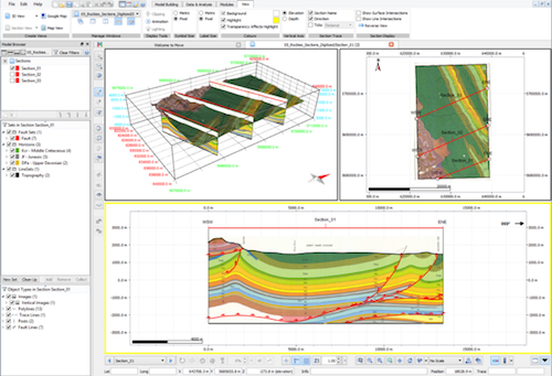
Move Core Application
Move is the core application of the Move suite. It provides a powerful stand-alone environment for data integration, cross-section construction and 3D model building, and forms the base for the specialist structural modules for 2D and 3D Kinematic Modelling, Geomechanical Mode ...
Read More ...

Crude Oil Analysis Database: Database contains information on 9,056 crude oil analyses performed at the National Institute for Petroleum and Energy Research (NIPER). The database is available in Microsoft Access 2002 format.

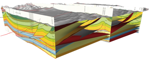
Build your structural models directly within the seismic volume, save time and incorporate all the details from your interpretation.
GeoTeric's modelling functionality allows you to build your models without getting into the (traditional) geocellular domain. Incorporating petrophysical property dis ...
Read More ...
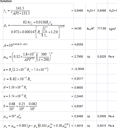
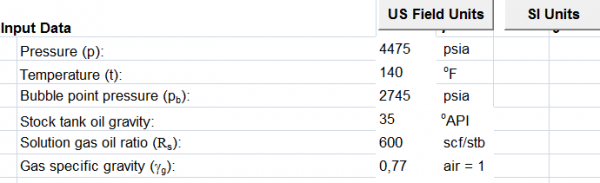
This spreadsheet calculates density and viscosity of a crude oil. Software to calculate some oil properties parameters. Easy to use because using macros and the view is very familiar, using Microsoft Office Excel.
The input parameters of Oil Properties Spreadsheet
Pressure (p): 4475 psia
Temper ...
Read More ...

Data Management Provides standardised, structured, and organised simulation data and project documentation. Process Delivers an intuitive environment/cockpit for simulation engineers to edit/manipulate, copy, run, track, document, view, and analyse models. Insight Monitor models and compare results ...
Read More ...

Online Data Analysis Tool Aniconist is a set of proprietary online data analysis tools developed by Golder professionals to seamlessly connect our specialists around the world as well as provide clients with 24/7/365 support and service. Developed with collaboration in mind, these tools allow both G ...
Read More ...

The Petrel Seismic Interpretation module enables basin-, prospect-, and field-scale 2D/3D seismic interpretation and mapping. You can work with thousands of 2D lines, thousands of kilometers, and multiple 3D vintages and surveys—across multiple coordinate systems with very high visualization perform ...
Read More ...
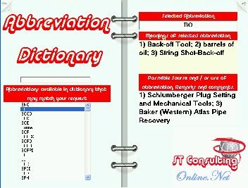
Did you ever wonder, while reading operations' reports, programs, or technical literature, what one or another abbreviation means? Of cause, even being an expert in oilfield speciality, one can't remember all abbreviations used in technical papers and studies, or even in oilfield slang.
This Applic ...
Read More ...