Directory: Random Listings
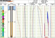
Advanced software suite that helps maximize drilling fluid performance and minimize drilling costs
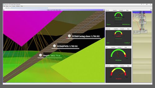
Our integrated suite of VIRTUAL HYDRAULICS ECD and ESD management software are used to evaluate and design critical drilling hydraulics under simulated downhole conditions. By monitoring and predictin ...
Read More ...
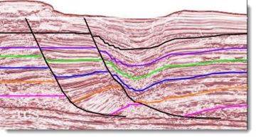
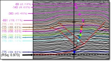
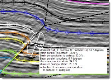
StructureSolver is an indispensable interpretation aid and structural analysis toolkit for earth scientists working in faulted basins.
StructureSolver helps you:
Understand structural and stratigraphic history
Infer correlations across faults
Validate fault and trap geometries
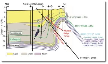
Determine detac ...
Read More ...
The new NORSAR-3D unveils a revolutionary new user interface for the NORSAR software. It makes the advanced and proven NORSAR-3D technology available in a completely new and simplified user experience.
NORSAR-3D is now part of the new NORSAR Software Suite framework.
The new NORSAR-3D is available ...
Read More ...
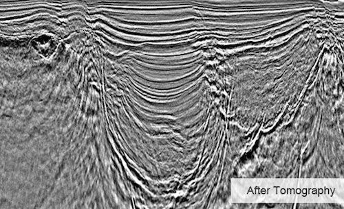
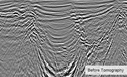
Obtaining high quality images of subsurface structures requires an accurate velocity model. Migration Velocity Analysis (MVA) improves the velocity model associated with a survey in order to create an accurate image of subsurface structures. After seismic data has been migrated through its current i ...
Read More ...
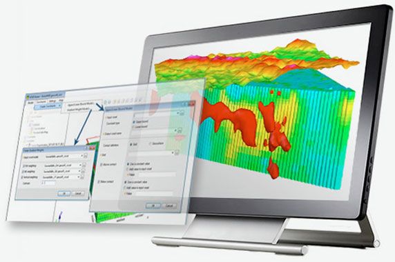
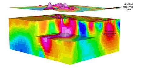
VOXI Performance Advantages
VOXI provides a solution for large, multi-parameter geophysical inversion modelling that can aid all stages of exploration and is suited for any size of project. It includes advanced inversion techniques that have been proven to increase geophysical model accuracy. On-de ...
Read More ...
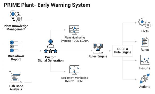
L&T Infotech helps clients detect the failures in critical equipment and systems, much ahead in time. Our proprietary solution, "PRIME Plant", is an early warning system, designed to help predict potential failures of critical equipment (undesired event) and process conditions. It shifts the mai ...
Read More ...
ST Calculator is the only mobile tool that allows to plan any well purging, Nitrogen lifting, or downhole pressure calculation.
This tool is unbeatable application for Petroleum Engineers, Coil Tubing Supervisors, Nitrogen Pump Operators, you list them!
Try for free and see what it does! You do no ...
Read More ...
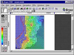
Cutting Edge Mapping and Spatial Analysis
MapViewer is an affordable mapping and spatial analysis tool that allows you to produce publication-quality thematic maps easily. Independent consultants, scientists, GIS analysts, sales organizations and numerous government agencies are discovering importa ...
Read More ...
Well Path including Driectional Drilling can be integrated with Casing Design
Registered users of Casing Design can purchase this at half price
Well Path allows you to design a new directional well path trajectory with;
Starting survey point
Survey intervals
Units in meters or feet
KOP
EOB ...
Read More ...
CycloLog® Popular
Biostratigraphy and chemostratigraphy are not always available in well correlation projects, or do not always provide sufficient constraints. Consequently, correlations and stratigraphic models derived from them can remain uncertain. CycloLog® is well correlation software which:
Enhances interpre ...
Read More ...
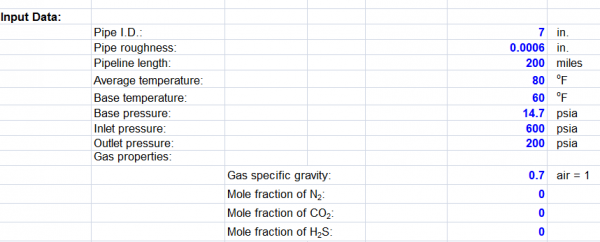
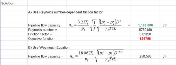
This Spreadsheet calculate the capacity of gas pipe line. Using pipe parameter Pipe I.D Pipe roughness Pipeline length How to use it Update paremeter blue text Macros will be run View Solution
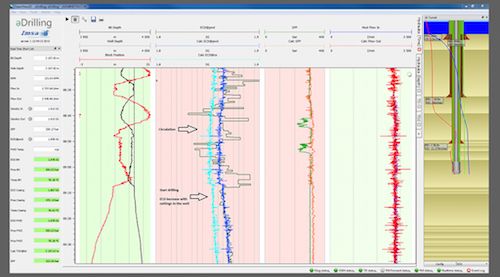
wellAhead enables decision makers to have better insight into the status of the well and formation surrounding the well and thus make better and quicker decisions. wellAhead uses all available real-time drilling data (surface and downhole) in combination with real-time modeling and operational plans ...
Read More ...
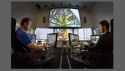
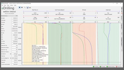
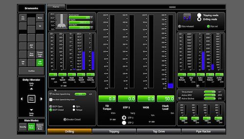
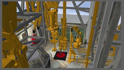
wellSim™ hiDRILL™ is the real-time simulator for collaborative team training at all levels. It comprises the hiDRILL™ VR (Virtual Reality) top-side rig floor simulator dynamically coupled to the wellSim™ downhole simulator, providing a simulator with unprecedented realism and capability. The simulat ...
Read More ...
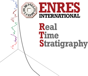
ENRES International is currently developing RTS (Real Time Stratigraphy), a new software product that will help you to reduce the risk and costs of missing the landing point of a deviated well. With RTS you will be able to:
Accurately correlate Logging While Drilling (LWD) data to a stratigraphic ...
Read More ...
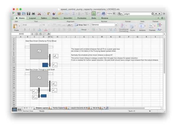
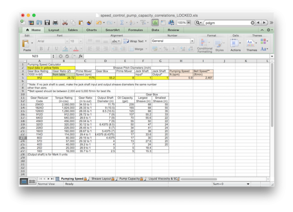
This Excel workbook has spreadsheet pages to compute:
The necessary sheaves to achieve a desired pumping speed. This includes the use of a jack shaft if necessary. A supplemental page shows a diagram of the gear box driven directly by the prime mover and through the use of a jack shaft. Belt spee ...
Read More ...
BLUEBACK INVESTIGATOR Popular
PLOT AND ANALYZE EVERYTHING GEOSCIENCE
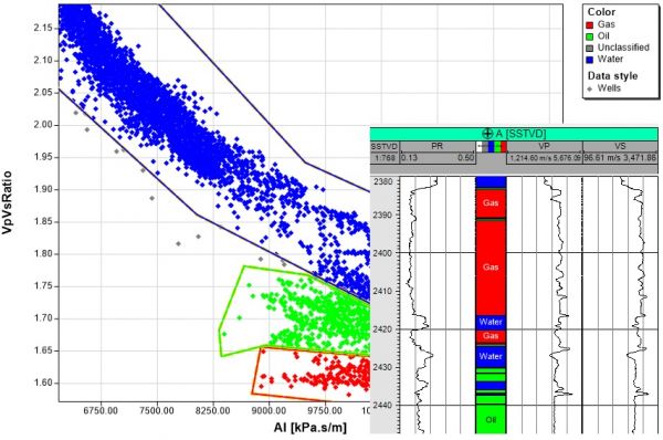
The Blueback Investigator brings long-awaited powerful cross-domain data analysis to Petrel. The custom windows provide unique visualization ideas to improve your understanding of the data.
Overview
Investigator provides statistical analysis tools you can ap ...
Read More ...
Three-Dimensional Flow, Heat, and Solute Transport Model
The Heat- and Solute-Transport Program (HST3D) simulates ground-water flow and associated heat and solute transport in three dimensions. The HST3D program may be used for analysis of problems such as those related to sub-surface-waste injecti ...
Read More ...
This is a small utility program to translate Longitude and Latitude coordinates into UTM coordinates and vice versa. You can choose from several different map datums, edit data and have it converted instantaneously to the other format, etc. Additionally, it can calculate all of the coordinates in a ...
Read More ...
Our cementing experts use advanced simulation software and reliable technical design to create innovative and effective solutions. With advanced simulation software, we can model and predict cement sheath integrity, optimized centralizer design and placement, cement slurry placement, wellbore proper ...
Read More ...
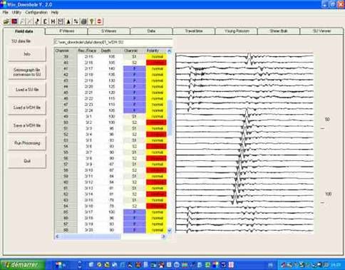
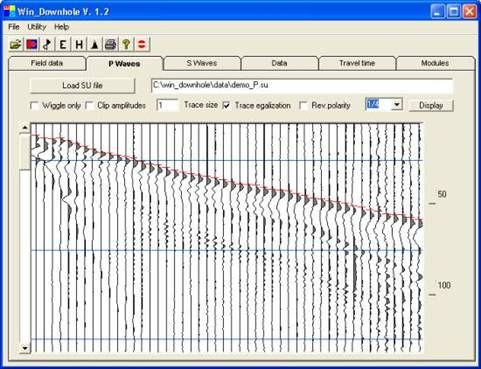
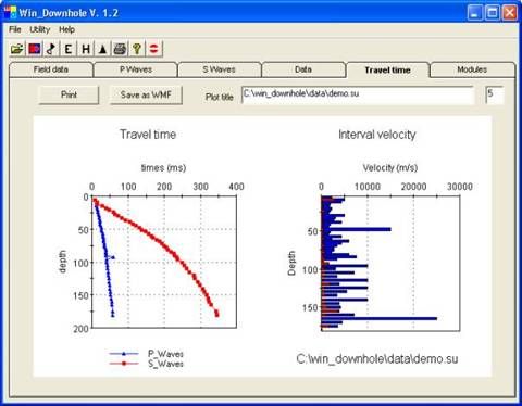
Grid with trace information and original SU file display
Import SEG2, SEG-Y,BISON, PASI, OYO, ABEM data files
Filtering and gain field records
Use 3 component geophones
Interactive P-waves and S-Waves first break picking
Invert and stack horizontal traces to enhance S-Waves
Produce travel ti ...
Read More ...