Directory: Random Listings
CGM Import™
Seamlessly Insert CGM Files into PowerPoint and Word!
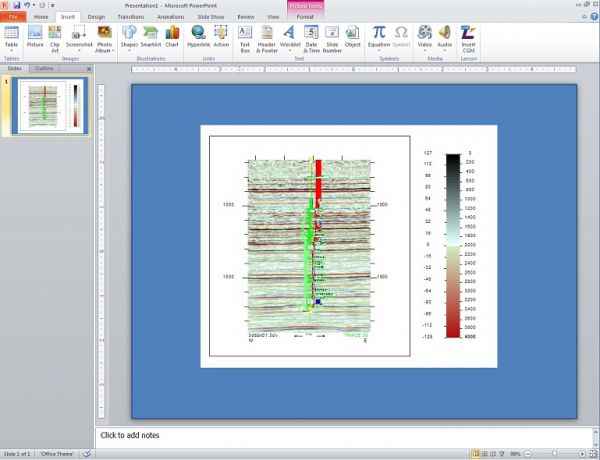
Improve your slides and reports with high resolution CGM files. Our CGM Import Add-In is the only software solution for seamlessly inserting CGM files into PowerPoint and Word. Insert your drawings, graphs, logs, maps, and even seis ...
Read More ...


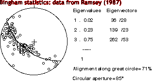
An easy to use menu driven program for orientation analysis of spatial data and paleostress calculation. This Mac based program is written by Hugo Ortner, University of Innsbruck, Austria.
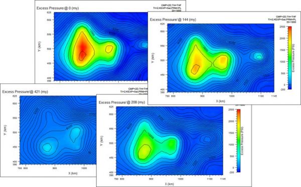
PVI is currently developing PlugPRO, a cement plug placement model that calculates under-displacement volumes and optimizes fluid volumes to balance slurry and spacer levels after pull out of the hole (POOH). In addition, PlugPRO also models the displacement hydraulics of fluids. We look forward to ...
Read More ...
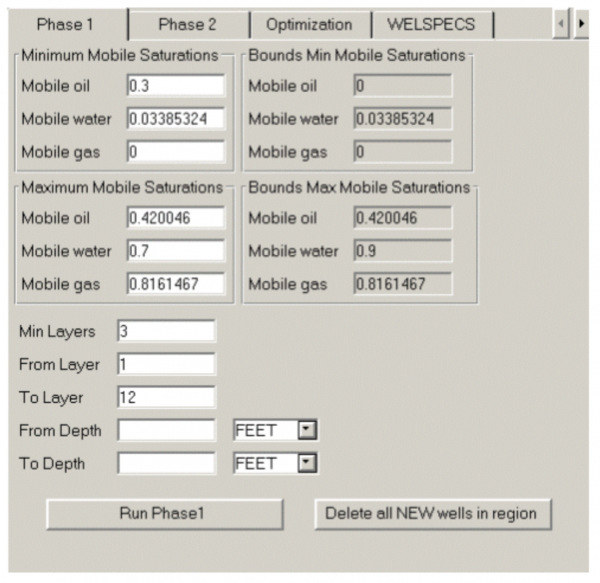
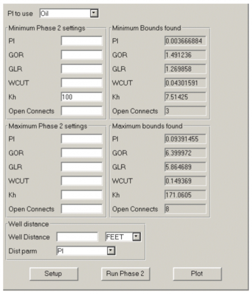
PlanOpt is a tool that assists in choosing the locations of vertical production wells during development, by applying pre-defined screening criteria to each column of grid blocks in a 3D simulation model to determine which could sensibly accommodate a production well.
A vertical well is completed i ...
Read More ...

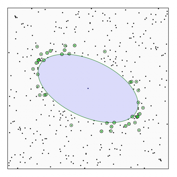
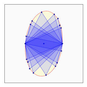
EllipseFit is an integrated program for geological finite strain analysis. It is used to derive two and three-dimensional strain from oriented photographs of thin sections, hand samples, or outcrop surfaces, and is designed for laboratory and field based structural geology studies. The intuitive gra ...
Read More ...
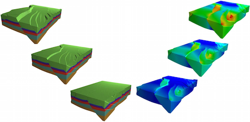
Structural Restoration can be used to verify the geological understandings of geologists through the structural restoration and give more reasonable interpretation data which follows geological principles to a large extent. Through a constant correction of understandings with the trial of structural ...
Read More ...

NPC Public Database: (NPCPUBDB.GEO). Database developed by the National Petroleum Council (NPC) for its 1984 assessment of the nation's enhanced oil recovery (EOR) potential. The technical data description is at the reservoir level. Included with the database are the Appendices from the "TORIS Data ...
Read More ...

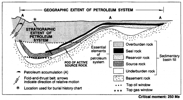
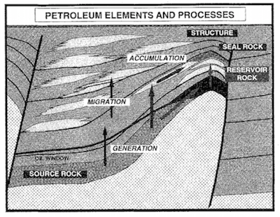
The petroleum system is defined by Magoon and Dow (1994) as a natural system which includes all geological and geochemical elements and processes essential to oil and gas accumulation. The concept itself is not new, but they reviewed and introduced a simple method to evaluate the petroleum systems. ...
Read More ...
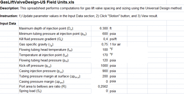
This spreadsheet performs computations for gas lift valve design spacing and sizing using the Universal Design method. Instruction: Update parameter values in the Input Data section Click “Slotion” button View result
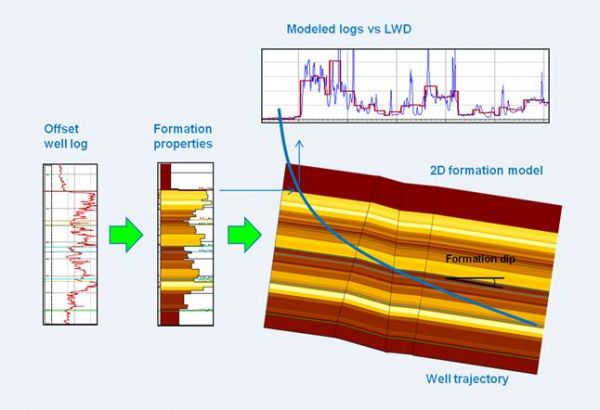
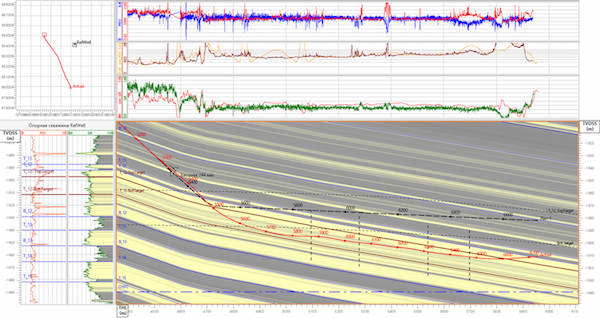
GEOSTEERING MODULE
The CS module allows geosteering based on comparison actual and synthetic logs. A distinctive aspect of the method is that it does not require expensive images for dips’ calculation and may well prove yourself even if geologist has GR curve only. Synthetic log is constructed on t ...
Read More ...
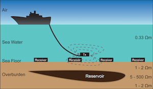
The marine controlled source electromagnetic (CSEM) method is a low-frequency electromagnetic imaging technique aimed at generating the electric resistivity map of seafloors. In a CSEM survey, an electromagnetic transmitter and arrays of electromagnetic (EM) receivers are used to probe the subsurfac ...
Read More ...
EasyCopy Graphics Suite is a suite of tools designed to manage graphics ideally suited for GeoScience Professionals. It includes advanced capture tools including window, region, full screen and Movies. Conversion tools support the most used graphic image formats including CGM (including Seismic), EM ...
Read More ...
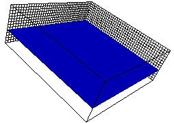
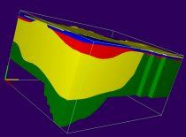
Create Informative and Impressive 3D Images for your Groundwater Flow and Transport Models!
Introduction
The software package 3D Master (GE) provides for three-dimensional visualization and animation of data from groundwater flow and transport models. The current version of GE uses any native MODF ...
Read More ...
BasinView links the products in the Petroleum Systems Suite, including BasinMod, BasinMod Risk and BasinFlow. Multiple BasinMod well models as well as surface grids or isopachs can be imported and used to generate surfaces for a multitude of calculated values. Results can be displayed as maps, cross ...
Read More ...
The multi patent-pending Productive-SRV combines engineering data with microseismic data to determine what proportion of the total stimulated rock volume (SRV) is propped and should, therefore, be productive. This novel approach helps you to finally answer the question “where did the proppant go?” W ...
Read More ...
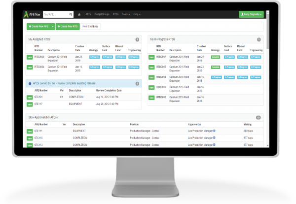


AFE Navigator Popular
A better way to manage AFEs and capital
AFE Navigator® (AFE Nav) is an all-in-one Approval For Expenditure software solutionthat integrates with your other key systems. It even works from your smart phone!
Speed your AFE workflow from creation through approval
Currently, more than 100 companies a ...
Read More ...
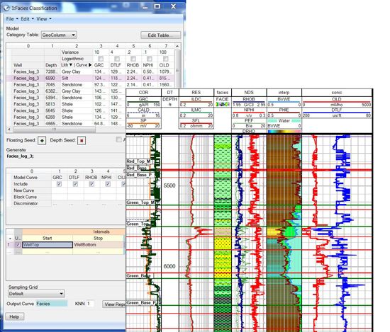
FaciesID reconstructs your input logs so you can overlay them to see how well you are covering the profiles in your log space, and you can write the block logs to the database when needed. That comes in handy when you classify electrofacies on wells with different logging suite compositions. A missi ...
Read More ...
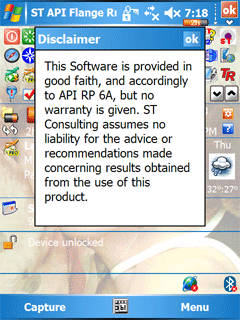
This program replaces hard version of the Flage Slide Rule for the oilfield applications.
This is digital API RP6A based Flange Slide Rule.
The program may be used by Petroleum and Completion Enineers, Superintendents and Supervisors, by Wellhead designers, and by anybody at the oilfield at their ...
Read More ...
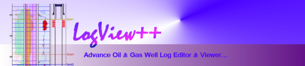
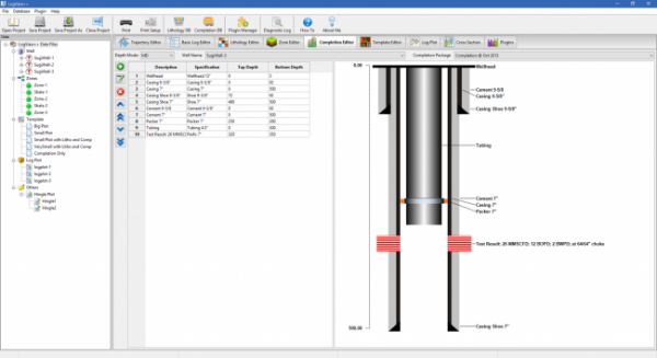
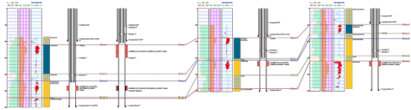
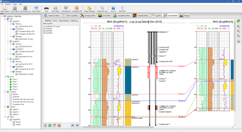
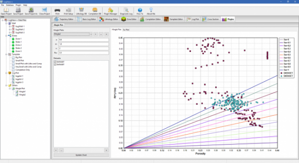
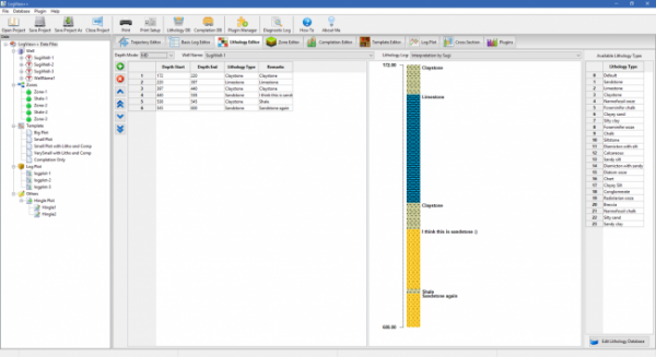
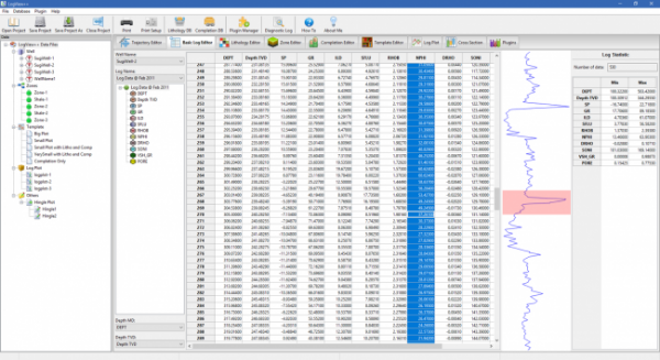
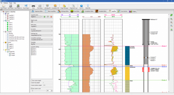
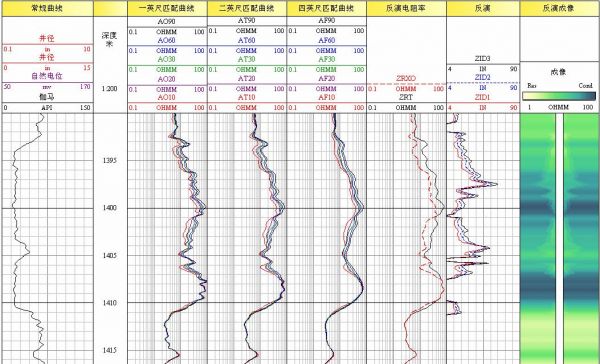
LogView++ is a sophisticated but easy-to-use application that lets you (especially engineer, geologist, and petrophysicist) to quickly manage well log data files, to be edited, analyzed using advance calculator, plotted as single well log plot, and also as cross-sectional plot compared with other lo ...
Read More ...
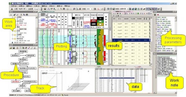
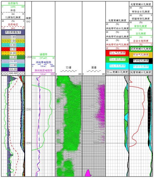
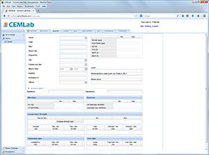
LEAD includes the interpretation knowledge DB, logging DB, digital core DB and several interpretation application modules, and can provide open-hole, cased-hole logging interpretation, imaging process services.