Directory: Random Listings
DepthInsight® Geomechanics Popular
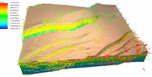
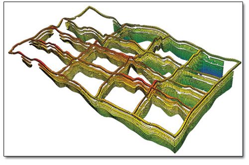
DepthInsight® Geomechanics is finite element based. It allows you to get the computational grid converted directly from the structural model with finite element method, which hugely increases your work efficiency by reducing the tedious grid editing work and other operations. Then make a direct FE c ...
Read More ...
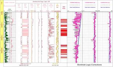
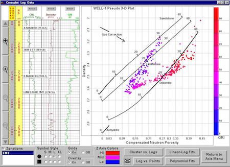
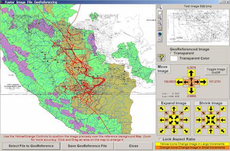
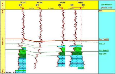
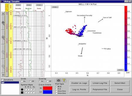
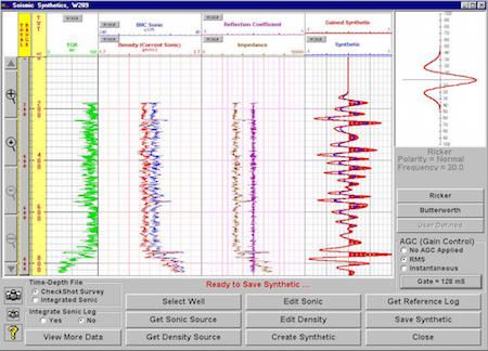
GS is a fully integrated PC-Windows based geological system whose primary features include interactive well correlations, cross sections (including raster log images), comprehensive petrophysical analyses, Pore Pressure and Fracture Gradient prediction, FIT Pressure Analysis, single or multiple well ...
Read More ...
GasAssure Popular
GasAssure is an advanced integrated oil and gas, production planning technology which, in particular, can perform a vital role in the planning of short, medium and long-term gas projects. It offers a truly integrated solution, from "reservoir to market", for the widest range of gas planning issues ...
Read More ...
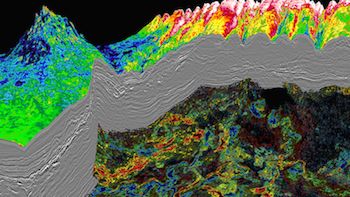
PGS uses a very efficient AVO/AVA workflow that allows for the rapid evaluation of prospectivity over large datasets. The elastic attributes calculated are routinely used as a first step in de-risking prospectivity using pre-stack seismic data.
Based on angle stacks or PSTM/PSDM gathers, we derive ...
Read More ...
MBAL Popular
Efficient reservoir development requires a good understanding of reservoir and production systems. MBAL helps the engineer better define reservoir drive mechanisms and hydrocarbon volumes. This is a prerequisite for reliable simulation studies. MBAL is commonly used for modelling the dynamic reservo ...
Read More ...

Formation testing, or FT, has many applications including formation fluid characterization, pressure measurements and reservoir characterization. Pressure data can be analyzed as it varies with depth. Multiple pressure measurements are taken in the well to determine fluid density gradients and poten ...
Read More ...
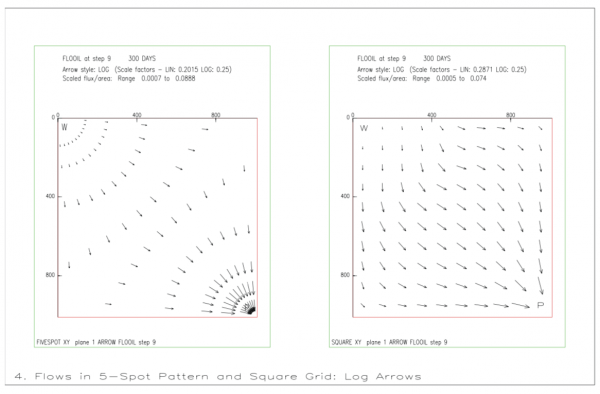
GRAF is a general post-processing package for the ECLIPSE simulator. It provides facilities for displaying simulation results and user data in graphical form. Various types of plots are available, including line graphs, colour-filled grid solution displays, contour displays, arrow diagrams, transmis ...
Read More ...
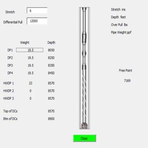
Free point calculator for Excel Popular
Calculate the free point for any depth from MD to surface.. User selectable units API or Metric Using up to 4 sections of Drill Pipe 3 sections of Heavy Weight 3 sections of Drill Collars You have the option to select API or Metric units


The petroleum industry has undergone tremendous change over the past decade. There has been a wave of consolidations and mergers in an attempt to gain greater efficiency and market share. Not surprising, many companies now provide both products and services to the oil and gas sector. In the past, ...
Read More ...
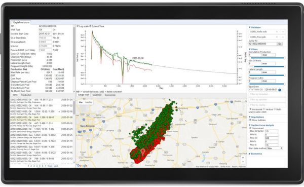
The Production Insights Platform is a collaborative, cloud-hosted platform that provides decision-makers and technical staff with the tools they need to quickly make critical insights and reach the best decisions. Production and economics-focused workflows allow staff to quickly advance projects fro ...
Read More ...
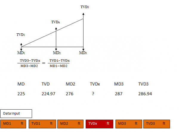
Interpolasi calculation usually using for calculate middle value between two value How to use this spreadsheet Input data for MD1 MD2 MD3 TVD1 TVD3 Look for Data result in table MDx right coloum and drag to general calculate if yoo have any data to calculate
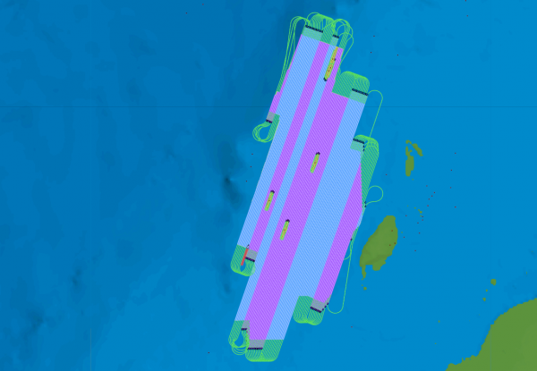

SurvOPT is the ultimate marine seismic project planning, optimizing and costing tool, letting you examine the effect of survey design changes in near real time.
As well as finding efficient shooting plans and accurate completion estimates, SurvOPT seismic survey design software can compare vessel c ...
Read More ...

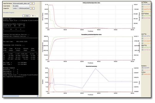
FlowSim Studio is a fully implicit, three-phase, three-dimensional black-oil and composite reservoir simulator. It simulates dynamic responses of oil and gas reservoir performance by computing gas, oil and water phase flow within the reservoir.
FlowSim Studio can handle both single and dual porosit ...
Read More ...

Groundwater Risk Assessment Tool for Contaminated Land ConSim was created and developed by Golder in 1999 for the Environment Agency in England and Wales as a tool to assess quantitatively the risk to groundwater by leaching contaminants. It is a relatively simple tool that uses commonly available s ...
Read More ...
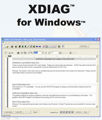
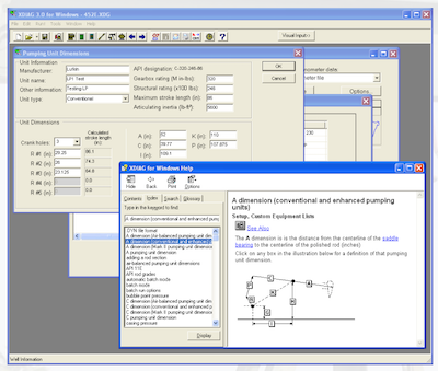
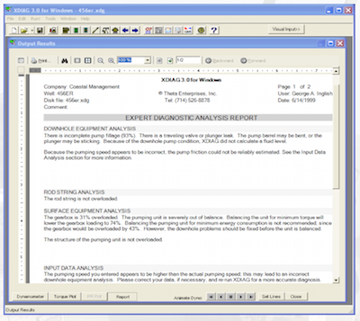
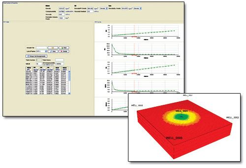
XDIAG is a revolutionary new diagnostic and analysis software that combines state-of-the-art expert system and pattern recognition technology with accurate wave equation diagnostic modeling. XDIAG uses exact pumping unit kinematics to analyze any available pumping unit geometry. XDIAG can determine ...
Read More ...
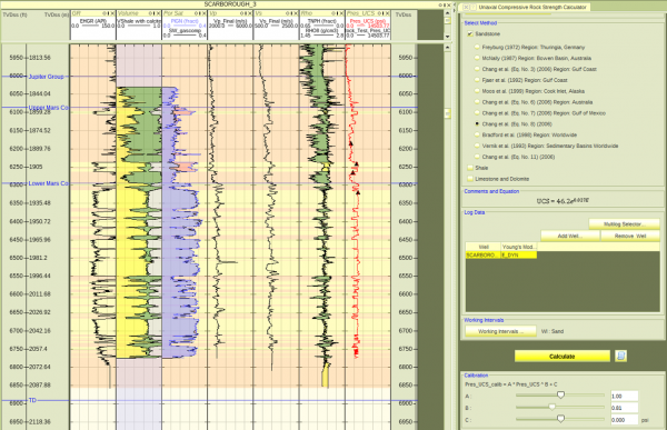
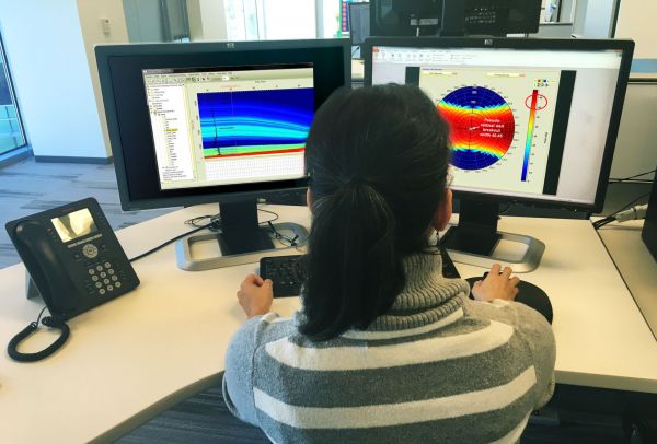
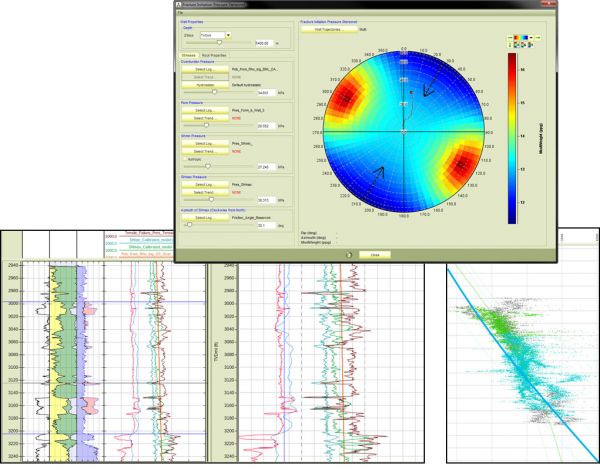
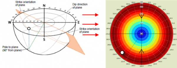
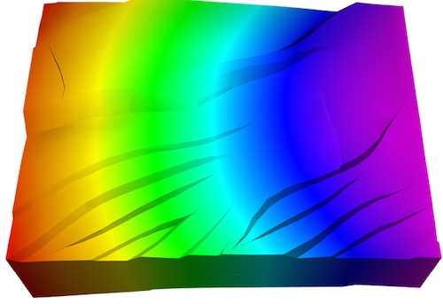
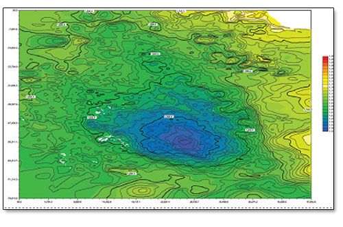
RokDoc GeoMechanics adds geomechanical model building to rock physics and quantitative interpretation package. Understanding the stress state in the earth is of vital importance for well plan design, completions optimisation, cap rock integrity, and wellbore stability. Finding a prospect is only par ...
Read More ...

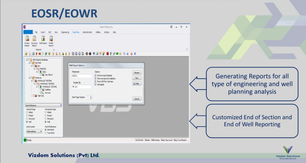
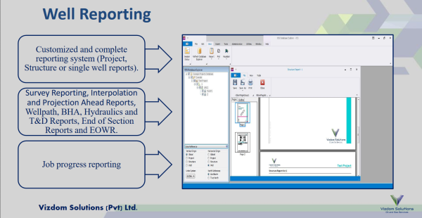
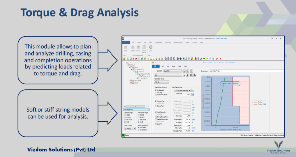
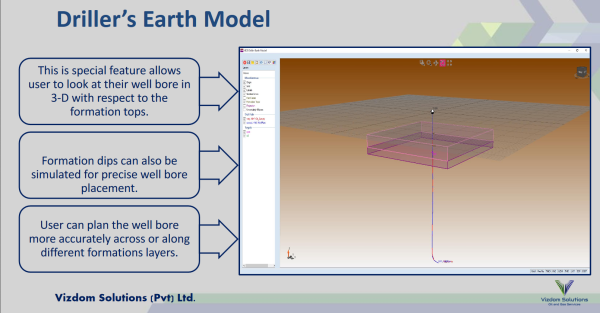
VDS™ is a software platform for Petroleum Engineers, Drilling Engineers and Drilling Supervisors for well bore planning, construction and optimization. Our Software has been designed to have user friendly interface where users can optimize drilling trajectories quickly based on cost, torque and drag ...
Read More ...

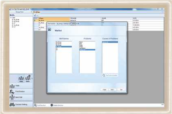
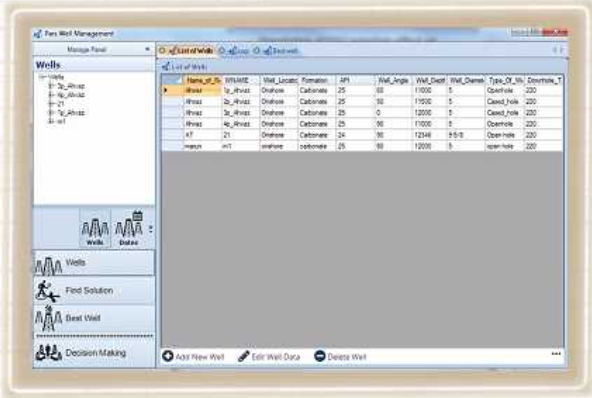

PWM is mainly management software to investigate prioritization of different alternatives in front of managers. It uses two methods from package of Multi Criteria Decision making Tools (MCDMT). These methods are fuzzy AHP and TOPSIS. Functionalities of PWM are proposing and prioritizing different ap ...
Read More ...
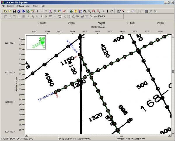
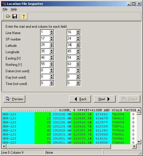
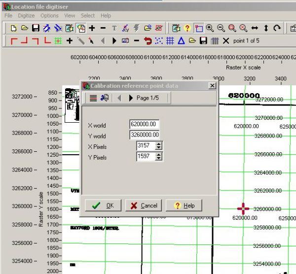
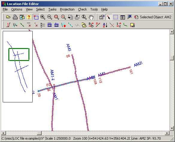
LEAMAP Version 3.0 Specification
The Lynx Exploration Archivist Map Scanning and Vectorising (LEAMAP) software is a comprehensive software solution for converting hard-copy seismic line location (shotpoint) maps into digital data, and importing and editing existing location data from a variety of f ...
Read More ...
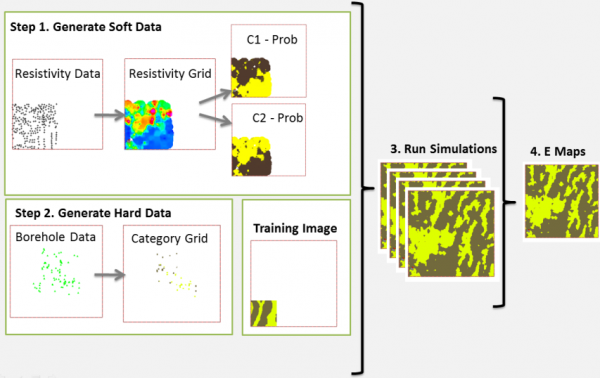
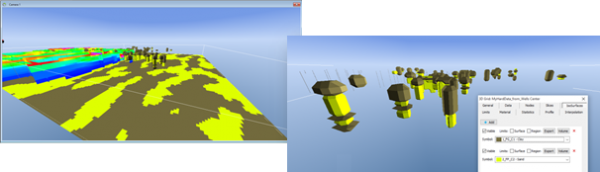
Simulation Extension
The Simulation Extension adds extra functionality to the Voxel Builder Module in GeoScene3D. The extension provides access to Multiple Point Statistics for property simulation in voxel models. This set of tools provides you with the functionality for working with the latest adv ...
Read More ...