Directory: Random Listings

On-line data acquisition and processing, database recording, drilling parameters control, precise calculations makes real time well monitoring easier and more effective than ever before. The main features of the on-line software package are:
Drilling status definition.
Hydraulic, PVT, bit, forma ...
Read More ...

CSR and the preservation of our planet have always been one of our major concern. Through RB.eye, Fame+ and orKsoft® and their ability to prevent extremely damaging incidents, we have tried for 17 years to improve the safety of Oil&Gas, Petrochemical and Power production to reduce the impact of ...
Read More ...
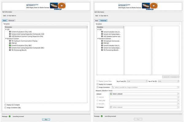
Simplified user interface with choice of Basic or Advanced view
The Basic tab provides quick viewing with very little interaction. Ideally suited for users wishing to review the results with pre-defined formats. For users wishing to QC and investigate complex behavior, the Advanced tab allow greate ...
Read More ...
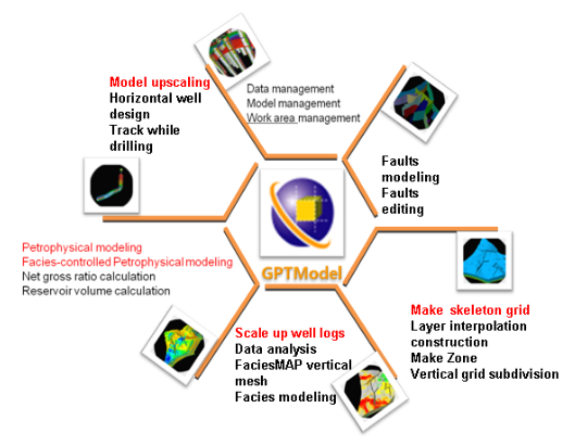
GPTModel Reservior geological modeling software
GTPModel is a corner mesh generation, geostatistics, 3D visualization technology-based reservoir geological modeling software, mainly based on detailed geological study, detain the 3D character of the reservoir structure, reservoir geometry and physic ...
Read More ...
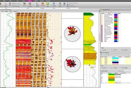
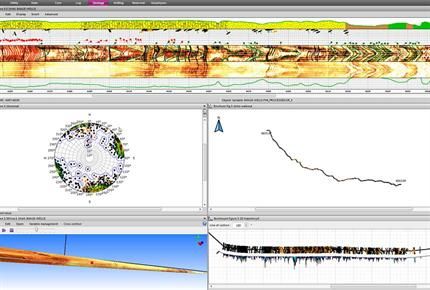
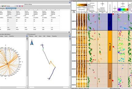
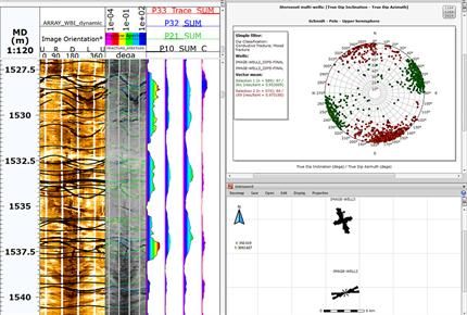
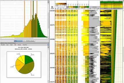
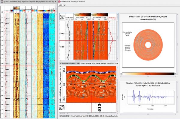
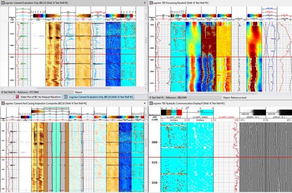
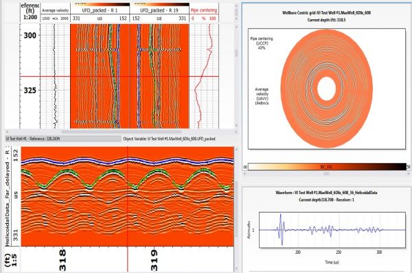
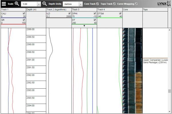
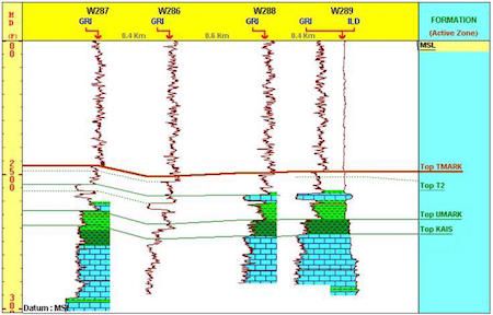
Data handling The Wellbore Imaging (Wbi) module lets you benefit from tool recognition on loading, interactive depth matching, and splicing of processed data from multiple passes. It also provides the ability to handle raw and processed data from multiple vendors with ease. Results are exported in A ...
Read More ...

Rock mechanical and pretrophysical properties database for well design, seismic modeling, log analysis, hydraulic fracturing, reservoir engineering and more. PC, LAN, intranet and internet versions.

Bring clarity. Choose IC. IC™ is a powerful tool used to store and visualise well data. It is a simple but powerful data integration and data management platform. IC™ is designed for Geologists, Data Managers, Petrophysicists, and Engineers who are tasked with taking control of the integration and i ...
Read More ...
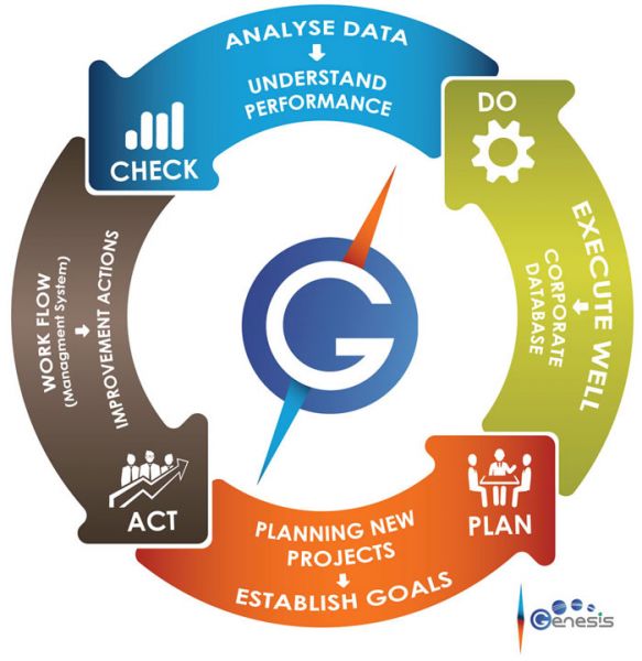
Genesis Planning and Follow Up (PFU) is a comprehensive software tool for planning and following-up the execution of drilling, completions and workover activities. It produces an optimized forecast of the time and cost of future interventions.
How will your company benefit?
Optimized forecast of ...
Read More ...
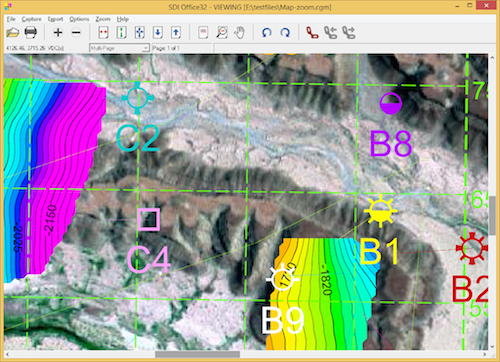
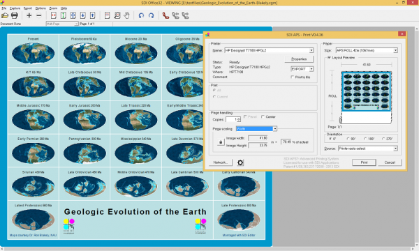
View CGM and other vector or image graphics files, view, convert and print.
SDI Office is a multi-purpose Windows application for viewing, conversion and printing graphics and image files. View multiple 2-D formats including CGM, PDF, PostScript, HPGL, DWG/DXF, EMF, TIFF, JPEG, PNG, BMP, XWD and CA ...
Read More ...

NIPER-705. PC-GEL: A Three-Dimensional, Three-Phase, Permeability Modification Simulator. IIT Research Institute, National Institute for Petroleum and Energy Research (NIPER). October 1993. 190 pp. NTIS Order No. DE94000104. Executable program. Min. Req.: IBM PC/AT, PS-2, or compatible computer with ...
Read More ...

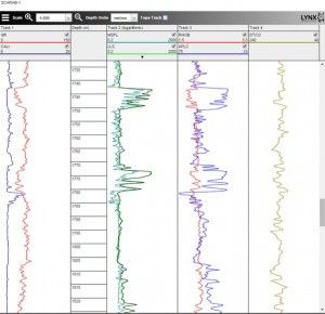
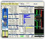
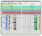
iLogview is a wireline log viewer app for web browsers. Digital composite logs can be viewed interactively in a multi-track display, with formation tops and core photos. Individual curves can be turned on and off, and the vertical scale can be changed intuitively by users and switched between metres ...
Read More ...
This program will take a table of orientation data, saved as tab-delimited text file, and reformat the data so that it can be read into v. 9-12 of Canvas GIS drafting software. Upon import, you will see all of your strikes and dips of bedding, cleavage, joints, or lineations plotted with their corre ...
Read More ...
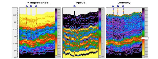
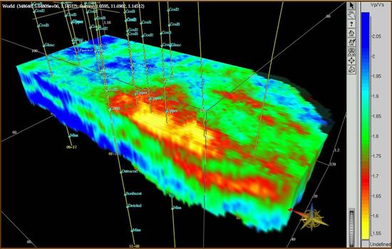
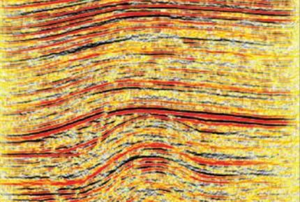
Simultaneous AVA/AVO Inversion
Since its introduction in 2000, RockTrace® has significantly impacted the way the industry uses and incorporates pre-stack time migration (PSTM) seismic data. It is the only technology that quantitatively integrates well log elastic rock properties and AVA seismic to ...
Read More ...
Includes Over 1000 Hi-Resolution Tools and Graphics to use in your well bore schematic This is the first and most comprehensive Workover office program in the oil patch One click select a tool and drops it into your well bore schematic plus much more
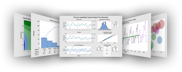
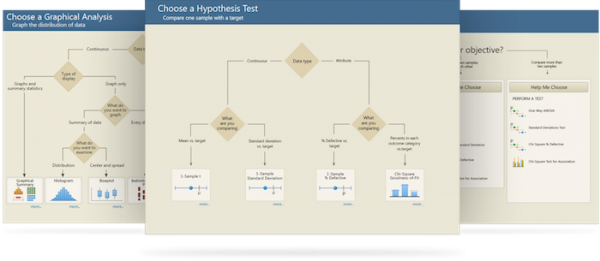
Minitab 17 has all the tools you need to effectively analyze your data. By guiding you to the right analysis and giving you clear results, Minitab helps you find meaningful solutions to your toughest business problems.
The complete statistical software package.
Minitab provides convenient features ...
Read More ...
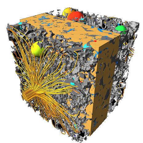
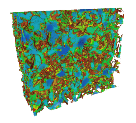
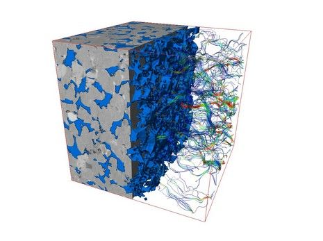
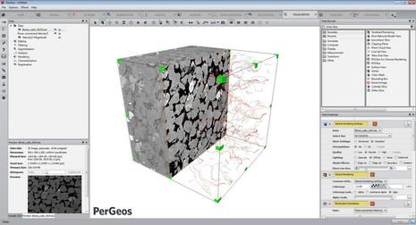
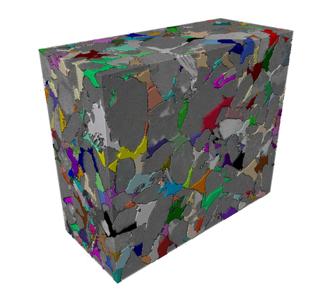
PerGeos Software
Digital rock analysis
Thermo Scientific™ PerGeos Software for digital rock analysis is the industry's first software designed to help geoscientists rapidly interpret digital rock imagery so that E&P engineers can quickly and easily obtain meaningful, actionable data. Its visua ...
Read More ...
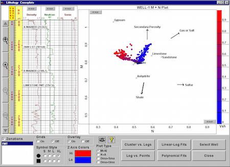
GS is a fully integrated PC-Windows based geological system whose primary features include interactive well correlations, cross sections (including raster log images), comprehensive petrophysical analyses, Pore Pressure and Fracture Gradient prediction, FIT Pressure Analysis, single or multiple well ...
Read More ...
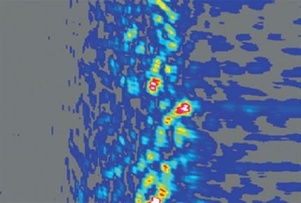
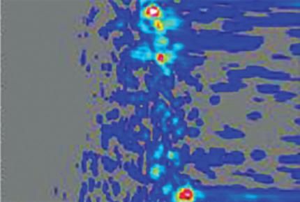
Extended internal multiple prediction (XIMP) is a data-driven demultiple algorithm that attenuates interbed multiples. Attenuation of interbed multiples poses a unique challenge because these multiples arise from seismic reflections bouncing between closely spaced geological beds, resulting in multi ...
Read More ...


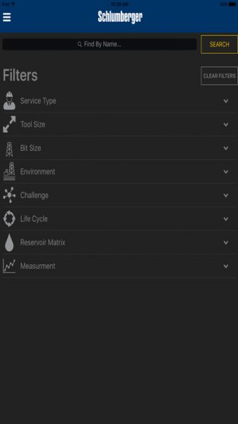
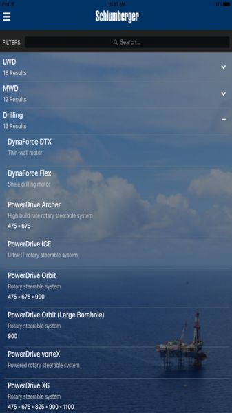
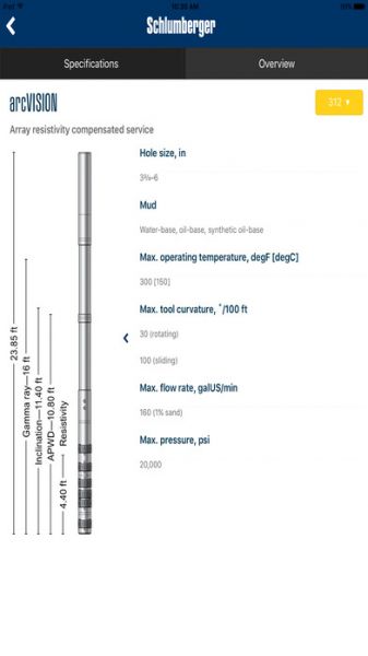

Access the most robust portfolio of directional drilling, MWD, and LWD technology in the oil and gas industry from the office or at the wellsite. Users can search by challenge, tool size, measurement, environment, or reservoir type to match the right technology with the specific application
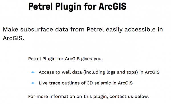
Make subsurface data from Petrel easily accessible in ArcGIS. Petrel Plugin for ArcGIS gives you: Access to well data (including logs and tops) in ArcGIS Live trace outlines of 3D seismic in ArcGIS