Directory: Random Listings

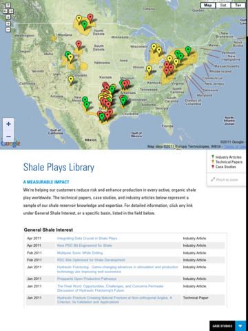
Gain a better understanding of the challenges facing operators today. Explore videos and read case studies, articles, technical papers, and more. Featured challenge: Shale plays.
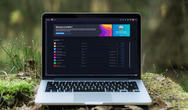
The power of remote real-time monitoring
Remote locations make it extremely difficult to manage drilling operations, especially when problems arise. With Petrolink’s Real-Time Solution, you always know exactly what is happening with your well, even when thousands of miles away, so you can address a ...
Read More ...
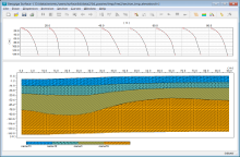
TruVert 2-D provides a sophisticated calculation procedure to determine true vertical thickness (TVT) and net pay in deviated wellbores that penetrate dipping reservoirs. While the computation procedures are relatively simple, manual TVT calculations can be very time consuming and often confusing. W ...
Read More ...
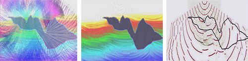
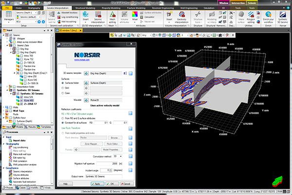
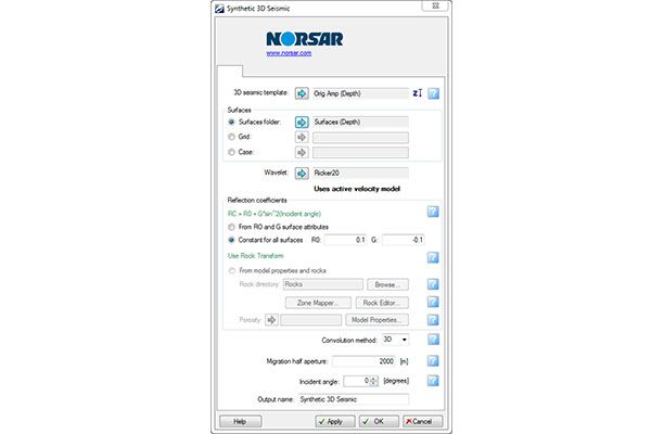
Powerful seismic interpretation for your play
The LogM™ modeling package is an add-on to the Advanced Synthetic Package and includes industry-standard stratigraphic modeling and structural modeling. Stratigraphic models are easily generated from the cross-section view and include the formation corr ...
Read More ...
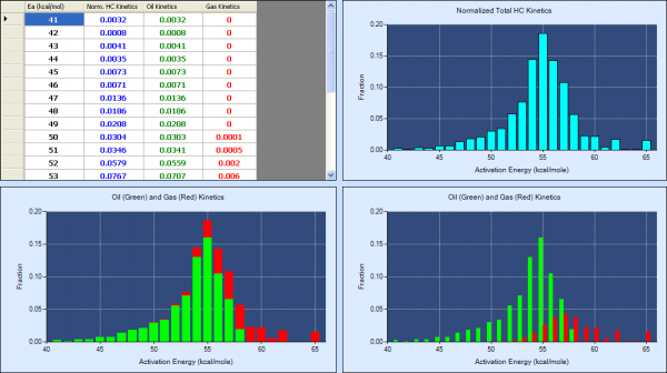
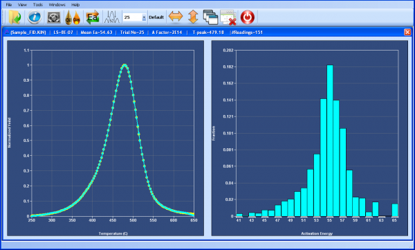
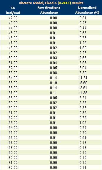
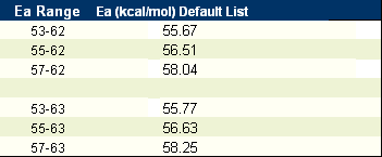
ORFA (One Run Fixed A-factor) was created by pioneering geochemist Dr. Douglas Waples of Sirius Exploration Geochemistry and StratoChem’s Hossam Ali. Designed especially for petroleum explorationists who want to determine source-rock kinetics, this software analyzes data from a single pyrolysis run ...
Read More ...
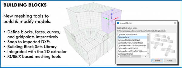
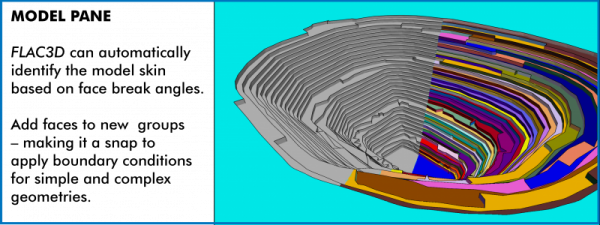
FLAC3D (Fast Lagrangian Analysis of Continua in 3 Dimensions) is numerical modeling software for geotechnical analyses of soil, rock, groundwater, constructs, and ground support. Such analyses include engineering design, factor of safety prediction, research and testing, and back-analysis of failure ...
Read More ...
KARTOTRAK, THE INTEGRATED SOFTWARE SOLUTION FOR CONTAMINATED SITE AND SOIL CHARACTERIZATION
Kartotrak is the first all-in-one software solution designed for an efficient characterization of soil contamination. It has been conceived for all those in charge of environmental site assessment or remedia ...
Read More ...
Kirchhoff methods are widely recognized as one of the most comprehensive and flexible methods of imaging prestack 3-D seismic data. ZTK is Z-Terra’s implementation of three-dimensional Kirchhoff migration in depth and in time. ZTK images seismic data by approximately solving the wave equation with a ...
Read More ...
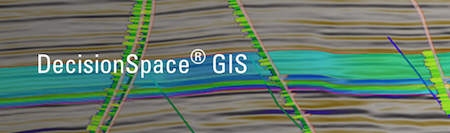
Geospatial Context for Interpretation
E&P professionals in many domains need GIS data to visualize cultural data, satellite images and leases, set the geospatial context for interpretation, map play fairways, plan optimal well locations, and assess environmental impact. Built on industry-leadin ...
Read More ...

Economic Analytics Popular
Monitor and analyze changes in the global economy
Need to track and report on global macroeconomic trends?
Designed for economists and analysts, this macroeconomic data access and software solution provides data and analysis for 200+ countries. We also homogenize and standardize key global economi ...
Read More ...
Compressor Simulation Tool CompAna® models the end-by-end and stage-by-stage performance of a reciprocating, positive displacement compressor of virtually any head end / crank end, cross-over and by-pass geometry. The model handles any range of staging, compression ratios and gas throughput. Because ...
Read More ...
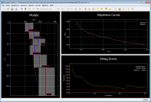
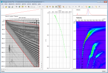
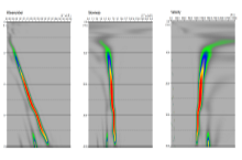
SURFACE is able to process active surface waves with SASW and MASW. The dispersion spectrum can be calculated in F-K, F-V, or F-P domain, where the fundamental and high-mode dispersion curves are interactively picked. The robust forward modeling and the global genetic algorithm (GA) assure the quick ...
Read More ...
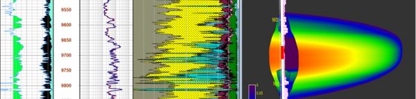
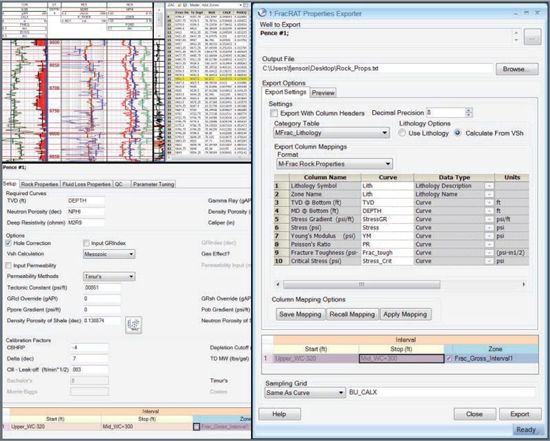
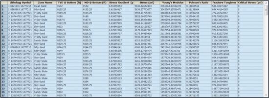
FracRAT takes petrophysical curve data from PowerLog and uses empirical and deterministic algorithms that have been field tested by Baker Hughes Pressure Pumping for over 20 years, to output the formatted rock and fluid properties for immediate loading into major frac simulation packages like MFrac ...
Read More ...
Axxim™ is a unique software solution that optimises the management of asset integrity and reliability. It provides upstream and downstream oil and gas operators, chemical, power and other asset-intensive industries, with a single resource to identify critical assets, increase equipment reliability a ...
Read More ...
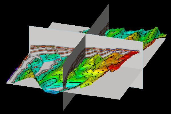
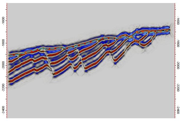
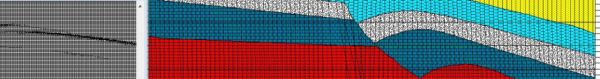
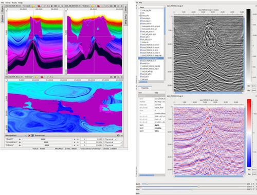
Seismic cross-section
An Inline of the resulting synthetic 3D seismic along with the surfaces (stippled) from which it was generated. Notice how the steeply dipping faults are not illuminated using the current Migration half aperture (500 m). Increasing the Migration half aperture will give a bette ...
Read More ...
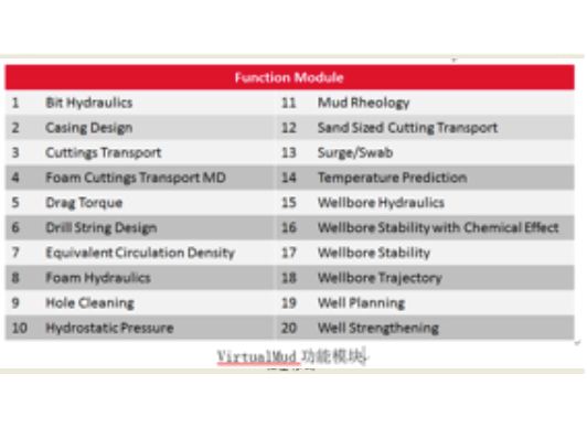
VirtualMud is a software for performing computations of hydraulic in an oil well drilling operations self-developed by COSL which includes Prediction of Temperature, Bit Optimization, Well Strengthening, Wellbore Hydraulic, Torque&Drag, etc. It can accurately calculate the of ECD, ESD and Hole C ...
Read More ...

The aim of DDR-One is to provide a practical tool to record the day to day drilling activities to print, export the daily drilling report to automatically generate standard reports, and to give easy access to the recorded data for further use (post analysis, ad-hoc reporting).
Overview
Data Qual ...
Read More ...
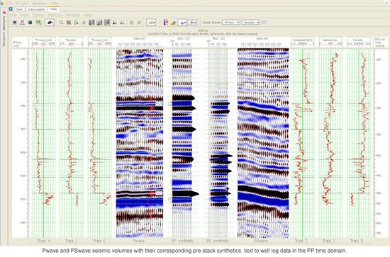
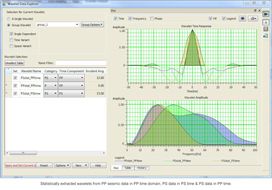
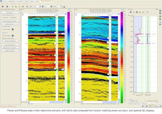
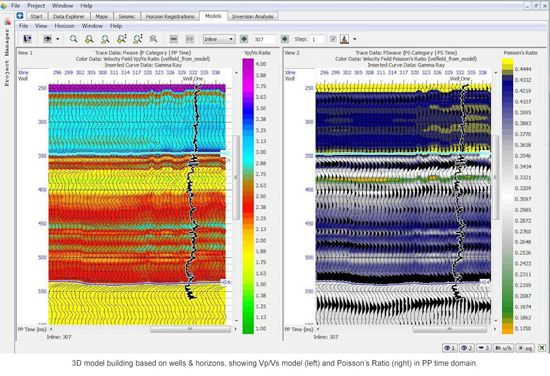
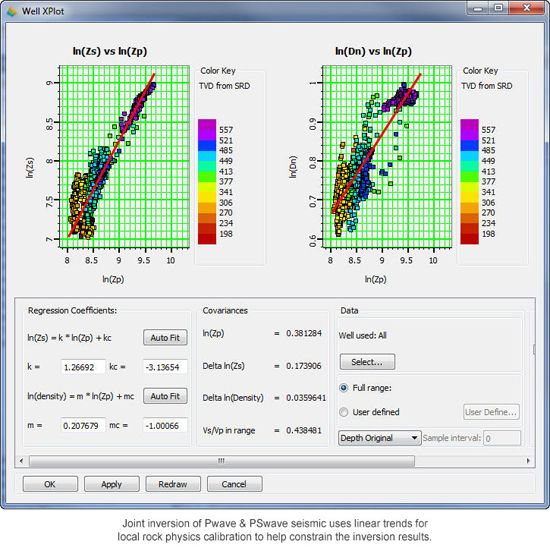
ProMC allows consistent interpretation of multicomponent data. It addresses the challenges of differences in event times, frequencies and reflectivity between PP and PS seismic volumes. The easy-to-use and intuitive work environment offers interpreters the ability to handle the increased number of s ...
Read More ...

GeoCarta is a single-point data access software solution that enables project teams to explore, analyze, extract and map public and proprietary data with ease to make faster and more accurate decisions.
Using industry-leading technologies, GeoCarta provides a modern, intuitive interface and access ...
Read More ...
ParaView is an open-source, multi-platform data analysis and visualization application. ParaView users can quickly build visualizations to analyze their data using qualitative and quantitative techniques. The data exploration can be done interactively in 3D or programmatically using ParaView’s batch ...
Read More ...