Directory: Random Listings
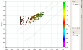
TRACESEIS’ ROCK PHYSICS PACKAGE
Tool to analyze the relationship that rock properties (Vp, Vs, density and derived properties) have with reservoir properties (porosity, lithology and fluids). The analysis and modeling packages (SeisRP and SeisMod) lead to the reservoir characterization module (Seis ...
Read More ...
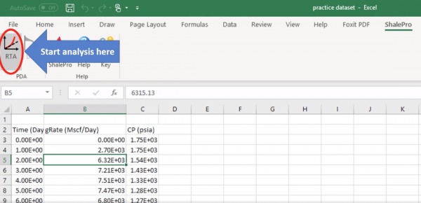
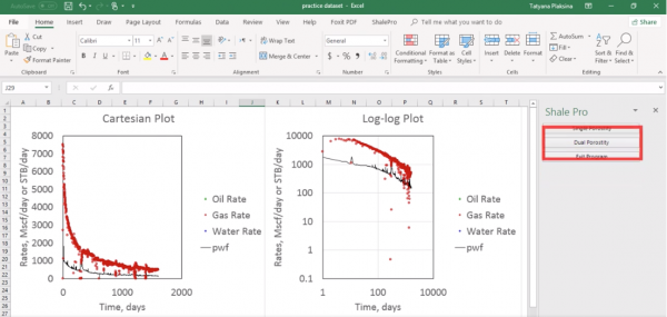
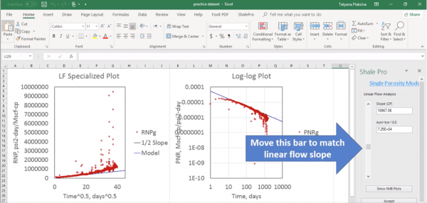
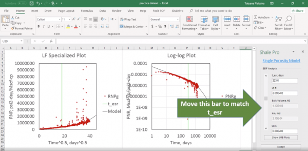
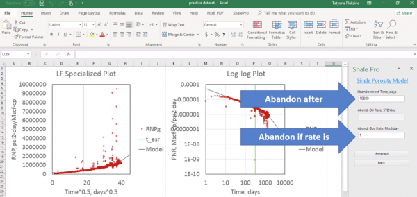
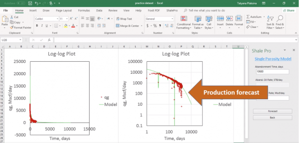
ShalePro to create type curves, analyze data coming from your wells, or conduct research in production data analysis.
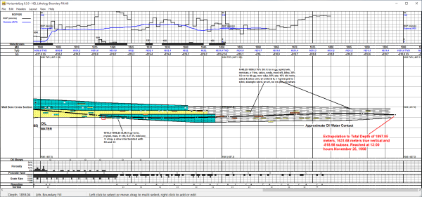
Why Buy HorizontalLog 8? Easy to Learn and to Use Whether you are an experienced computer user or not, you can quickly learn to use HorizontalLog. If you are familiar with similar Windows programs, you will be off and running in minutes.
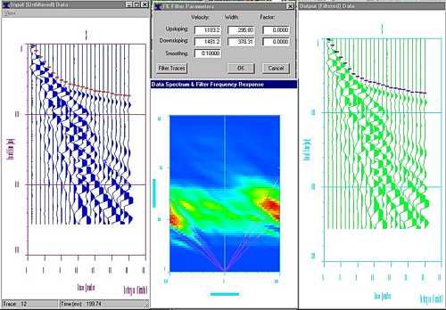
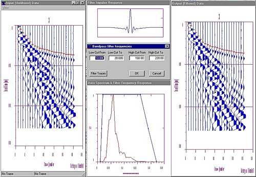
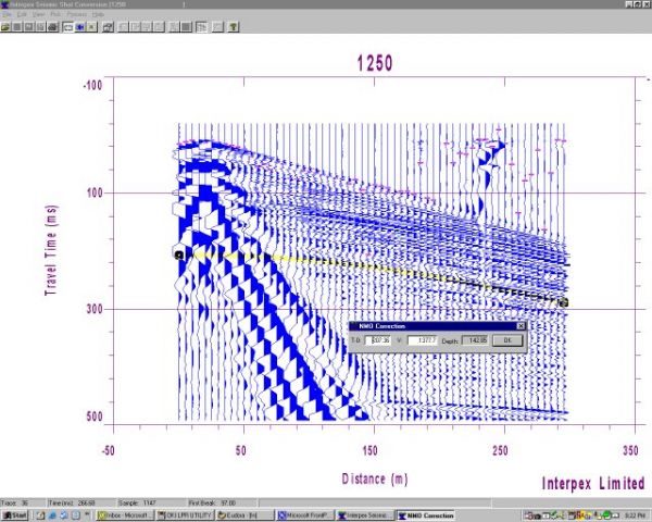
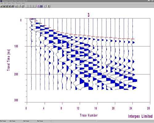
IXSeg2Segy is a 32-bit Windows program designed to read SEG-1, SEG-2, SEG-Y, ASCII, CSV and other instrument manufacturer’s multi-channel seismic data formats, view, process and interpret the data using simple techniques and output the data as SEG-2, SEG-Y or ASCII files.
It also functions as a SEG ...
Read More ...
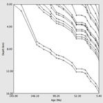
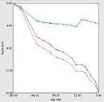
Backstrip Popular
The subsidence of a sedimentary basin is due to: tectonic subsidence, water and sediment loading, and sediment compaction. These three components can be estimated from a stratigraphic section using "backstripping" (Allen and Allen, 1990). This removes from each sedimentary layer the effects of sedim ...
Read More ...
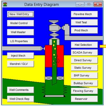
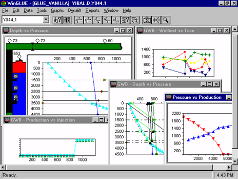
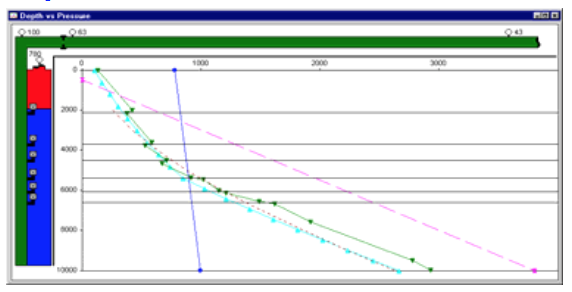
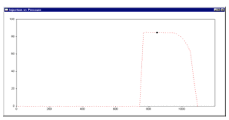
WinGLUE® is Gas Lift Software:
WinGLUE® is a powerful, ground-breaking gas-lift well surveillance software tool, developed and field-proven by AppSmiths and Shell over the last 16 years. This tool is now available commercially.
What do we mean by gas lift surveillance?
Gas-lift design is easy. It ...
Read More ...
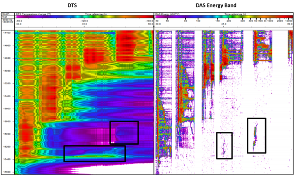

Unlimited, multi-scale, high-definition DFO viewer
ARIANE is a powerful visualization tool specifically designed to manage and analyze Distributed Acoustic Sensor (DAS) data.
During acquisition, DAS data is accumulated into hard-drives in obscure formats while it can be usually visualized through ...
Read More ...
Pipe-It is a unique software application that allows you to graphically and computationally integrate models and optimize petroleum assets.
Pipe-It can launch any software application you are currently running, on any operating system. Pipe-It chains together your applications, in series and in par ...
Read More ...
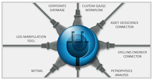
WinDOT - The Digital Oilfield Toolkit
WinDOT is an enabling technology that allows customization of Gravitas to provide plug-in solutions to specific business needs.
Gravitas has always been highly flexible and customizable to suit the needs of operational geology. Now the scope has been widened t ...
Read More ...

Graphical features
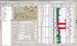
Easy and Powerful Logplot
Log curves, with shadings and transparency.
Dipmeter plots.
Symbols with fixed or log curve dependent size.
Color plots (Variable density based on log curve values).
In-Logplot instantaneous log curve editing for Depth Shift, Patch and Baseline co ...
Read More ...
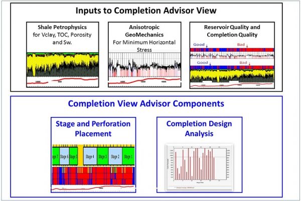
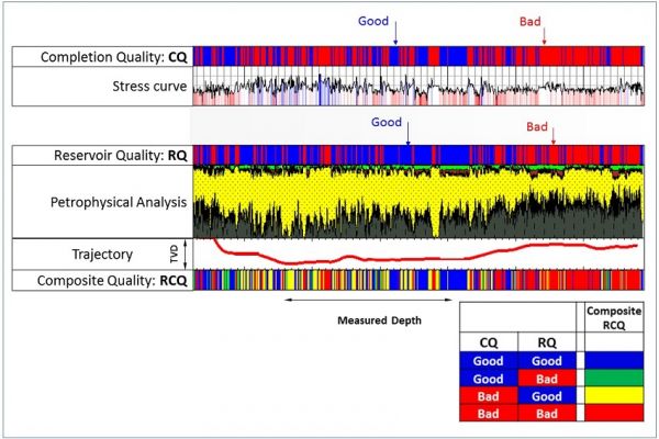
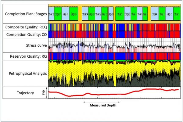
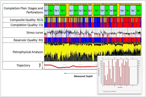
Lay out the perforation clusters.
Completion Advisor View automatically generates histograms of the stress differential between perforation clusters in each stage. Higher stress differentials within the stages increase the likelihood that the interval may not be optimally stimulated. The completion ...
Read More ...
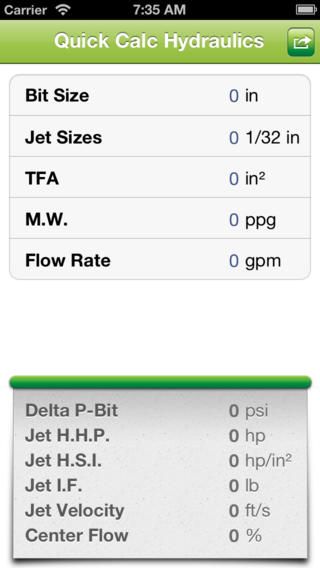
The Quick Calc Hydraulics app lets you calculate hydraulic parameters for conventional drilling fluids. Calculated results can then be forwarded to anyone in your contact list.

NPC Public Database: (NPCPUBDB.GEO). Database developed by the National Petroleum Council (NPC) for its 1984 assessment of the nation's enhanced oil recovery (EOR) potential. The technical data description is at the reservoir level. Included with the database are the Appendices from the "TORIS Data ...
Read More ...


This page allows you to search for information on oil and gas leases of Kansas. Currently we have historical production data for many leases in Kansas. You can also investigate production by field name.
In Kansas, Township values vary from 1 in the north to 35 in the south, and the values for Range ...
Read More ...
The digitalization of well and rig operations. The SmartPLAN™ tool seamlessly manages both the operator’s and drilling contractor’s workflows to deliver digital drilling recipes that optimize efficiency and improve performance.

A standard in Production Logging analysis
PLATO is based on global statistical modeling of the entire well. Probabilistic modeling enables simultaneous use of the entire dataset, meaning all available data is used in conjunction with all surface information to deliver a comprehensive visual represe ...
Read More ...
The program will keep track all the mud materials,receipts and transfers The program saves all the data in a background running database
logLayerManager is designed to define well markers and classify permeable formations (layers) interactively. The thickness of both gross-sand and net pay can be estimated from permeable layers, and well markers can be updated according multi-well solutions and seismic solutions. The average layer-lo ...
Read More ...
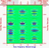
Seismic Time-Frequency Attribute Designed to decompose post-stack seismic dataset into time-frequency panel through an implementation of Match-Pursuit Wigner-Ville Distribution (WVD). The time-frequency panel will be used to propagate logs.

Artificial Intelligence Design Software
XROD is the fastest way to get superb rod pumping system designs (typically A+ or A design scores) with minimum effort. This new program uses sophisticated Artificial Intelligence (AI) techniques to provide you with the most accurate and best designs for non- ...
Read More ...