Directory: Random Listings
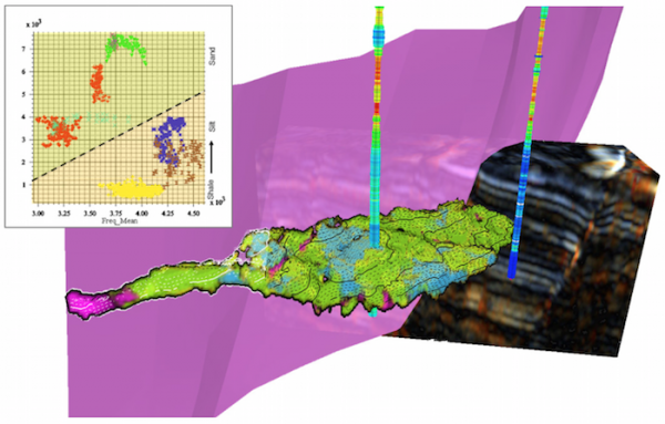
Interrogate the geophysical response with intuitive data-driven and semi-supervised tools, while maintaining the geological context.
Correlating your well-data with the seismic and attribute response, to build your remarkably accurate reservoir model, completes the workflow. Any classified volume h ...
Read More ...
Compressor Simulation Tool CompAna® models the end-by-end and stage-by-stage performance of a reciprocating, positive displacement compressor of virtually any head end / crank end, cross-over and by-pass geometry. The model handles any range of staging, compression ratios and gas throughput. Because ...
Read More ...

Groundwater Risk Assessment Tool for Landfill Design LandSim was created and developed by Golder in 1996 for the Environment Agency in England and Wales as a tool to assess the leakage of leachate from landfill sites and its impact on groundwater, to satisfy the requirements of the EU Groundwater Di ...
Read More ...

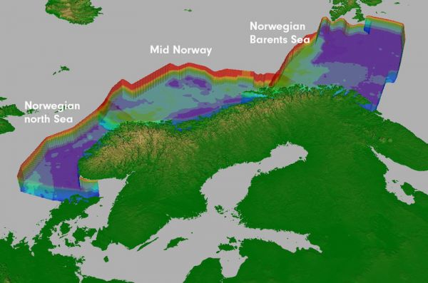
hiQbe™ is First Geo's regional high quality velocity cubes for depth conversion. Easily available to users, hiQbe™ enables the oil companies to change the way they work.
hiQbe™ is available as a multi client product in Norway, UK and Australia, based on a combination of data from the public domain ...
Read More ...
Q-SCAL is a new product for loading, storing and analyzing all types of conventional and special core analysis data.
NEWS
March 2011: LogicomEP complete Q-SCAL geomechanical integration with Petris Recall ™.
Core data and in particular special core analysis laboratory measurements are central to ...
Read More ...
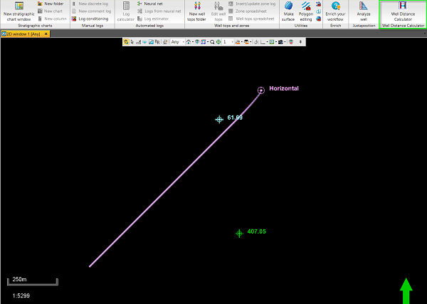
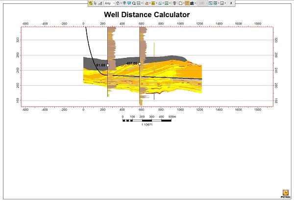
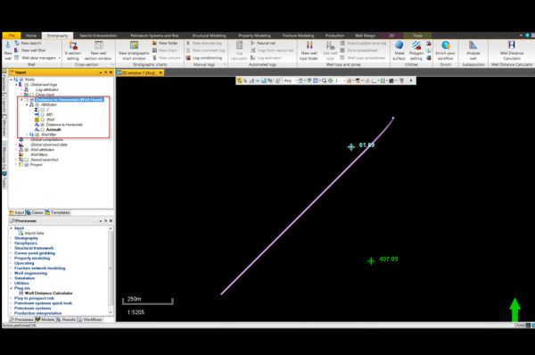
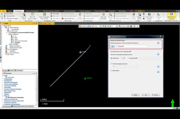
Distances calculated stored as point well data
After the reference well or polygon is selected and settings confirmed, a point well set is created and stored underneath the project’s global well logs folder. These points can be turned on and off in the desired window to display the distances measur ...
Read More ...

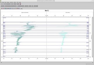
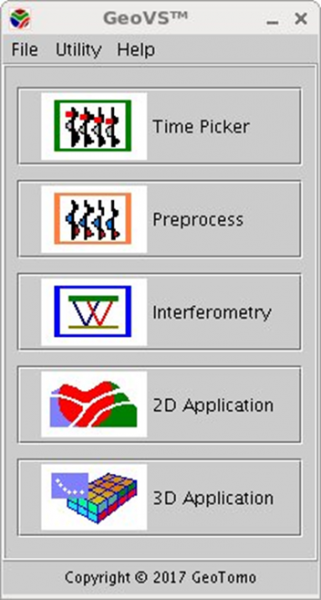
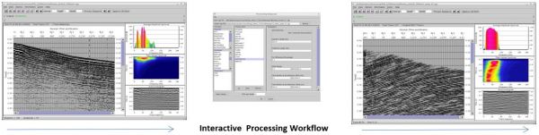
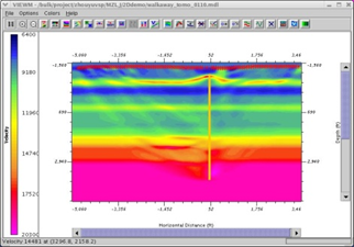
GEOVS™ 2D/3D VSP DATA PROCESSING AND IMAGING
GeoVS™ is a 2D/3DVSP data processing and imaging software program. GeoVS™ offers capabilities including building geometry, picking first breaks, particle motion analysis, orientation, signal processing for 2D and 3D wave field separation (parallel comput ...
Read More ...
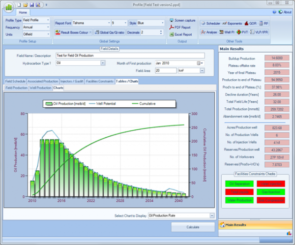
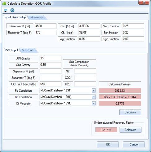
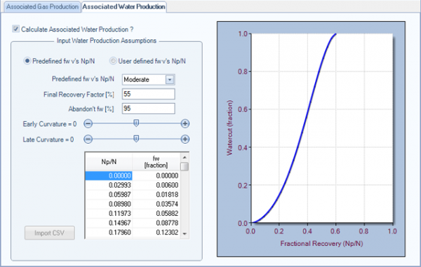
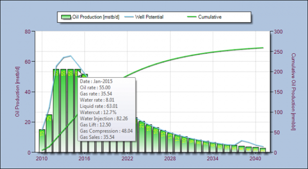
Profile was developed from ideas, experience, spreadsheets and manuals, over the years, for today’s Petroleum Engineers to quickly develop consistent, reliable and model independent hydrocarbon and associated production profiles
The application is intended for Petroleum Reservoir Engineers to : ...
Read More ...
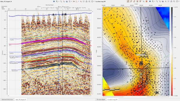
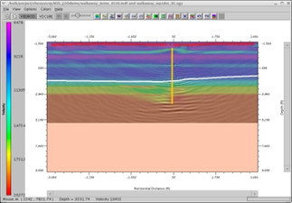
Seismic Interpretation Software
Dynamic synchronization between all views
Horizon picking and management
Simultaneous horizons interpretation on 2D, 3D or arbitrary line view
Interactive picking in time or depth domains
Import/export horizons in ASCII and some other formats
Horizon map creat ...
Read More ...
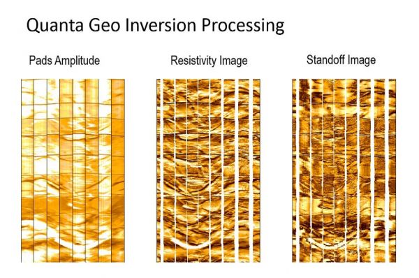
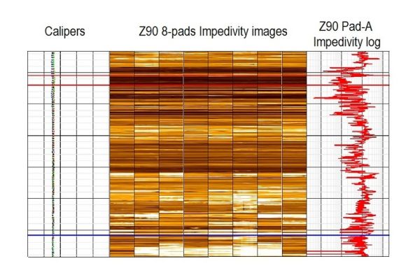
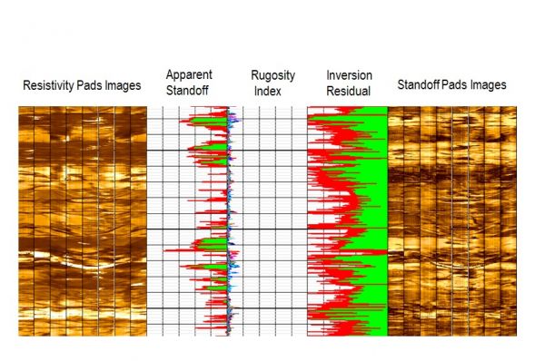
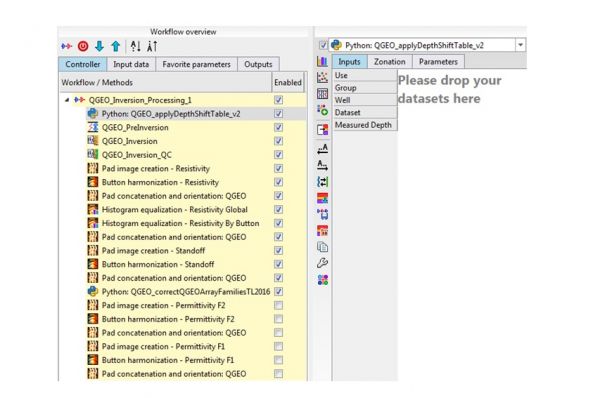
Quanta Geo Inversion Workflow
Quanta Geo Inversion workflow allows the automation of the processing activities from the raw data depth matching (using the Depth Shift Table from DepthMatcher step in Quanta Geo Z90) until the generation of final concatenated multiple images.
Plug-in Overview
Desig ...
Read More ...
Working Stress Design (WSD) True Vertical Depths are linked to Vertical or Directional Well Geometry On Shore, Shallow Water Offshore and Deep Water Offshore calculations
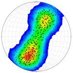
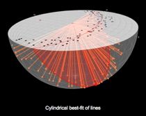
Stereonet3D (previously OSXStereonet) plots lines and planes in spherical, equal angle or equal area, projections. The program can produce various types of plots such as scatter plots, great or small circles, arc segments, contours, rose diagrams, stereonets from any view direction, latitude-longitu ...
Read More ...

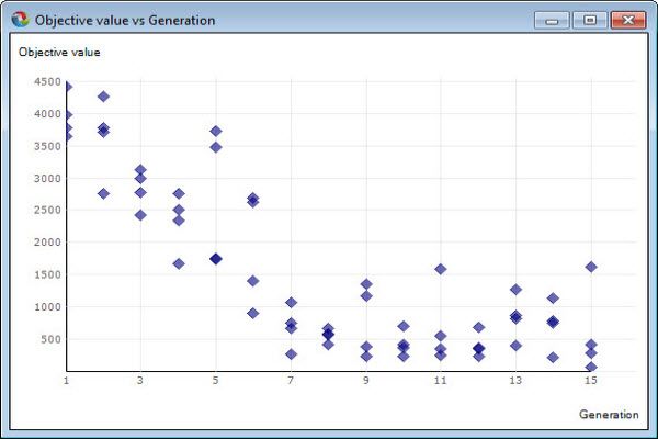
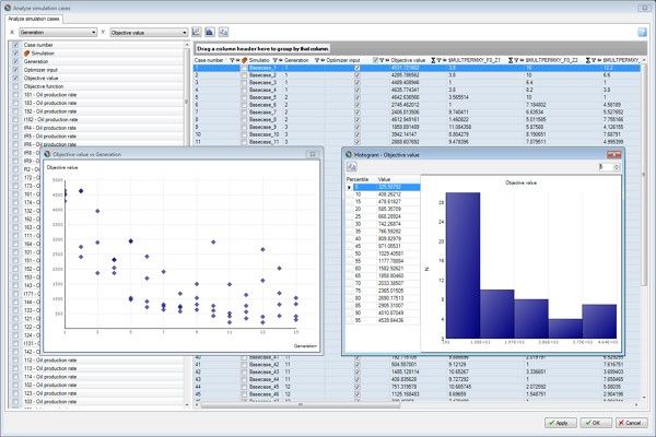
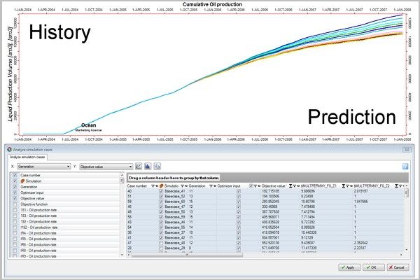
Olyx Popular
Advanced reservoir simulation plug-in for Petrel® Optimize your Petrel workflow and make all your simulation runs count using Olyx! Olyx enables true integrated reservoir simulation studies through advanced history matching and optimization work directly within Petrel’s workflow manager. No more nee ...
Read More ...

The field scale reservoir and overburden are 3D structures with complex material and stress states that cannot be accurately described by traditional 1D methods; Elfen horizon ensures that the geomechanical aspects of the reservoir receive as much attention as the fluid flow is given – and more: cap ...
Read More ...
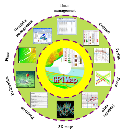
GPTMap Automatically reservoir mapping software
GPTMap is based on fine reservoir geological studies, can be automatic mapping 2-D plan and profile drawings, also compatible with interactive editing. Meet the need of the geological static and production dynamic maps, providing practical and easy to ...
Read More ...
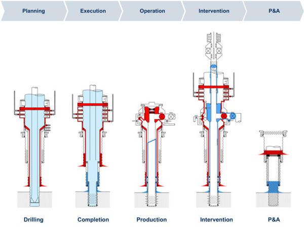
Wellbarrier Illustration Tool brings value to the engineers Time efficiency
Prepare well barrier integrity information in a quick and easy manner.
Consistency
Provide standardised presentation of graphics and language.
Quality
Ensure it’s verified by using the electronic verification function. ...
Read More ...
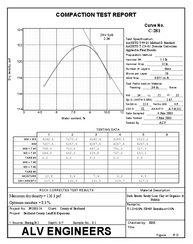
Proctor reduces and reports data from moisture-density (compaction) tests. The software's calculations are compliant with ASTM D698, ASTM D1557 and ASTM D4718 standards, AASHTO T 99, AASHTO T 180 and T 224 and California Test Method 216. Features include one-point test curve matching (including some ...
Read More ...
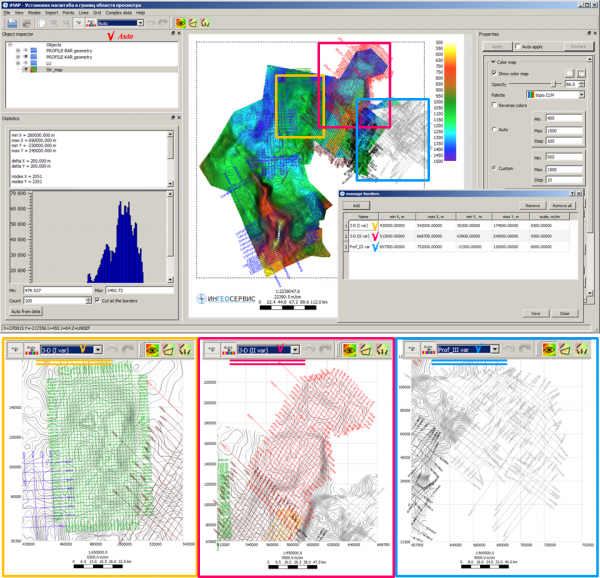
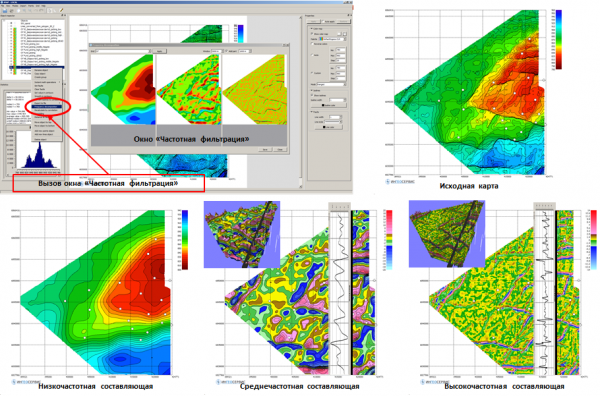
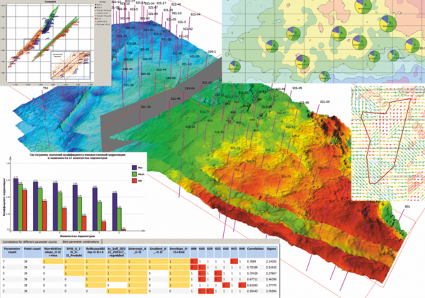
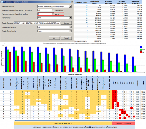
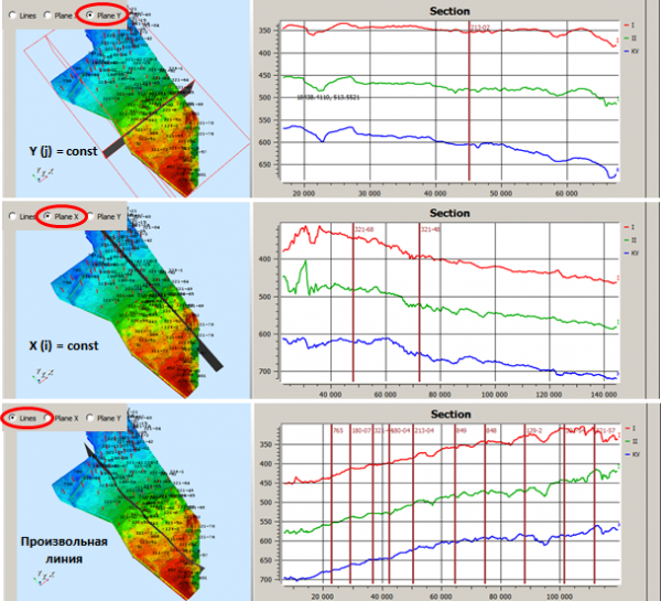
IngeosMAP (iMAP)® is the first product in the special-purpose software, and allows to fully solve a wide range of problems related to technologies of G&G data mapping, prediction and integration.
Ten advantages of the IngeosMAP software (iMAP):
Complete cycle technology to work with 2D geolo ...
Read More ...
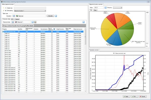
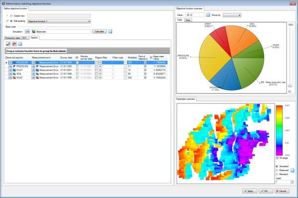
These are specical purpose software programs designed for history mataching using commercial flow simulators.
Landmark’s DecisionSpace Earth Modeling serves as a central repository and visualization tool for models coming from a variety of disciplines.
It ensures asset teams share a consistent understanding of the subsurface, providing extensive geomodeling capabilities within a complete geoscience work en ...
Read More ...