Directory: Random Listings
Introducing Microseismic Evaluation
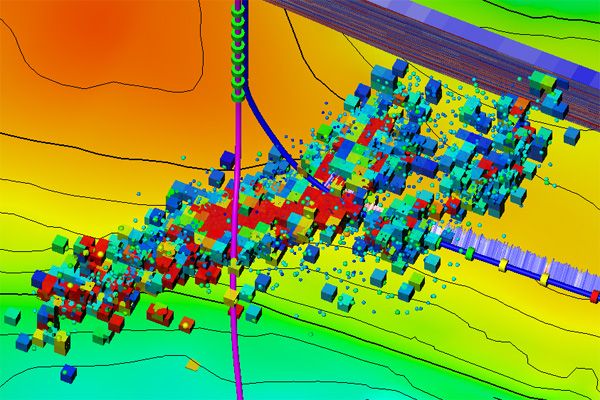
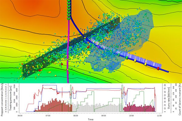
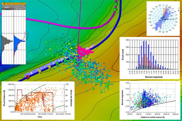
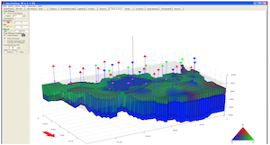
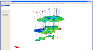
Microseismic Evaluation plug-in for Petrel is part of an integrated environment through which geoscientists, stimulation, and production engineers can interact to provide hydraulic fracture geometry interpretations, combining microseismic event locations with pum ...
Read More ...
Drilling Performance Monitoring A unique, cloud hosted, vendor neutral real-time service.
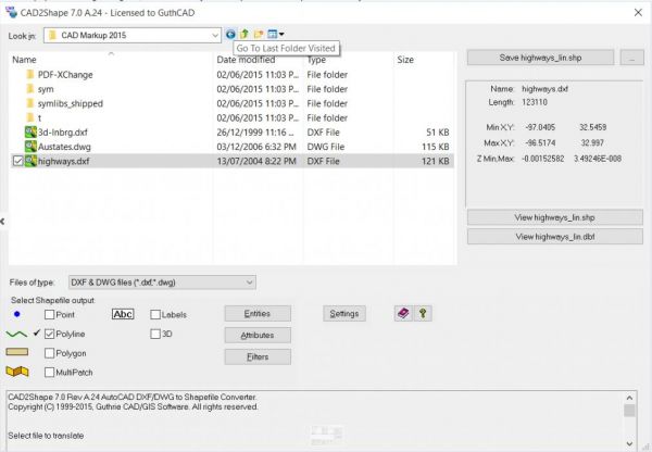
Convert AutoCAD DWG / DXF to ESRI Shape (.shp) CAD2Shape is a dwg and dxf converter that converts AutoCAD DWG and DXF files to ESRI SHP (shapefile) files.
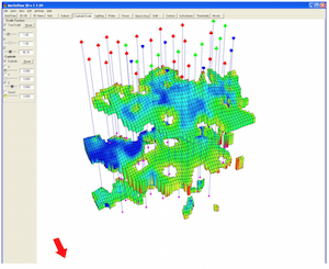
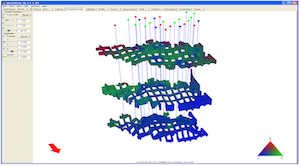
MerlinView3D is a 3D modeling extension of the Merlin Reservoir Simulator that allows users to view the inplace oil and gas in a 3-dimensional representation of the oil and gas reservoir.
A USER-FRIENDLY SOLUTION
MerlinView3D is a result of our informal alliance with creator Sciencesoft—our 3D vis ...
Read More ...

LasApps - (freeware ) includes the following processes:
Batch processing (up to 4 files)
Repair LAS files for common errors
Converts LAS 1.2 to LAS 2.0 and LAS 3.0 to LAS 2.0
Fixes start, stop, step problems
Resample LAS files
Set depth direction of LAS files
Wrap/Unwrap LAS files
Convert ...
Read More ...
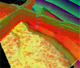

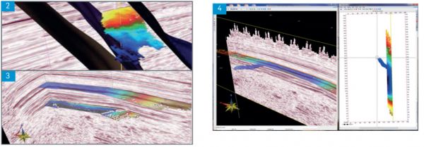
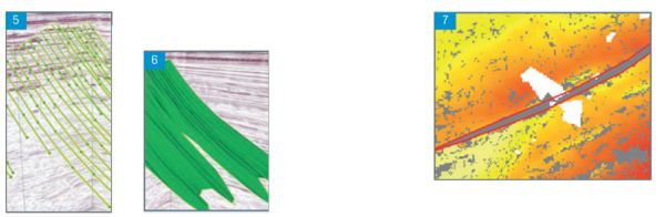
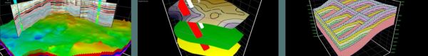
RockFrame’s structural characterization tools are designed to complement the Jason Workbench of quantitative interpretation workflows and products. QI teams can take advantage of the 3D horizon auto-trackers and manual fault pickers to build, refine, or enhance a reservoir’s structural framework. Th ...
Read More ...
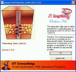
A device used to perforate oil and gas wells in preparation for production is called Perforating Gun. Containing several shaped explosive charges, perforating guns are available in a range of sizes and configurations. The diameter of the gun used is typically determined by the presence of wellbore r ...
Read More ...
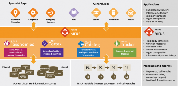
The Information Management platform for Oil and Gas
Sirus is built on Flare’s vision of ‘integrated business information’. Sirus meets the needs of Information Management departments, as well as providing an enterprise search capability for general users. Sirus can also augment existing enterprise ...
Read More ...
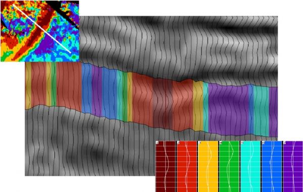
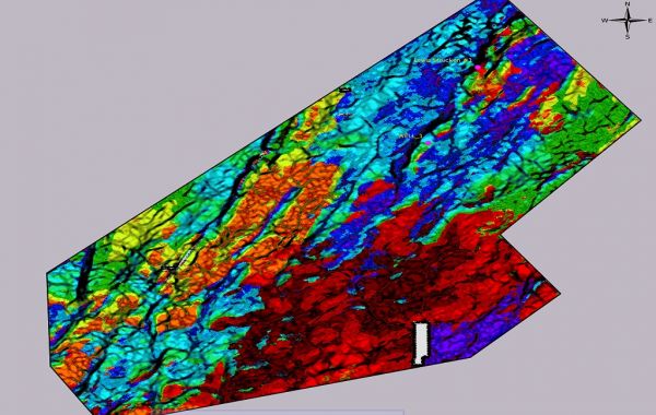
A truly geological interpretation of seismic data. Reliable and proven, Paradigm® Stratimagic® enhances the qualitative and quantitative assessment of a reservoir through seismic facies analysis. It is the leading commercial solution and de facto market standard for facies analysis of 2D and 3D seis ...
Read More ...
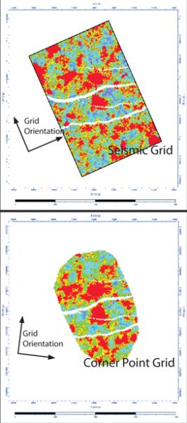
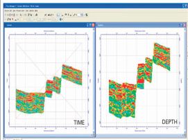
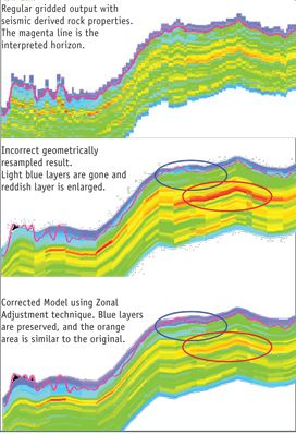
RockScale® transfers 3D models from orthogonal (seismic) grids to corner point grids. Its unique Zonal Adjustment technique ensures proper mapping of the seismic property samples into the correct stratigraphic layers in the Corner Point Grid. Flow geometry is preserved for NTG, Porosity, and other v ...
Read More ...

Includes; wiper trip, round trip, Cored, Drilled and calculations for horizontal and extended reach wells Calculated ton miles for drag though horizontal wells also ton miles for short trips The program is designed with many safety factor options plus drilling line cost per foot analysis
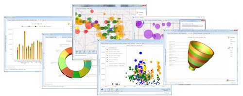
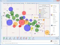
BLR Rosetta is a business intelligence tool for Microsoft Windows. It connects to databases across your organization, allowing you to ask questions about your data and then analyze query results with a rich collection of maps, grids, charts, pivot tables, and drilldown trees. BLR Rosetta's benefits ...
Read More ...
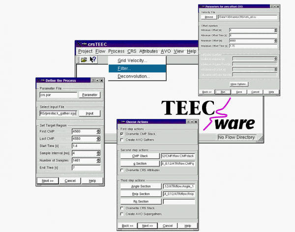
crsTEEC is a seismic processing software designed to support the Common Reflection Surface (CRS) techniques. This software package includes standard seismic processing methods (e.g. filters) and CRS specific algorithms like data driven CMP stack or data driven CRS stack.
crsTEEC can be used for a b ...
Read More ...
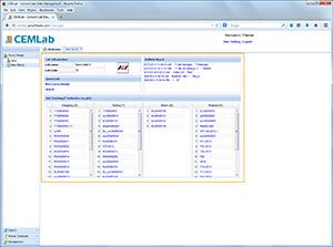
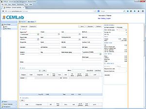

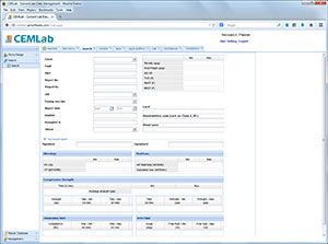
CEMLab aids experts and technicians in creating globally consistent slurry formulations and in rapidly disseminating cementing techniques. It standardizes the slurry design and provides a common historical support base for multiple cement labs worldwide. Slurry design and testing are integral parts ...
Read More ...
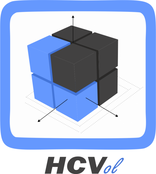
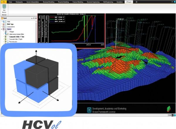
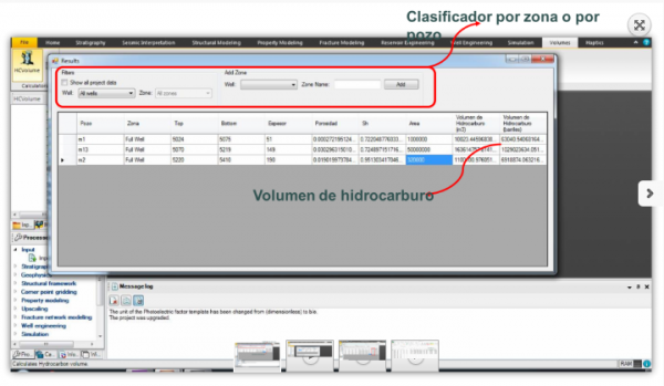
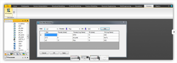
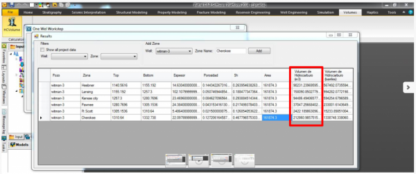
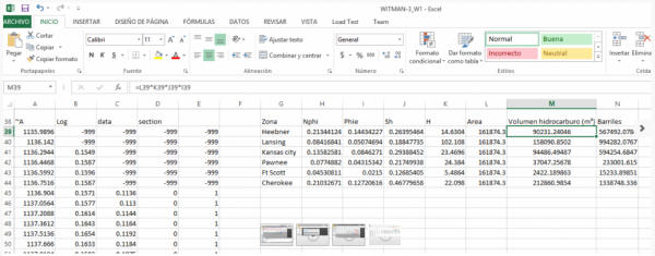
The HCVolume plugin for the Petrel plataform has the objective of optimizing and automating the process of calculation and estimation of the original hydrocarbons volume contained in a reservoir, using for it, employing various methods to better estimate and compare values and results of each one of ...
Read More ...
Tubing Tally, Pipe Tally Popular
Not just a simple tally spreadsheet this Tubing Tally for Windows 7 and Office 2007 is complete with BHA add in for tubing Workovers, Hi-Resolution final well reports and well drawing for both vertical and horizontal completions with a vertical and horizontal tool library.
You wont find a Tubing Ta ...
Read More ...
Fully Integrated 3D Interpretation
GVERSE Geomodeling is a sophisticated integrated solution for subsurface geological/reservoir modeling. Detailed analysis of the reservoir is always crucial prior to field and well planning. With GVERSE Geomodeling, making an informed decision is much easier as th ...
Read More ...
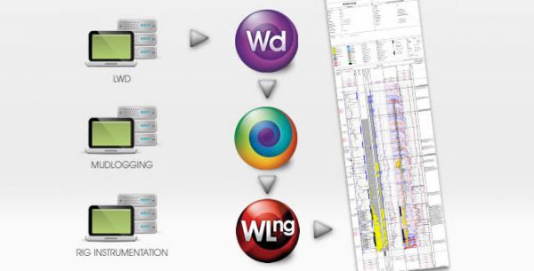
WinDART - The Data Acquisition Module
Direct, central collection point for real-time drilling data at the rig, including MWD, LWD, drilling instrumentation and mudlogging.
WITS (Wellsite Information Transfer Specification) Level 0 is used to collect standard or custom data records across a network ...
Read More ...
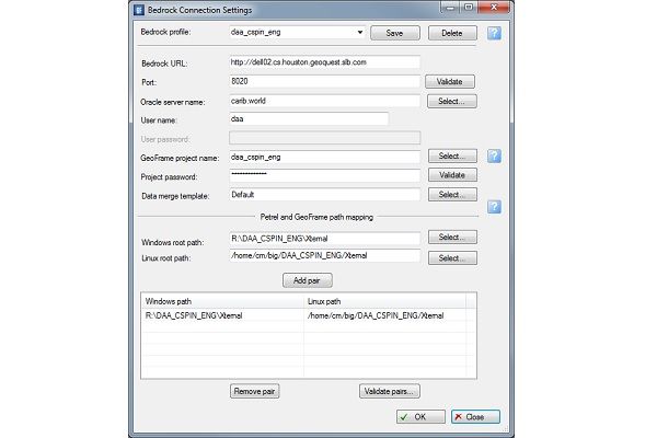
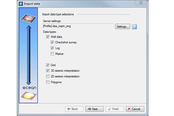
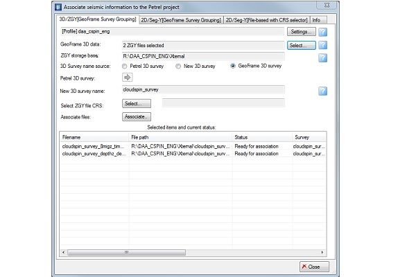
Remotely connect to GeoFrame using Bedrock server
Access GeoFrame well data, 2D and 3D seismic and seismic interpretation directly from Petrel.
Plug-in Overview
The Bedrock server and the GeoFrame Data Connector plug-in for Petrel 2014 facilitate the direct exchange of data between GeoFrame and P ...
Read More ...
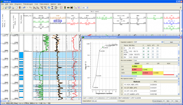
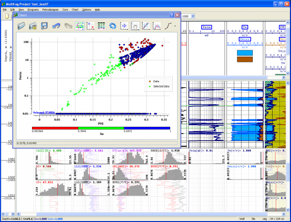
PetroExpert Popular
PetroExpert™ is designed for petrophysical modeling and log data interpretation. It contains modules for standard and advanced log data interpretation.