Directory: Random Listings
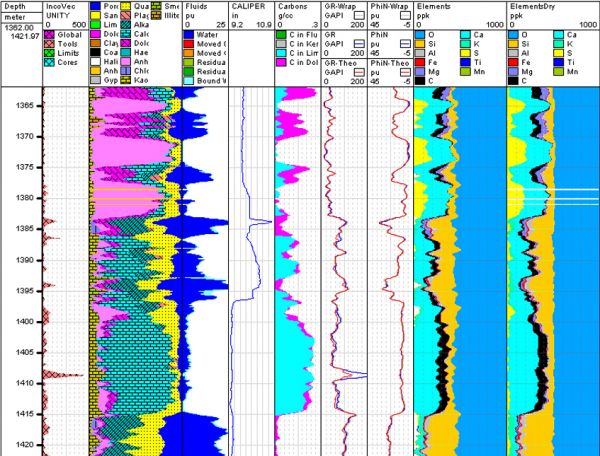

Accurate complex multi-mineral lithologies
The biggest challenge in formation evaluation has always been determining the formation characteristics.
Resolver employs probabilistic modeling for formation evaluation. Formation characteristics are determined utilizing all available data (including cor ...
Read More ...
A suite of cementing design software programs that offer interactive data entry, comprehensive visuals and post-job analysis. The user can simulate multiple downhole conditions to optimize the job design and ensure wellbore integrity and zonal isolation goals can be achieved.
IntegraStar Facts
A p ...
Read More ...
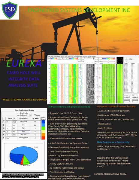
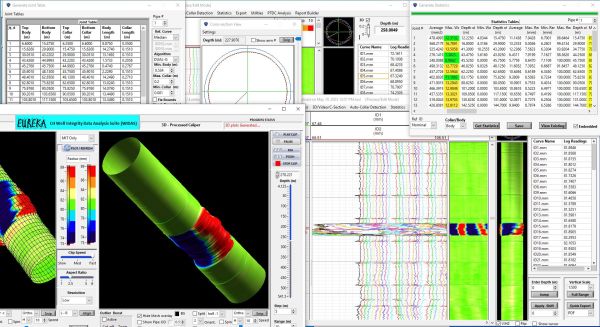
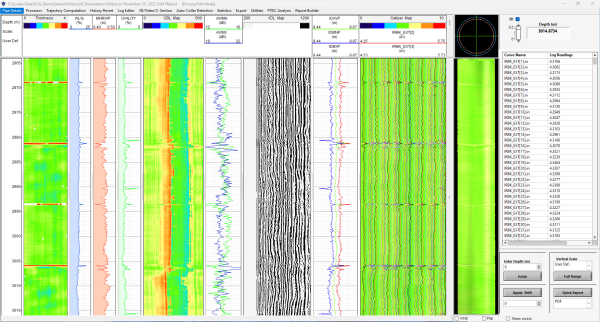
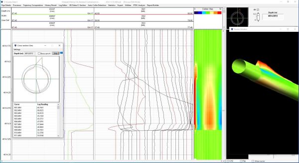
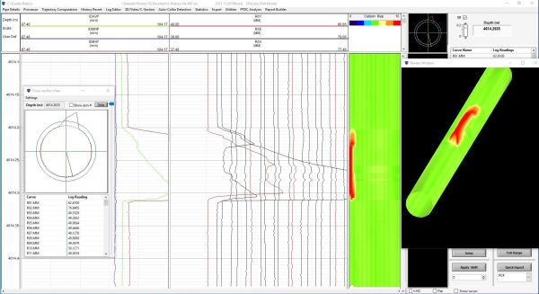
EUREKA Cased Hole Well Integrity Data analysis Sui... Featured Popular
The EUREKA Cased hole well Integrity Data Analysis Software Suite is a tremendously compact, yet versatile data analysis and interpretation Software for all Multi-Arm Calipers as well as single barrier Electromagnetic Thickness tools. Advanced add-on modules (licensed annually) offer processing capa ...
Read More ...

A RELIEF WELL & INTERCEPT WELL COMPANY
Relief Well
Field proven methodology – First pass intercept • High profile relief well project specialists
Specific process from planning to interception
Enhanced 3D ranging interpretation
Well Control throughout Re-entry or perforation • Interceptio ...
Read More ...
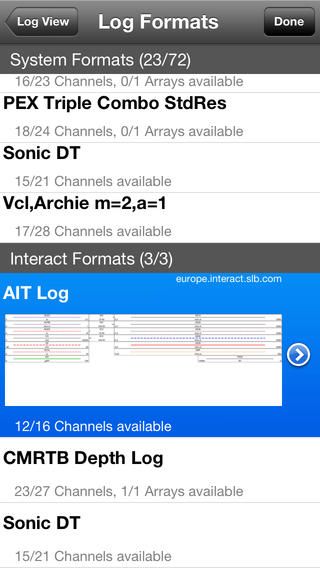
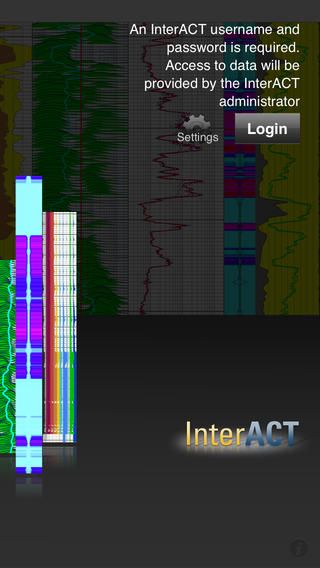
Get real-time data delivery through the InterACT app for quick access to your current logging data, as well as access to information after operations have concluded.

egssPort Gas is our software used for nomination and balancing of gas portfolios. Whether physical or only trade, egssPort supports the gas markets across Europe, including Fluxys, GTS, NetConnect, GASPOOL, National Grid, GRTgaz, Gas Connect Austria and more.
A great benefit is the modular based ap ...
Read More ...
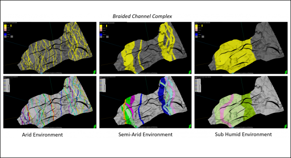
Ava® Clastics analogue database and clastic sedimentology software includes transformation technology, GeoCypher™ logic, that converts a Depositional Concept into recommended parameters for use in facies modelling algorithms. Based on your query of the analogue databases, GeoCypher logic analyses th ...
Read More ...
Using the history scroll function, all the graphs can display information from the past days only by scrolling up and down. There is no limit for scrolling, as all the data is stored on the server. The web page retrieves the data and display it immediately. You can scroll to previous days or previou ...
Read More ...
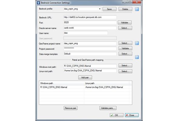
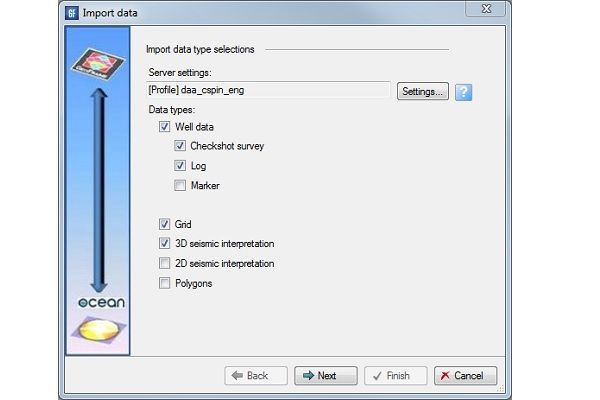
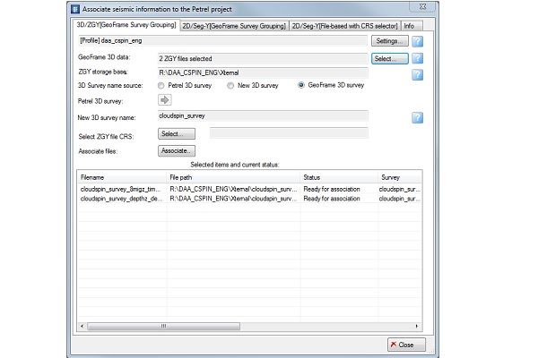
Remotely connect to GeoFrame using Bedrock server
Access GeoFrame well data, 2D and 3D seismic and seismic interpretation directly from Petrel.
Plug-in Overview
The Bedrock server and the GeoFrame Data Connector plug-in for Petrel 2014 facilitate the direct exchange of data between GeoFrame and P ...
Read More ...
QuickLook economics evaluation software gives the user a simple, fast tool to compute screening economics for prospects, evaluate workovers and recompletions and run preliminary lending economics. The user can run complete reserves and cashflow projections for individual wells or properties. QuickLo ...
Read More ...
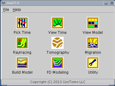
GeoCT-II is a 2D seismic modeling and imaging software package designed for geophysical engineering applications. It includes an advanced model builder, finite-difference full wavefield calculation for acoustic, elastic, and anisotropic media, raytracing and tomography for refraction, reflection, cr ...
Read More ...
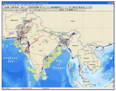
PetroView® Popular
Many major oil and gas companies, contractors and financial institutions regard PetroView as the most comprehensive data visualisation package available for the global oil and gas industry.
Mapping software
PetroView is a Geographic Information System (GIS), which facilitates spatial analysis of t ...
Read More ...

With ResSum zone properties averaging software, you can take the output from ELANPlus or Petroview Plus and calculate thickness and average properties in your reservoir intervals or zones. Zones are easily created in ELANPlus, PetroView Plus or with WellPix correlation software. ResSum allows you to ...
Read More ...

Landmark’s DecisionSpace Natural Fracture Network provides easier, faster, and more accurate modeling of natural fracture networks to help optimize well planning and stimulation strategies.
E&P companies require technology-based solutions to enhance production from low permeability and naturall ...
Read More ...

Enter a New Era in Digitizing Technology
Didger 4 is a highly accurate digitizing software program that will be an invaluable addition to your software library. In seconds, Didger precisely transforms points, lines, or areas from your paper maps, graphs, aerial photos, scanned raster images, import ...
Read More ...
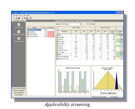
SWORD Popular
SWORD is a unique software package designed for rapid reservoir, field or prospect evaluation, fast screening and predictions of Improved Oil Recovery (IOR/EOR) methods potential.
The fast screening and prediction techniquesare based on multi-criterion models, proven analytical solutions, existing ...
Read More ...
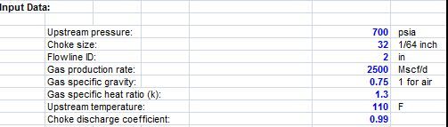
Before this we already share about Gas Up Choke Pressure with the function is calculates upstream pressure at choke for dry gases, and for this time we will share about Dry Gas Downstream Pressure Spreadsheet
This spreadsheet calculates dry gas downstream pressure at choke for dry gases. This sprea ...
Read More ...
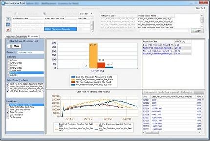
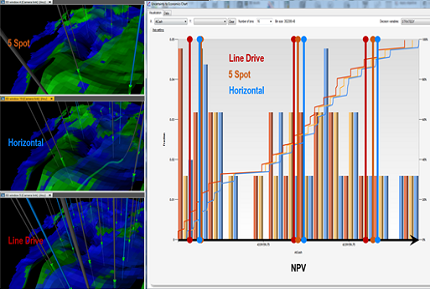
Petrel Economic Screening Tool Popular
In today's challenging and high-cost E&P environment, it is more important than ever to consider economics in the earlier stages of field development planning. Traditionally, a few representative production profiles are used for economic analysis. However, these do not comprise the full scope of ...
Read More ...
Surface Modeling, Mapping & Design
GWN-SURF is an ideal application for surface modeling and mapping projects. GWN-SURF is a world class surface modeling package, with advanced contouring, profiling and slope analysis capabilities. GWN-SURF is available as an AutoDesk or MicroStation add-on pro ...
Read More ...
These are specical purpose software programs designed for history mataching using commercial flow simulators.