Directory: Random Listings
LEACAT Version 3.6 Specification
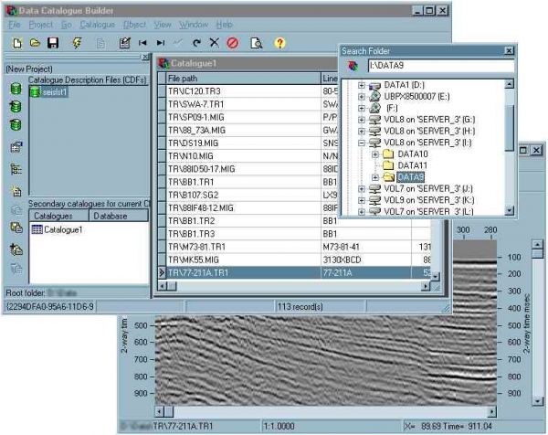
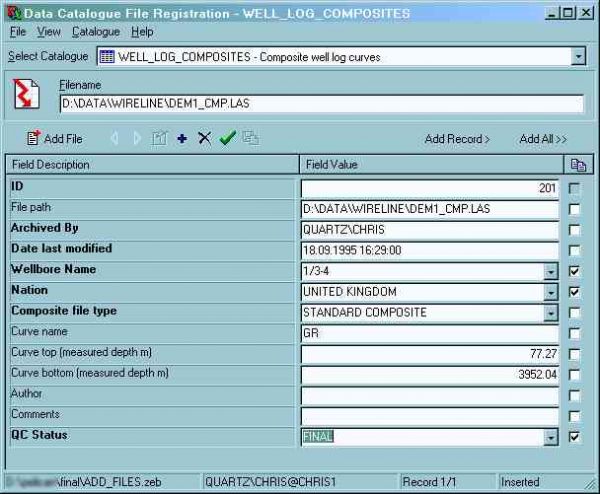
Lynx Exploration Archivist Cataloguing and Archiving (LEACAT) software is a comprehensive solution for preparing, cataloguing and archiving your existing E&P project data. Our software does not force you to adopt a rigid over-arching database schema, but provide ...
Read More ...
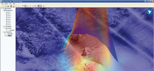
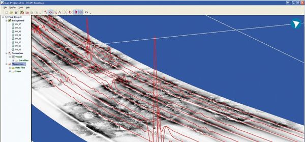
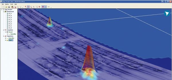
DELPH Mag locator is a unique operational solution for the mapping of buried objects; in a few comprehensive steps, it filters and maps magnetic anomalies. Although requiring no prior expertise in magnetic science, it provides an accurate magnetic anomaly map to locate magnetic sources.
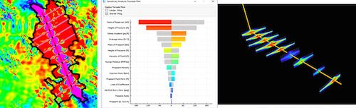
New generation fast 3D grid based frac simulator with proppant transport constrained by validated geomechanical half lengths. Resulting fracture geometry used as input in ProdPredictor and commercial reservoir simulators.
Features:
StimPredictor™ is a new generation lightning fast 3D grid based fr ...
Read More ...

This tool will convert full files. Most tools only convert single points.
Calculate position in multiple formats, and convert an entire file between coordinate systems in one go.
Convert individual points
Full File batch conversion with no size limitations
Drag and drop files for conversion
U ...
Read More ...
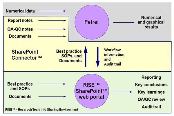
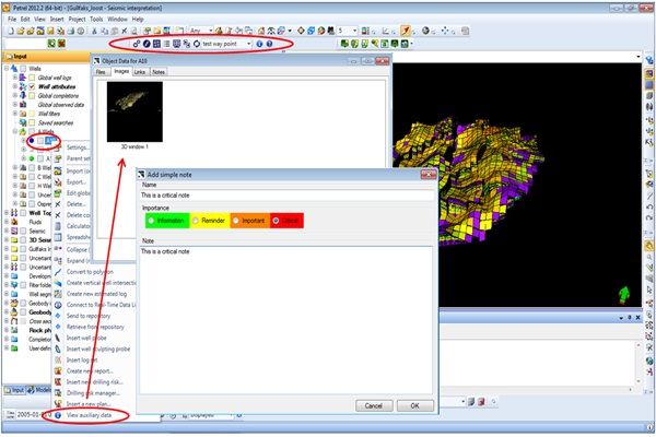
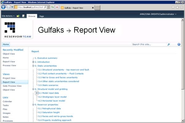
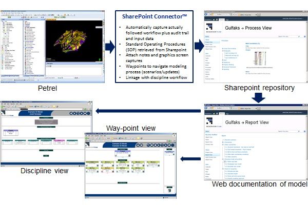
RISE™ - creating a knowledge ecosystem
Sharepoint Connector™ leverages of the Petrel modeling effort to create a knowledge ecosystem documenting (RISE™) specific model results in a systematic manner, capturing the modeling journey via QA/QC waypoints, and correlating modeling results in a general t ...
Read More ...
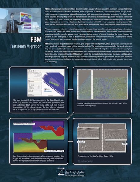
FBM is Z-Terra’s Fast Beam Migration, a super-efficient algorithm that is two orders of magnitude faster than the industry standard Kirchhoff depth migration. Fast Beam Migration images multipathing energy, a property that is typically associated with wave equation migration algorithms. The faster a ...
Read More ...
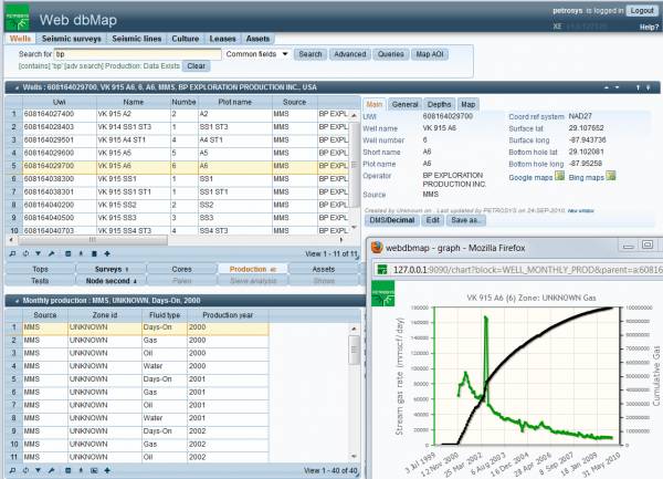
Petrosys data management solutions will improve the order in your data, making it more widely available, streamlining data handling, improving auditability, and allowing more reliable linking between applications and business domains.
Petrosys data management software products and consulting servic ...
Read More ...
MatBal® Popular
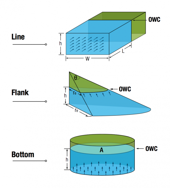
Tracking recoverable reserves over time no longer requires a complex and costly reservoir modeling package. Material balance techniques allow you to track how pressures and fluid characteristics change with time, giving you an accurate production forecast and a true accounting of your reserves.
Wea ...
Read More ...
Unlike other SDK and software development tools found in the oil and gas industry, Magma™ contains unique features that allow E&P and service companies to focus on their workflows and algorithms rather than ancillary problems related to software development. These unique features include viewers ...
Read More ...
We pay much attention to database storing, data integration and interpretation, reports producing and up to scale fine logs printouts. That is provided by means of software kit, which allows the preparation of the data in a modern style according to the requests of the Customer as follows:
Databa ...
Read More ...
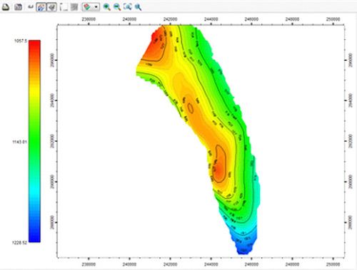
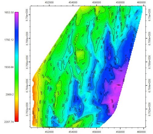
2D mapping techniques based on geostatistics, and artificial intelligence to estimate rock properties and well performance distribution.
Features:
MapPredictor™ uses limited 2D well data to create geologic maps and 2D grids of key properties such as curvature, distance to faults, average reservoir ...
Read More ...
SURFACE PLUS can handle both active and passive surface waves with any shape of geometric layout. It contains all the features provided in GEOGIGA SURFACE and includes SASW, MASW, REMI, SPAC, and ESPAC.
Features
Process active and passive surface waves
Build CMPCC gathersnew
Include SASW, MASW ...
Read More ...
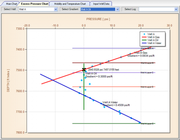
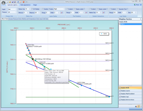
PDPlot is an easy to use application developed for Petroleum Reservoir Pressure versus Depth Plotting and Analysis.
Though the use of PDPlot you will ultimately :
Save a significant amount of time and shift the emphasis from preparation and presentation time to interpretation time,
Achieve bet ...
Read More ...
Interactive location map
Allows to visualize multiple data coordinates on interactive location map
Features related to visualization of multiple dataset locations available only in commercial version. The view includes following options:
Interactive selection of seismic dataset
Plotting all so ...
Read More ...

Add in App Free Point for DrillPro This add in App is for the latest version of DrillPpro only

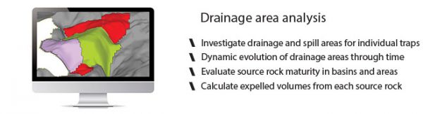
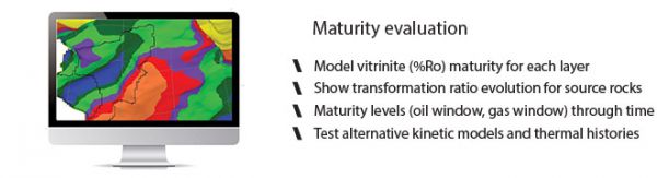
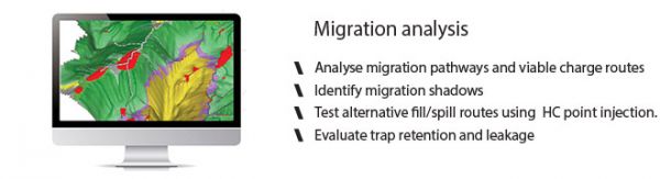
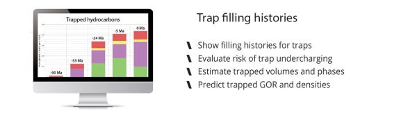
MigriX provides the exploration geologist with a lightweight tool for fast and simple analysis of the petroleum systems – streamlining your team’s workflow.
Charge modelling is often considered a time-consuming task, relying on complicated and expensive modelling tools that require expert skills to ...
Read More ...

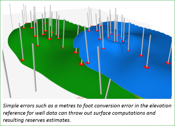
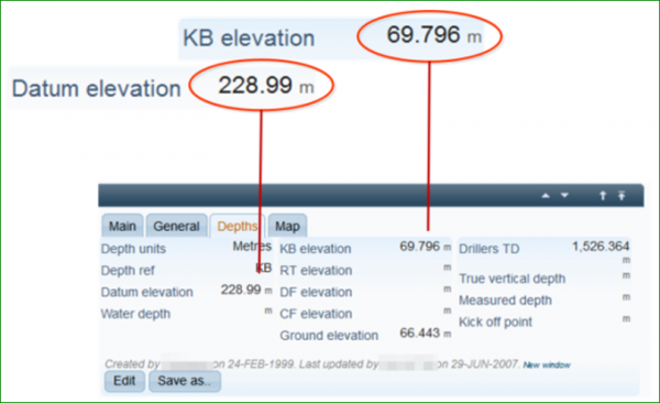
Overstating oil and gas reserves can have a negative impact on financial security, market reputation and market ratings. If challenged by auditors, the evidence behind estimates can be required quickly – in a matter of days. How confident are you that you could access your data?
Reserves Guard is a ...
Read More ...
SPEED UP AND EXPAND YOUR PETREL RE WORKFLOWS The Reservoir Engineering (RE) Toolbox speeds up and improves the workflows within the reservoir engineering domain in Petrel. A series of tools are provided to improve pre- and post- simulation functionality.
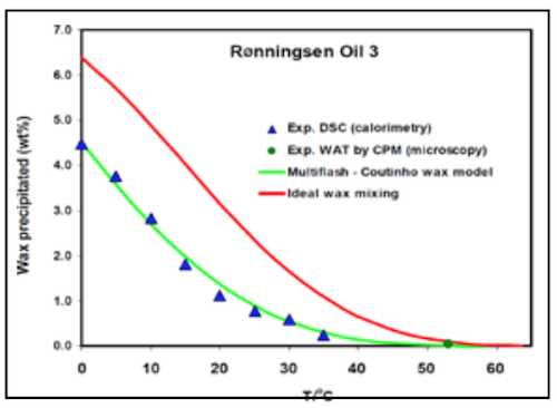
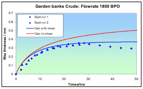
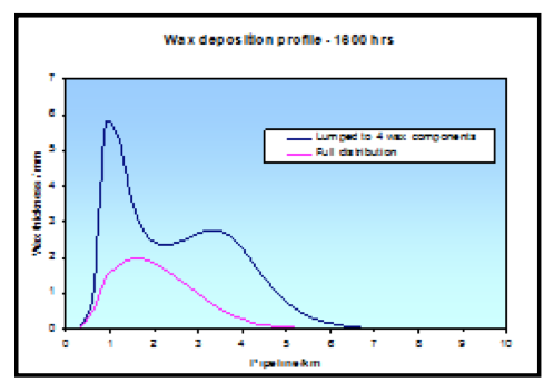
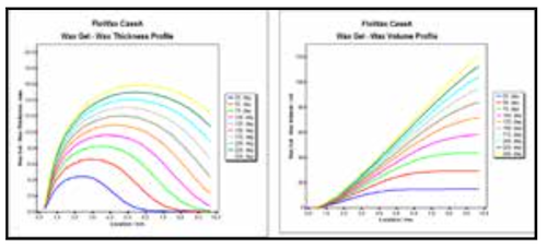
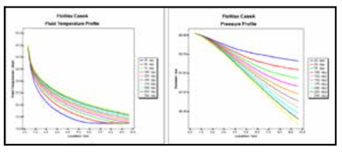
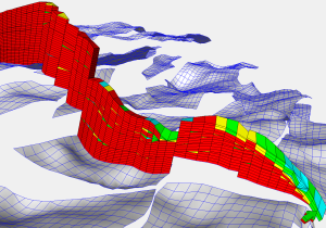
FloWax is a powerful multiphase pipeline simulator with wax deposition modelling capabilities for flow assurance and production applications.
Through the unique blend of Multiflash’ advanced wax thermodynamics and a robust implementation of multiphase flows model in pipeline, FloWax allows Flow Ass ...
Read More ...

Risk Analysis and Decision Making Software:
Monte Carlo Simulation Software: A Monte Carlo simulation is used to solve certain stochastic (involving a random variable) problems where the passage of time plays no substantive role. It is widely used to solve certain statistical problems that are not ...
Read More ...