Geology Software
Geological Engineering include understanding and analyzing field depositional environment along with earth techtonic movements to create a reliable 3D model of underground reservoir structure (e.g., geological model). Geological models may be complicated depending on the number of oil bearing horizons and faults.


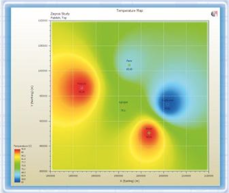
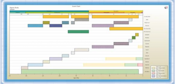
PBM 1D (Pars Basin Modeler) Popular
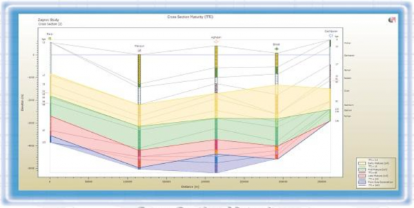
PBM 1D is a basin modeling software that determines burial, thermal and maturity history as well as timing of hydrocarbon generation and expulsion for a 1D basin model. PBM 1D allows the user to construct and work with multiple 1D basin models at the same time. The user can easily visualize spatial ...
Read More ...

Roxar RMS Popular
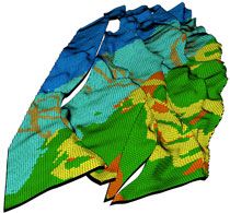
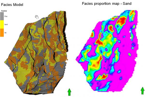
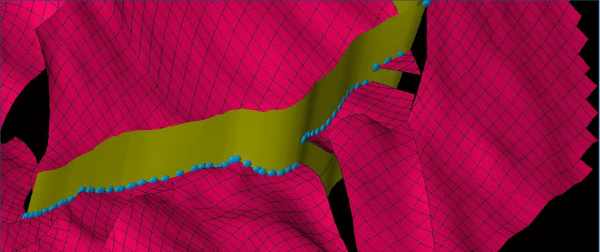
RMS is an industry leading reservoir modelling solutions which comprises fully integrated interpretation, mapping, modelling, well planning, simulation and uncertainty management tools. Reservoir modelling is the best platform for examining and understanding subsurface geology and generating vital i ...
Read More ...
SPEED UP AND EXPAND YOUR GEOMODELING WORKFLOWS The Blueback Geology Toolbox includes a series of tools for input data preparation and QC, data analysis, fault analysis, 3D property modeling and QC and log data upscaling.
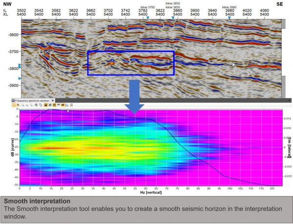
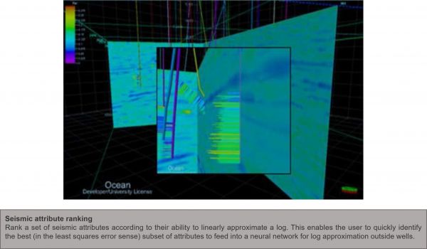
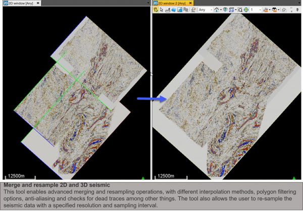
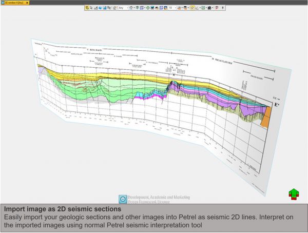
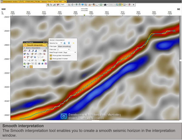
BLUEBACK GEOPHYSICS TOOLBOX Popular
SPEED UP AND EXPAND YOUR SEISMIC DATA WORKFLOWS
The Blueback Geophysics Toolbox offers a wide range of functionality from seismic data analysis tools, data manipulation and editing, seismic interpretation operations and expanded data import/export options.
Overview
The Blueback Toolbox suite cont ...
Read More ...
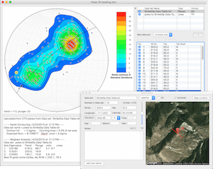
Stereonet 9 Popular
Stereonet 9 brings location and date tagging of individual measurements as well as a free form notes field. Points with location data can be plotted on a Google satellite (or terrain or roadmap) image right in the program. This version of Stereonet is compatible with all modern operating systems and ...
Read More ...
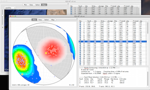
FaultKin 7 Popular
FaultKin 7 is a complete rewrite of my venerable fault slip analysis programs for Mac and Windows. The program has a revamped, and vastly improved, user interface, includes most of the scientific functionality of the older versions, and will work just fine on modern operating systems such as Mac OS ...
Read More ...
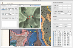
GeolMapDataExtractor is a program to extract information from a scan (raster image) of a geologic map or image of known scale. A huge assortment of maps are available for free online from the USGS and the GSC, or you can scan your own maps. StrikeDipThickness can read .jpg, .jp2, .png, .tif, and .pd ...
Read More ...
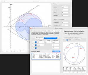
MohrPlotter Popular
MohrPlotter is a simple program to plot Mohr Circles for stress and do simple calculations related to them. It was written to help structural geology professors and students quickly and accurately construct Mohr diagrams so that will have to spend less time plotting and more time exploring the resul ...
Read More ...
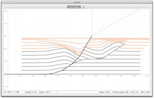
FaultFoldForward is an update of the forward modeling part of my program FaultFold. It has an updated interface and the forward modeling part has added functionality over the original program. Eventually, the inverse modeling part of the original program will be added but I wanted to get this into t ...
Read More ...
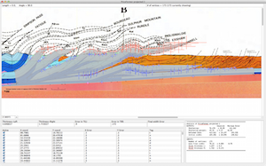
AreaErrorProp is a complete program with modern graphical user interface (GUI) to carry out the analysis of uncertainties in area balancing on both Mac OS X and Windows operating systems. Its primary purpose is to estimate the error on shortening magnitude and percent based on the uncertainties assi ...
Read More ...