GPTModel
GPTModel Reservior geological modeling software
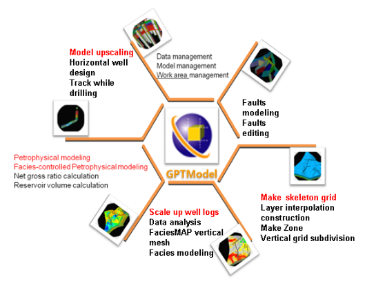
GTPModel is a corner mesh generation, geostatistics, 3D visualization technology-based reservoir geological modeling software, mainly based on detailed geological study, detain the 3D character of the reservoir structure, reservoir geometry and physical properties. Geological modeling software simplifies the operation of the process, as the "fast model" as the goal, and strive to promote the modeling popularity in oil field production site.
Main feature
- Corner grid structure modeling
Widely used in the mainstream of the international modeling software ---grid corners, can describe the stratigraphic sequence and complex fault system very well, it not only has the characteristics of fast, but also applicable to general geostatistics algorithm.
- Sedimentary facies model
With sedimentary units for the vertical element simulation of 3D grid microfacies modeling to better characterize the reservoir surface heterogeneity, can be used as the constraints for the internal properties of reservoir modeling parameters. With quickly modeling speed, it also can consistent with the geological understanding of the deposition laws.
- Phased property modeling
Phased modeling take the geology in particular sedimentary facies research into the modeling process, using the control of sedimentary facies to interpolate or simulate reservoir parameters, making property distribution more fit deposition laws, better reflect the true underground geological conditions .
- Combine deterministic modeling and stochastic simulation
Deterministic interpolation methods is diverse, so more considering the experience of geologists and various constraints, that we get more accurate modeling results, and avoiding choice between multiple simulation results. It also provides a large number og stochastic simulation algorithm for a geostatistical library based GSlib for the uncertainty research.
- Fast modelling
Anticipate the needs of numerical simulation, full use of existing geological studies, quickly set up the grid structure model. According to the sedimentary facies rapid establish the sedimentary facies diagram model, take the results of the sub-layer sandstone physical interpretation as the input conditions for the phased attribute model, and enhance the practicality of the geological model. Data preparation is simple, direct connection with the oilfield database, can easily import all kinds of well data and seismic interpretation results data; save the fault interactive editing time; property modeling parameters are optimized, improve the modeling efficiency.


