Pluri-Gaussian Simulation (PGS)
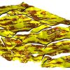
Pluri-Gaussian Simulation (PGS) is a widely used method for simulating facies properties.
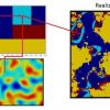
The specificity of this method lies in its capacity to involve inter-facies relationships through a bivariate Gaussian truncation diagram (also known as the lithotype rule).
Two Gaussian variables are simulated over the geological domain. At a given grid node, the pair of Gaussian values are used as coordinates on the truncation diagram. The facies code read at the designated location is then attributed to the grid node, resulting in a facies map wherein the contacts between facies are coherent with the truncation diagram.
Our implementation offers the following advanced features:
Truncation diagram:
- Draw manually truncation diagrams from scratch
- Build automatically truncation diagrams from conditioning data
- Simple editing tools to add, move or delete limits
- Update automatically truncation diagrams to fit target proportions
Pluri-Gaussian Simulation:
- Conditional and unconditional simulations
- Stationary or non-stationary proportion trends
Listing Details
Visits
1,657
Redirects
354
Don't Miss Out! Get the Best Deal on this Software - Email Us Now!
Map
© OpenStreetMap contributors


