DSS
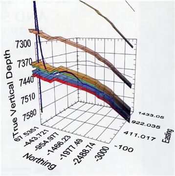
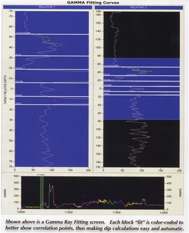
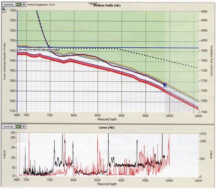
In early 2010, Selman & Associates, Ltd. initiated a development software program to improve GeoSteering and GeoNavigation techniques by leveraging our advanced computer technology targeting the need to enhance curve fitting and correlating techniques. The latest achievement from this ongoing research is our patent pending DSS (Dimensional Steering Services) computer software program. The DSS application generates three- dimensional (3-D) images far exceeding the industry's standard and produces reports to visually improve the use of actual, near-real time data acquired while drilling. The fact that Selman & Associates, Ltd. developed this software in-house within our own Research & Development department allows us to adjust the program to solve any operator's unique requirements. Since the 1990's, the industry's standard for Geosteering has produced a report that is flat, uninformative and unreadable for anyone lacking some required technical knowledge in the field of oil and gas exploration and drilling. The old style spreadsheet reports have left some operators at a disadvantage when trying to drill their project and resulted in higher costs. Dimensional Steering Services software solves all of the shortcomings of many other software packages on the market today and in the foreseeable future


