Geoscreening


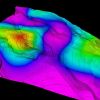
Ananlyze maps of uncertainty in connectivity
Sample the distribution of dynamic connectivity at regular spaced points to create maps showing uncertainty. Use these maps as input to further modelling investigations, support for data acquisition decisions or while planning appraisal and infill wells.
Plug-in Overview
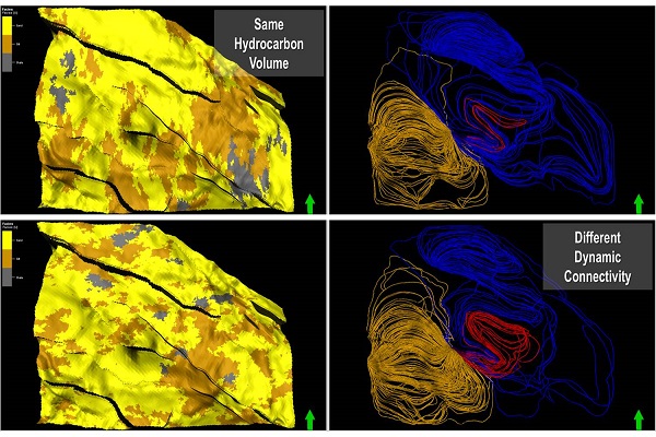
Geoscreening is a plug-in for use in subsurface uncertainty analysis workflows to select representative geological models. These models are intended for detailed reservoir simulation to quantify production uncertainties and make robust development plans. The plug-in supports the use of volume, dynamic connectivity and flow calculations and input parameter analysis for model selection.
Specifications
- Connectivity to wells in a pattern or existing and proposed wells or to edges of the grid.
- Connectivity between oil, gas and water zones. Interactive point and click vertical well creation.
- A dedicated, high performance streamline simulator for flow based connectivity calculations. Over 30 different responses reported. Special streamline and grid visualization properties.
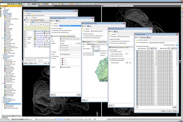
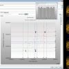
- A master table process aggregates data from uncertainty task generated cases.
- A two-step case selection process. Define clusters then select cases within clusters. Percentile based clustering. Interactive case selection on plots.
- Creation of point data sets with connectivity attributes for mapping uncertainty
Features
The plug-in provides a fast streamline based flow connectivity calculator that can be easily setup and included in uncertainty workflows by the geomodeler. The model selection approach is enabled by customized graphical analysis tools and statistical calculations. The system is designed to handle thousands of alternative geological models within a workstation environment.