Certainty™
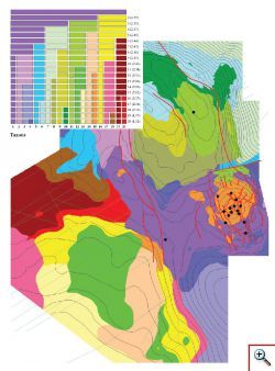
Subsystem Certainty™ is designed for integrated interpretation of cartographic data in combination with well data. It can be used by geologist and geophysicist at all stages of exploration a field development for generating maps of areal zonation, probability of success or predictive layer properties using any number of interval seismic and non seismic attributes. Uncertainty maps are generated simultaneously with predictions. Certainty™ includes the following main components: Base Module: Gridding for generating regular grids using splines, radial functions and Krige method. These programs have the option to generate approximating surfaces honoring faults. Data Analysis: Grids Arithmetic for arithmetic and logical operations with maps. Transformations package for calculation of 1st and 2nd derivatives for directions, 1st and 2nd Beltrami invariants, Gauss and mean curvatures, Euler delta, trends, local components, isotropy and zone variances, median, standard and robust deviations. Disturbances package for calculation of maps variability. Smoothing for smoothing initial map considering the influence of faults. Filtration for frequency filtering of a map. Grid to Limit for adjusting the map to the specified range of values without distorting the structure of the initial map. Correct by Wells for adjusting the map for reference points values. Similarity Matrix for analysis of the relationships between mapped and well data using Pearson, Kendall and Spearman algorithms. Principal Components for extracting combinations of attributes separating multi-D attribute trends from local variations and noise. Helwig Regressor Selection for selection of optimal combination of attributes for multidimensional linear regression analysis. Volumetric for computing volumetric characteristics of reservoir. Lineament analysis for calculation maps of density of faults, distance to faults and diagrams of lineaments direction. Classification Module: Classification for partitioning of the area into homogeneous zones using parametric unsupervised classification Taxonomy for non-parametric classification of the area using arbitrary set of attributes. Clustering for area partitioning into classes characterized by reference points. Topology Classification for areal classification based on topology algorithms. Portrait for visualization and analysis of multi-D attribute distribution for the classes. Prediction Module: Linear Regression for multivariate linear regression analysis which allows finding the relationships between layer properties defined in wells and combinations of mapped data. Regression for polynomial regression analysis. Prediction for prediction of layer properties based on multidimensional interpolation. Topology Prediction for prediction based on topology algorithms. Neural Net for prediction prognosis based on neural net algorithm. Certainty™ operates with hundred of ma


