EARTHMODEL FT GEOPHYSICS
Combine all the processes of surface mapping and integrated structural modeling for low frequency modeling. Use the resulting models in inversion workflows. Automatically update models to stay current with new information using a core feature of the software architecture-Updateability.
Fast, Up-to-Date Geological Models
Structural Modeling
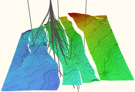
EarthModel FT Geophysics handles complex models with large numbers of faults. Assistants in the system guide you through all the steps to make it easy to deal with many faults and horizons. UpdateAbility is fully embedded in this process so that the model can be easily and quickly updated when data inputs change. This includes and is not limited to surface and fault handling and building grid meshes for low frequency modeling used in inversion workflows.
Reservoir Data Quality Control and Visualization
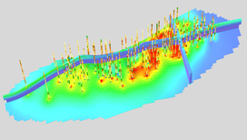
Porosity model distribution with porosity and facies well log curves EarthModel FT Geophysics provides all necessary tools to investigate and quality control your input data and results as well as create inputs for additional modeling workflows. The system provides tools for crossplots, histograms, cross sections, 2D maps and displays, plus full 3D graphics to view all elements of your project. Assistants in EarthModel FT link commonly used functionality, bring together viewers and parameters, and facilitate rapid movement between different items for investigation during modeling.
Risk & Uncertainty
EarthModel FT Geophysics enables “Knowledge Management” in geologic modeling. UpdateAbility makes evaluating “what if” scenarios easy and natural. By just changing a few input parameters, you can set up a variety of Monte Carlo simulation runs and explore different interpretations, multiple modeling scenarios, and options for production.
Key Features
- Powerful mapping and structural modeling with emphasis on complex faulting and volumetric calculations.
- Integral part of low frequency modeling workflows for inversion.
- UpdateAbility, a breakthrough in modeling technology, provides automatic rapid updates when data has changed or been added to a modeling project. As a workflow is built, every step is automatically recorded so that a complete history of the workflow is available at every stage of the project. As data changes or is added, all necessary processes will automatically run and keep the reservoir model current and dynamic.
- Tools to exchange data and models for characterization and inversion workflow studies with other modeling software packages.


