GeoThrust
GeoTomo's 2-D & 3-D Seismic Data Processing System
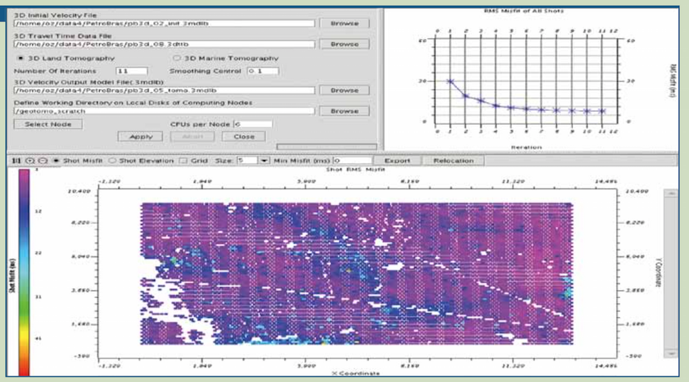
GeoThrust has been designed with a workflow architecture to obtain an accurate earth model and earth image in time and in depth from data recorded with irregular geometry in areas with rough topography, complex near-surface, and complex subsurface, with uncompromisingly high technical specifications for data analysis and quality control, but easy to learn and easy to use.
GeoTomo's GeoThrust2D/3D seismic data processing software is now a mature system --- it has been in use by major oil companies, national oil companies, and service companies for more than twelve years.
GeoThrust's workflow architecture provides the full freedom and flexibility for the user to follow any desired processing sequence. Additionally, to provide the GeoThrust user with streamlined solutions, we have constructed two uniquely image-based workflows --- the i-stats 2D/3D near-surface modeling and the i-cube 2D/3D subsurface imaging by using the various modules of GeoThrust.
The i-stats workflow for near-surface modeling is superior to traveltime tomography and full-waveform inversion in many respects. It does not require first-break picking as for traveltime tomography, does not require source wavelet estimation as for waveform inversion, does not fail velocity inversions as in traveltime tomography, does not suffer from velocity-depth ambiguity, does not require data modeling (traveltime or wave field) as for any inversion method, and does not exhaust computational resources as in waveform and joint inversions. In contrast with tedious and time-consuming first-break picking and editing required by traveltime tomography, the i-stats method is based on event and semblance picking --- interpretively appealing to the practicing geophysicist. In contrast with the yet-to-be-resolved practical aspects of waveform inversion and joint inversion methods, the intuitively appealing image-based i-stats method is extremely robust and efficient for modeling of near-surface anomalies. The i-stats method is applicable to correcting for near-surface anomalies associated with sand dunes, shallow anhydrites and salt bodies, shallow basalt layer, karstic formation, glacial tills, and permafrost.


