Geoscience Software
Geoscience is the branch of science dealing with planet earth, including features on the earth’s surface, and below it. In petroleum industry, geoscientists play an important role in finding underground oil and gas reservoirs. They are also involved in mapping and interpreting underground surface interpretation. Today there are a number of advance geophysical software packages available for processing, interpreting and running inversion on reservoir seismic data.


IsoMap
Subsurface Interpretation
GeoGraphix IsoMap utility is a comprehensive surface modeling and contouring application that can be used on a wide variety of data sets. IsoMap® provides 10 different interpolation algorithms, e.g. minimum curvature, adaptive fitting etc. from which geologic surfa ...
Read More ...
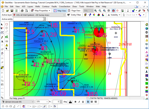
A Powerful Mapping Environment for Professionals
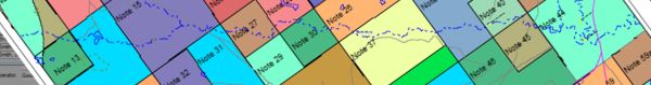
GeoAtlas is a robust mapping environment for GeoGraphix that facilitates displaying, modifying, and arranging map layers created in other GeoGraphix applications. It facilitates designing maps and montages, as well as providing a platform for other a ...
Read More ...
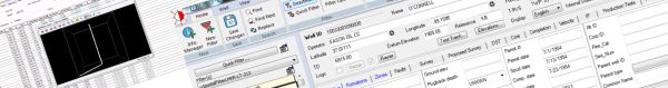
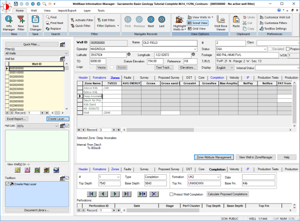
WellBase software provides access to a relational database management system for geological well data, including formation tops, deviation surveys, completions, perforations and other types of mechanical data. WellBase stores its data using the GeoGraphix® Data Model (GXDM). The model is based on an ...
Read More ...
LeaseMap software provides a complete understanding of any region's mineral interest and leasehold situation. Using industry standard reports and interactive maps, LeaseMap software helps you identify the details and status of mineral and lease holdings across your assets or in an area of interest. ...
Read More ...
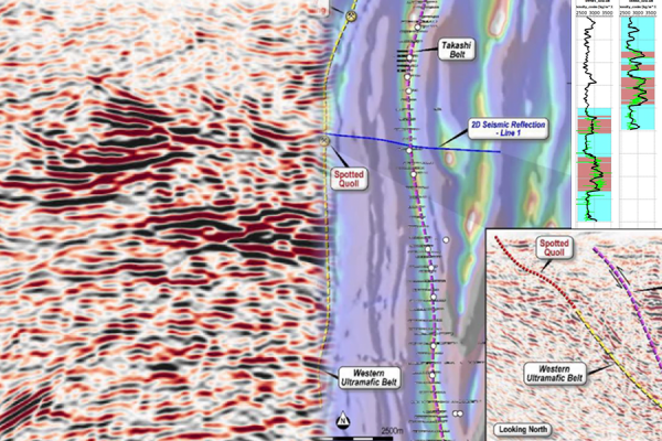
Accurately Tie Well Control to Seismic Data
LogM™ advanced synthetics software is the industry standard for seismic synthetic generation. It provides geoscientists with all the tools necessary to accurately tie well control to seismic data. Users can quickly link geological and seismic data and the ...
Read More ...
Powerful seismic interpretation for your play
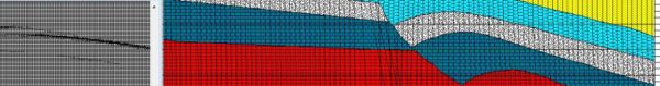
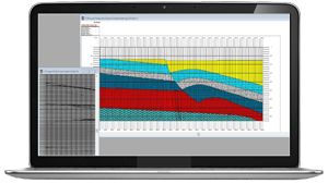
The LogM™ modeling package is an add-on to the Advanced Synthetic Package and includes industry-standard stratigraphic modeling and structural modeling. Stratigraphic models are easily generated from the cross-section view and include the formation corr ...
Read More ...
GeoCT-I is a fully automated refraction traveltime tomography application for Windows. It presents a new way to image the Earth. After you activate the software, point the program to the folder where the data will be recorded. As each new shot is recorded, the program will automatically load it and ...
Read More ...
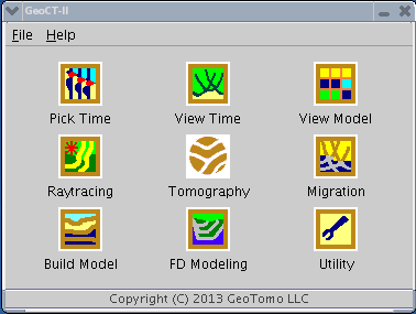
GeoCT-II is a 2D seismic modeling and imaging software package designed for geophysical engineering applications. It includes an advanced model builder, finite-difference full wavefield calculation for acoustic, elastic, and anisotropic media, raytracing and tomography for refraction, reflection, cr ...
Read More ...

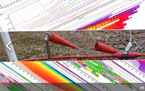
Professional software solutions for processing, inversion and visualization of geophysical data.
Aarhus GeoSoftware develops processing, inversion and visualization software for ground based and airborne EM data and ERT/IP data.
Software packages:
Aarhus SPIA: For groundbased single TEM and VES s ...
Read More ...