Geoscience Software
Geoscience is the branch of science dealing with planet earth, including features on the earth’s surface, and below it. In petroleum industry, geoscientists play an important role in finding underground oil and gas reservoirs. They are also involved in mapping and interpreting underground surface interpretation. Today there are a number of advance geophysical software packages available for processing, interpreting and running inversion on reservoir seismic data.
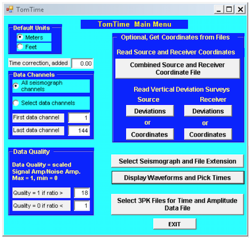
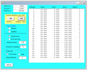
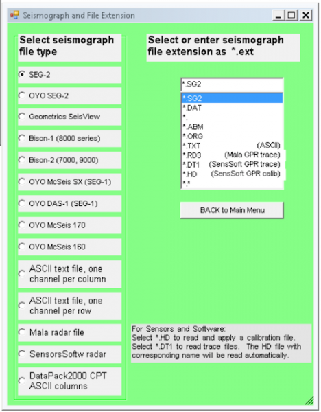
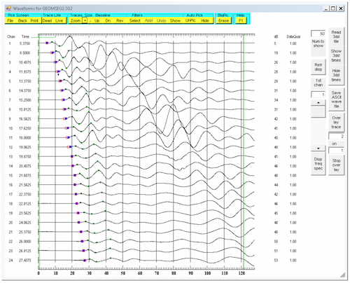
TomTime allows the user to pick traveltimes and amplitudes, and save those data with source and receiver 3-D coordinates in the format used as input by the tomography program GeoTomCG. The most common format is: Ray Identifier (integer) Source X, Y, Z Receiver X, Y, Z Time Amplitude (optional) e.g. ...
Read More ...
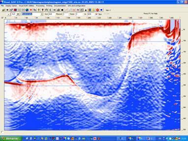
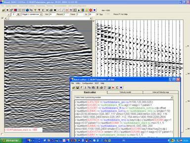
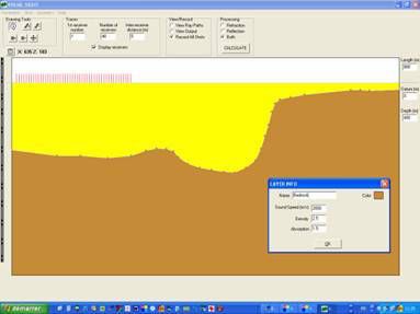
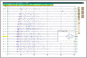
Visual_SUNT is a Windows 32 or 64 bits software that is linked to SUNT modules (Seismic UNIX for Windows). SUNT is an adaptation for Windows of SEISMIC UNIX (Center for Wave Phenomena of Colorado School of Mine). There are more than 100 modules allowing all usual steps of seismic reflection processi ...
Read More ...
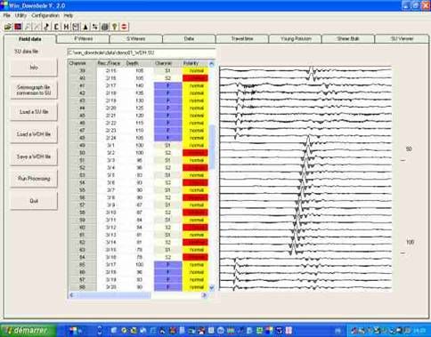
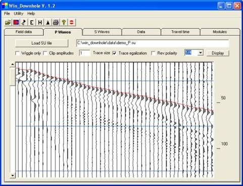
Grid with trace information and original SU file display
Import SEG2, SEG-Y,BISON, PASI, OYO, ABEM data files
Filtering and gain field records
Use 3 component geophones
Interactive P-waves and S-Waves first break picking
Invert and stack horizontal traces to enhance S-Waves
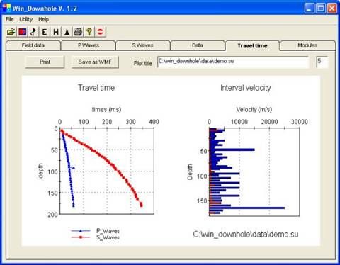
Produce travel ti ...
Read More ...
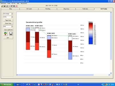
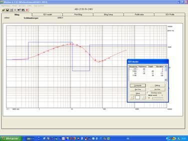
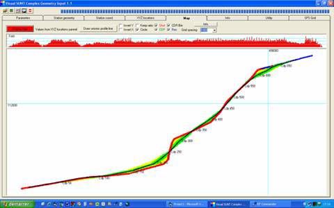
This software works under Windows® 32 and 64 bits It takes benefit of its display qualities, uses all the peripherals for printing and allows the transfer of the graphs by copy-and-paste and as metafiles. The use of the software is easy and intuitive. The measured values and the spread geometry can ...
Read More ...
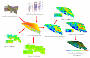
DepthInsight® Professional Edition is with a relatively complete functions including basic seismic interpretation, well data management, structural modeling, velocity and attribute modeling, reservoir property modeling and exporting simulation grid. Benefits:
Save your modeling time with its adva ...
Read More ...
Colored inversion, stochastic-geostatistical inversion, facies constrained pre-stack elastic inversion, spectral decomposition, structural attributes and seismic natural fracture proxies. Well ties, velocity modeling and time depth conversion.
Features:
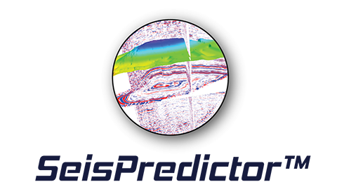
SeisPredictor™ Module uses imported seismic ...
Read More ...
Kirchhoff methods are widely recognized as one of the most comprehensive and flexible methods of imaging prestack 3-D seismic data. ZTK is Z-Terra’s implementation of three-dimensional Kirchhoff migration in depth and in time. ZTK images seismic data by approximately solving the wave equation with a ...
Read More ...
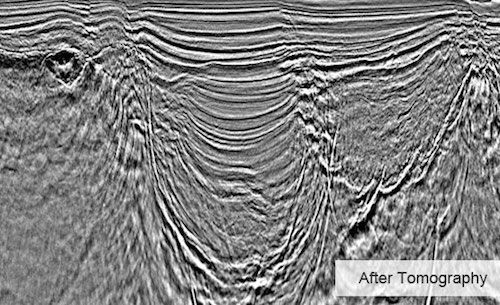
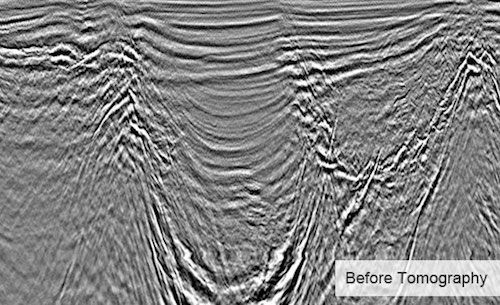
Obtaining high quality images of subsurface structures requires an accurate velocity model. Migration Velocity Analysis (MVA) improves the velocity model associated with a survey in order to create an accurate image of subsurface structures. After seismic data has been migrated through its current i ...
Read More ...
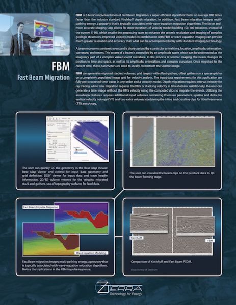
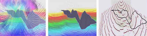
FBM is Z-Terra’s Fast Beam Migration, a super-efficient algorithm that is two orders of magnitude faster than the industry standard Kirchhoff depth migration. Fast Beam Migration images multipathing energy, a property that is typically associated with wave equation migration algorithms. The faster a ...
Read More ...

Diffraction Imaging (DI) is a novel seismic imaging technique for focusing diffractions in order to produce super-resolution images of diffractors unattainable by conventional means. Seismic diffractors are small scale scattering subsurface elements such as small faults, fault edges, pinch-outs, sal ...
Read More ...