Geoscience Software
Geoscience is the branch of science dealing with planet earth, including features on the earth’s surface, and below it. In petroleum industry, geoscientists play an important role in finding underground oil and gas reservoirs. They are also involved in mapping and interpreting underground surface interpretation. Today there are a number of advance geophysical software packages available for processing, interpreting and running inversion on reservoir seismic data.
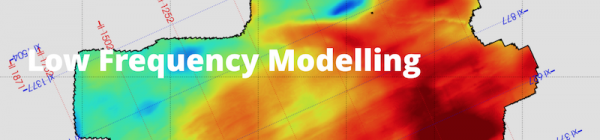
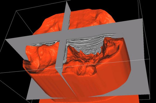
The Qeye low-frequency modelling uses well logs, seismic horizons and seismic velocities.
The algorithm supports the following features:
different depositional systems can be used between the horizons (conformable, on lapping and off-lapping)
radial basis function interpolation
interpolation g ...
Read More ...
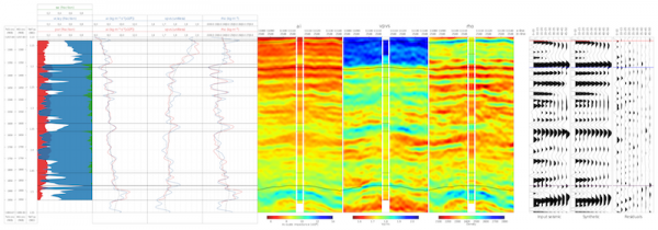
Historically, seismic data was used to generate images of the geological structure subsurface. Modern quantitative interpretation (QI) extracts additional, high value information from the (usually prestack) seismic data.
The variation of the seismic amplitude with incident angle (AVO) (and azimuth ...
Read More ...
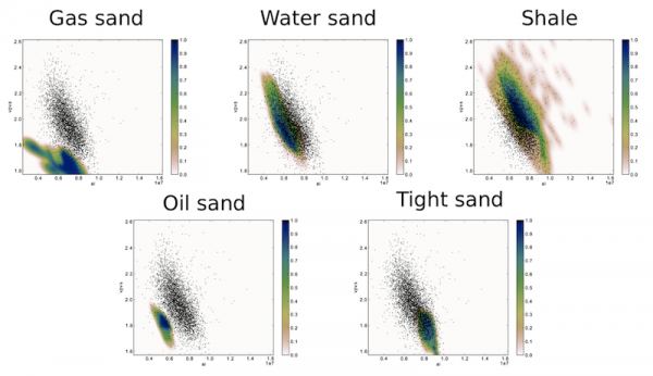
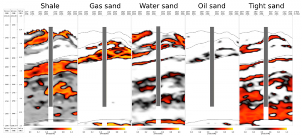
The prediction of subsurface lithology and fluid content can be performed using two approaches. The first approach is a Bayesian lithology classification scheme, which provides the probabilities of selected lithologies from their elastic response.
The second approach uses the derived rock physics m ...
Read More ...
With the Ikon Science alliance, FairfieldNodal now provides its clients with JiFi, an award-winning Bayesian pre-stack inversion with four unique benefits.
Estimation of facies and impedance properties in a single step
No conventional low-frequency model required
Greater use of rock physics inf ...
Read More ...

Capable. Reliable. Valuable.
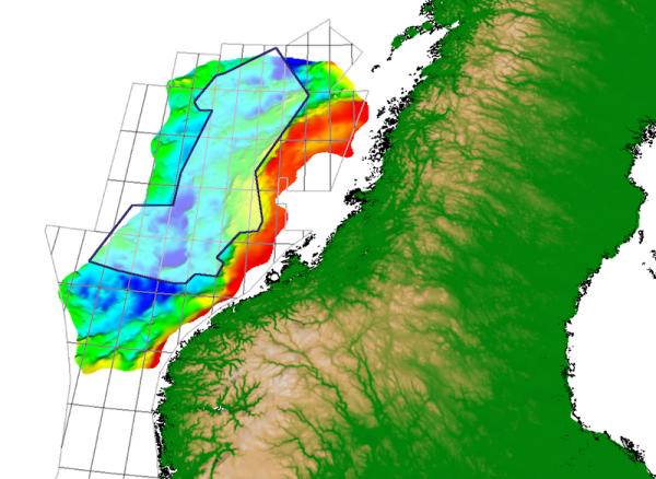
SeisQbe™ is a new addition to our product portfolio. It is a seamless merge of 3D full-stack final migration seismic data. All dynamically time and phase matched.
SeisQbe™ provides a consistent extensive coverage of the Norwegian Sea region and comes with supplementary ...
Read More ...

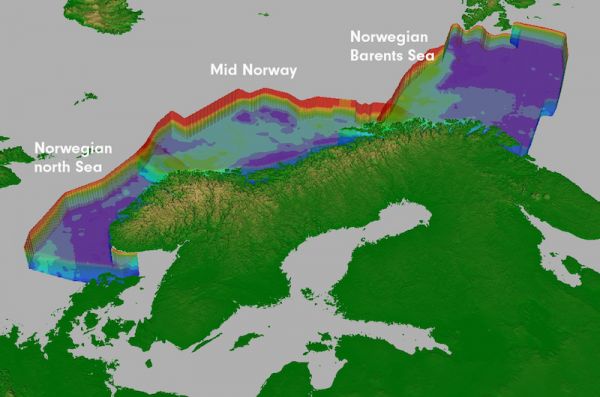
hiQbe™ is First Geo's regional high quality velocity cubes for depth conversion. Easily available to users, hiQbe™ enables the oil companies to change the way they work.
hiQbe™ is available as a multi client product in Norway, UK and Australia, based on a combination of data from the public domain ...
Read More ...
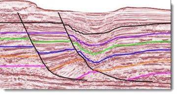
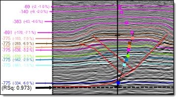
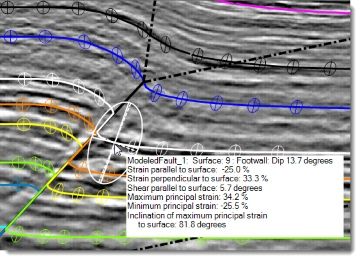
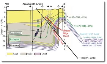
StructureSolver is an indispensable interpretation aid and structural analysis toolkit for earth scientists working in faulted basins.
StructureSolver helps you:
Understand structural and stratigraphic history
Infer correlations across faults
Validate fault and trap geometries
Determine detac ...
Read More ...
Bayesian Linear Inversion
LTrace Bayesian Linear Inversion provides a deterministic elastic seismic inversion using the linearized Bayesian methodology for estimating velocities or impedances and density. We use angle stacked seismic data - such as near, mid and far - along with low frequency model ...
Read More ...
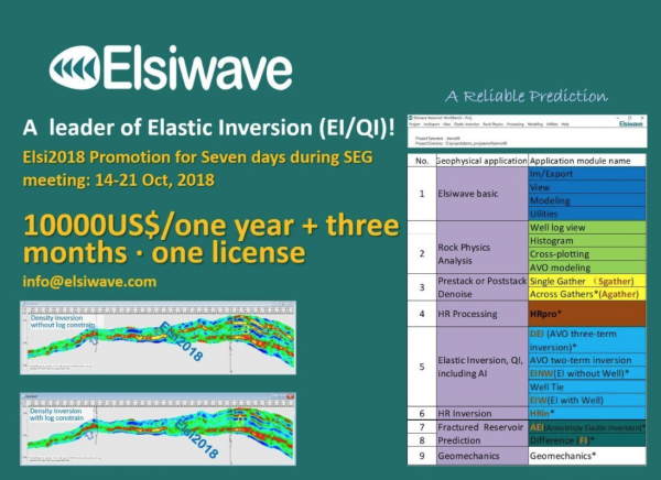
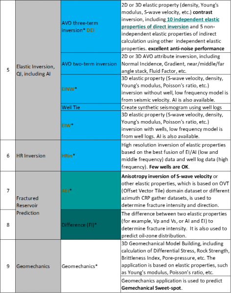
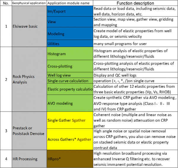
Elastic inverison dataset service
Elsi2018 Condition & Elastic Inversion EI/QI We invite you to test and witness its powerful amplitude-preserving denoise function, high S/N Elastic Inversion of 10 independent elastic properties including density (DEI module), high-resolution broadband processi ...
Read More ...
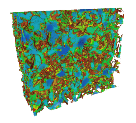
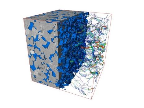
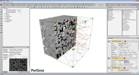
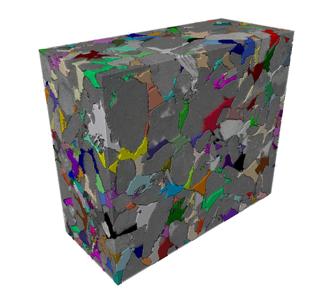
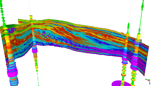
PerGeos Software
Digital rock analysis
Thermo Scientific™ PerGeos Software for digital rock analysis is the industry's first software designed to help geoscientists rapidly interpret digital rock imagery so that E&P engineers can quickly and easily obtain meaningful, actionable data. Its visua ...
Read More ...