Geoscience Software
Geoscience is the branch of science dealing with planet earth, including features on the earth’s surface, and below it. In petroleum industry, geoscientists play an important role in finding underground oil and gas reservoirs. They are also involved in mapping and interpreting underground surface interpretation. Today there are a number of advance geophysical software packages available for processing, interpreting and running inversion on reservoir seismic data.
LEASSV Version 2.9 Specification
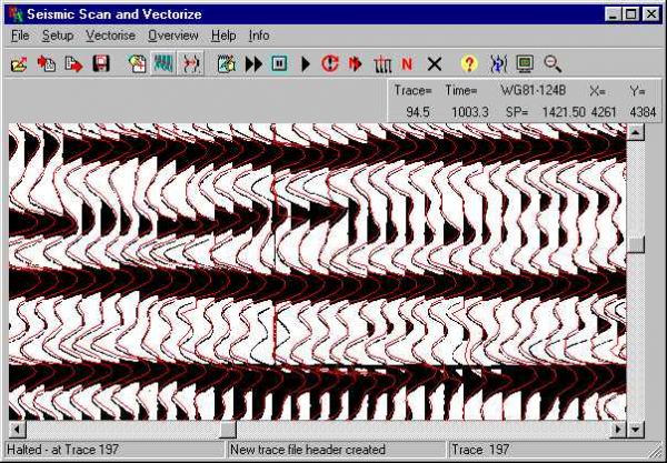
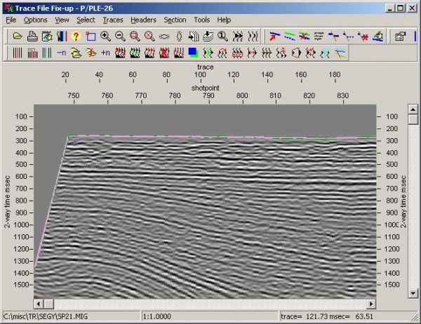
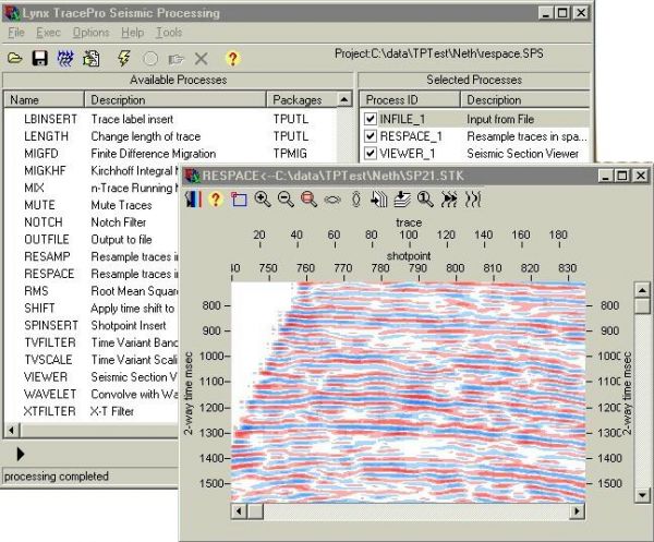
Lynx Exploration Archivist Seismic Scanning and Vectorising (LEASSV) software is a comprehensive software solution for re-vectorising scanned images of seismic sections and outputting the results as industry-standard SEG-Y format trace files. Using the utilities pro ...
Read More ...
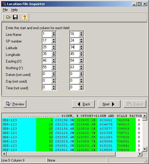
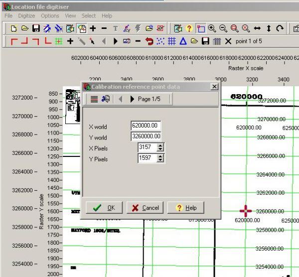
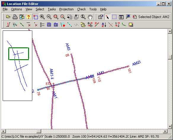
LEAMAP Version 3.0 Specification
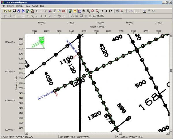
The Lynx Exploration Archivist Map Scanning and Vectorising (LEAMAP) software is a comprehensive software solution for converting hard-copy seismic line location (shotpoint) maps into digital data, and importing and editing existing location data from a variety of f ...
Read More ...
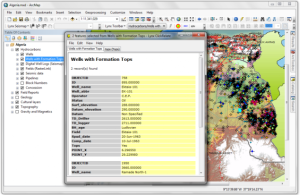
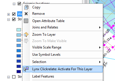
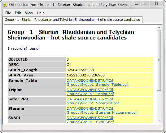
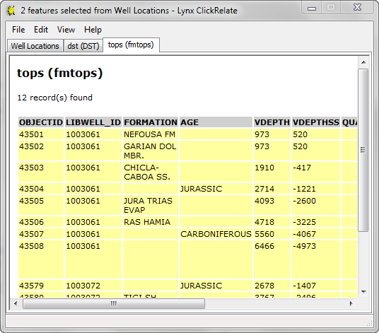
Lynx provides a number of plug-in extensions for ESRI ArcGIS Desktop®. ESRI is the market leader in GIS solutions, and its ArcGIS Desktop application suite is an essential tool for Explorationists.
Lynx has developed extensions which complement and extend the existing functionality in ArcMap:
Ly ...
Read More ...
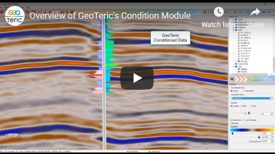
Improve signal to noise ratio and vertical resolution for the best possible post-stack seismic data conditioning results.
Interactive data conditioning tools offer preview-based noise attenuation and spectral shaping tools, enabling you to optimize your seismic data and gain a more detailed analysi ...
Read More ...
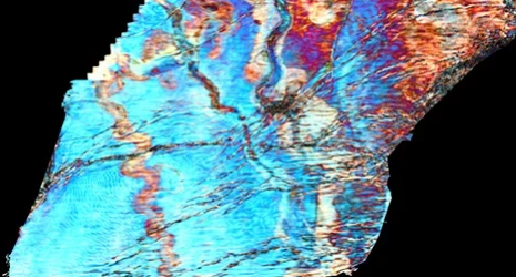
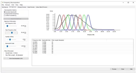
Reveal the geology in your data for a more insightful interpretation.
GeoTeric’s Reveal module comprises a comprehensive suite of attributes and volume mathematics tools to allow you to “see” and understand the geology before you interpret.
Industry-leading techniques including High Definition fre ...
Read More ...

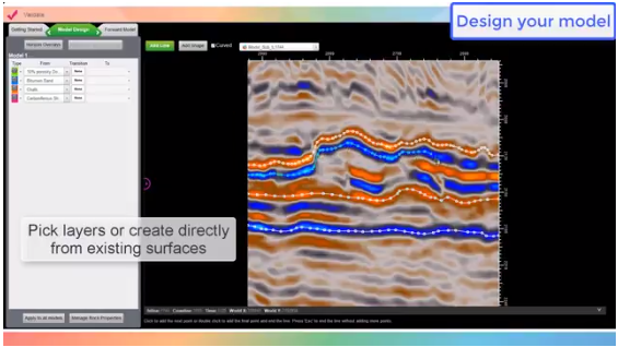
Build your structural models directly within the seismic volume, save time and incorporate all the details from your interpretation.
GeoTeric's modelling functionality allows you to build your models without getting into the (traditional) geocellular domain. Incorporating petrophysical property dis ...
Read More ...
QC and validate all available data, and/or the current hypotheses.
GeoTeric’s Validate module enables you to QC the accuracy of your interpretation and hypotheses. It allows you to test different geological scenarios and fluid/lithology models to de-risk drilling decisions. It provides a better und ...
Read More ...
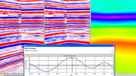
Automated Multi-volume Seismic Registration:
A flexible geophysical tool used for matching two or more seismic volumes for applications targeting: time-lapse reservoir monitoring, azimuthal fracture mapping and multi-component fluid and reservoir characterization.
Supports interactive and automate ...
Read More ...
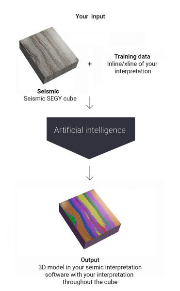


How does it work?
The AI technology is trained for volumetrical interpretation of 3D cubes by learning from traditional manual interpretations of geophysicists. The trained algorithm makes interpretations on seismic 3D cubes. The output integrates with the tools of the geophysicist and assists in h ...
Read More ...

INVERSION TO RESERVOIR PROPERTIES
Estimates of reservoir properties (porosity, lithology and fluids) using seismic data are customarily obtained through seismic inversion in two stages: in the first stage rock properties (P- and S-impedances and density, for example) are computed through elastic in ...
Read More ...