Shelf
Geocap Shelf is a full 3D toolbox including everything needed for continental shelf delineation in accordance with United Nations Convention on the Law of the Sea, Article 76.
Geocap Shelf is a complete solution for continental shelf mapping and determination of a nation's continental shelf beyond the 200 nautical mile limit according to Article 76 in the United Nations Convention on the Law of the Sea.
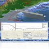
Geocap Shelf includes 3D visualization, Seismic interpretation, Depth conversion, Mapping, Foot of slope analysis, Outer Limit Generation, Final Outer Limit Table Generation, Base Line and Points analysis, Mid-line Generation, Sediment thickness generation and UNCLOS Article 76 specific algorithms.
Geocap Shelf also comes with additional functionality, including the Geocap Programming Language.


