A-Star™ Image Log Interpretation
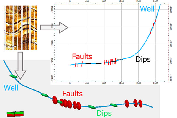
Example of the Borehole Image Log Interpretation
Interpret the Borehole Image Logs in Petrel by defining the dip and azimuth of the observed geological features.
Plug-in Overview
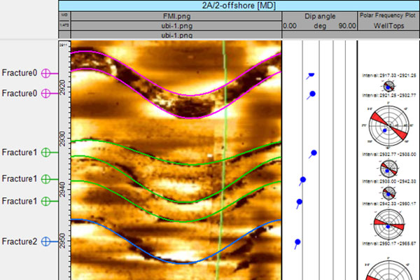
The plugin allows you to interpret the image log by defining the dip and azimuth of the observed geological features. The capabilities of Petrel’s object “top” have been extended – it can now be displayed as a “smile/frown” in the Well Section window. Each geological feature in the image log can now be described with a modified top (“smile/frown”).
Specifications
- Interpretation of the image logs with the different orientation: Top of the hole orientation or so-called high side orientation (typical for horizontal wells) or North orientation (typical for vertical wells)
- Interpretation of the image logs acquired in wellbores with the different diameters (defined manually or using a caliper log)
- The Image log depth of investigation is taken into account
Features
Interpretation consists of matching geological features on the image log (fracture, fault, beds boundary) with the “smile/frown” of the exact top. The results of the interpretation are stored under the true dip and true azimuth parameters of each top. The results can be used for horizontal well geosteering (see www.rogii.com for more information on well geosteering and image interpretation).


