GeoCloud
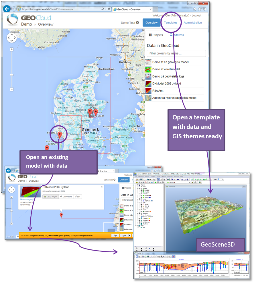
Combining GeoCloud and GeoScene3D enables easy access to existing data and models. The user defined templates offer the ability to start working with modelling, without having to go through the cumbersome task of compiling data and GIS maps. Everything is already customized by the user in a organization specific GeoCloud.
Overview and fast access to your geoscience data and geological models provides the basis for good data management. This can be a significant parameter for success in many situations e.g. the public administrator seeking information on available geoscience information for a specific area, or the private consultant working on a proposal for a new survey or modelling campaign seeking an overview of the company’s existing geological models, wells and other geological information for an area. With GeoCloud and GeoScene3D this task has become faster and easier.
GeoCloud store the geological models and the connected data, and make it available to both collegues and invited external partners. If needed, you may even make your models available to the general public.
Facilities for online, tailored Templates provides tools for creating task specific basic Template Models using the data content, GIS themes and program default values targeting a specific type of assignment. This could be a large scale regional groundwater mapping template, small scale template for a contamination site, city scale template for urban geological modelling - there's no limit!
Access to models and templates is managed by users with administrator privileges. Specific models can be made available for people assigned to a specific project.
Special development and integration
GeoCloud is continuously being updated and adjusted to customer specific needs. If your organization has special requirements or need for extra functionality, our GeoCloud developers are experienced in developing and adjusting the GeoCloud platform to your needs.


