SpatialQC
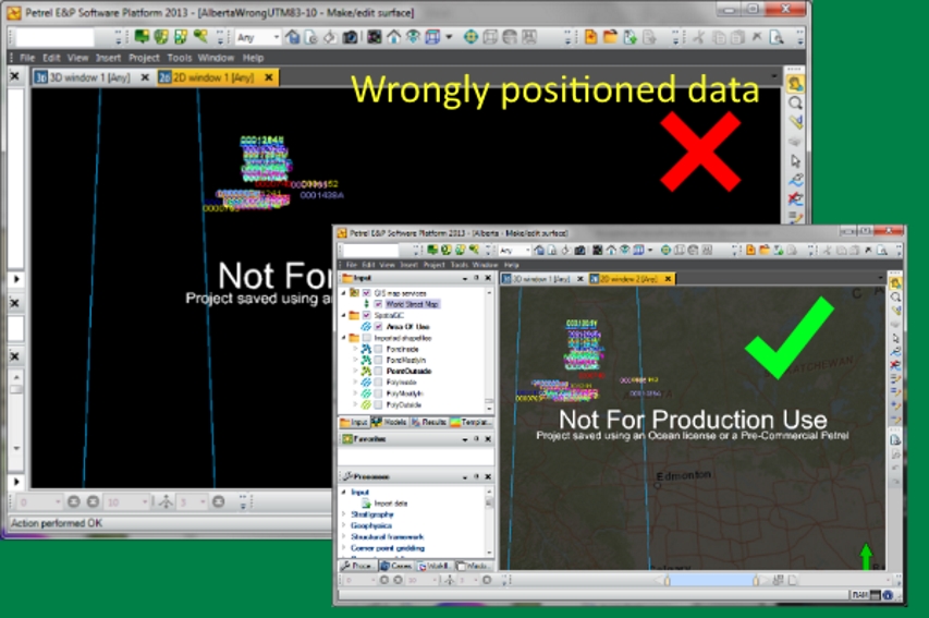
Your project CRS may become unfit as the study area grows
More data translates to better estimation and lower risk. Thus, it is common to see Petrel projects growing in data volume and geographical coverage. Using SpatialQC, users can check when the project data has exceeded the CRS valid coverage all at the click of a button.
Plug-in Overview
SpatialQC for Petrel provides a visual context to show whether Petrel objects are positioned in the right area. The plug-in is backed by the EPSG standard with fallback mode to Petrel default CRS catalog.
Specifications
- Insert a valid CRS area of use polygon to safeguard spatial quality
- Performs spatial data quality check on Petrel projects
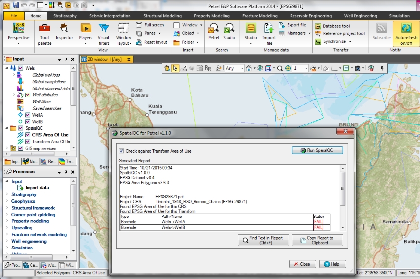
- Generates spatial quality report and allows users to copy it into other reports or applications
Features
SpatialQC for Petrel inserts a Coordinate Reference System area of use boundary into a Petrel project. This boundary provides a visual context whether the spatial data are within the proper area or otherwise. SpatialQC also generates a spatial quality report that highlights problematic Petrel objects. The plug-in is backed by the EPSG standard with fallback mode to Petrel default CRS catalog.


