Geoview
Geoview provides the power to visualize, interpret and manage seismic reservoir characterization projects easily and efficiently. Seamless visualization and interpretation functionality offers the ability to understand the reservoir complexity, while single window integration and data management tools make Geoview fast and easy to use.
Interpretation Framework
- Provides a foundation to access all HampsonRussell Software
- Incorporates powerful tools for seismic interpretation, mapping, cross plotting and visualization
- Utilizes a single intuitive interface to manage all data types and window sessions within a project
- Enhances efficiency and effectiveness with customizable workflows
Data Management and Project Efficiency
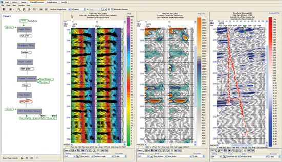
The integrated window design of HampsonRussell Geoview allows users to access their project data and processes from one centralized location. Geoview also includes a set of pre-loaded process workflows that can be easily customized and shared with other users, as well as batch and chained processing tools for improved efficiency.
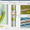
Interpretation Tools
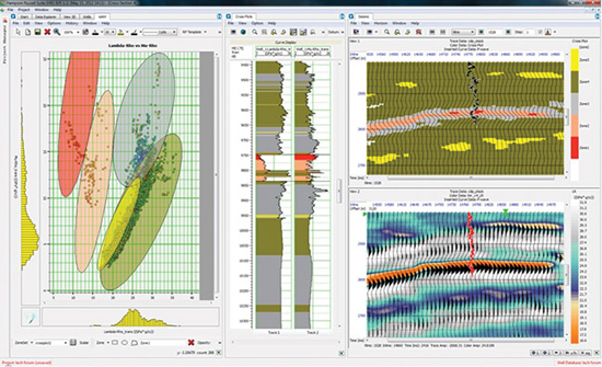
Integrated log and seismic interpretation tools give users the power to create accurate reservoir interpretations using crossplots, logs, seismic attributes and data slices simultaneously.
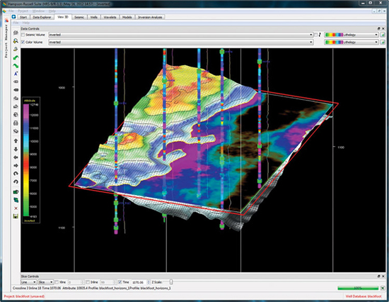
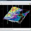
View3D
Geoview allows users to quickly and effectively visualize multiple data types in 3D, aiding reservoir characterization and interpretation.