List Categories and Listings by G
GasAssure Popular
GasAssure is an advanced integrated oil and gas, production planning technology which, in particular, can perform a vital role in the planning of short, medium and long-term gas projects. It offers a truly integrated solution, from "reservoir to market", for the widest range of gas planning issues ...
Read More ...
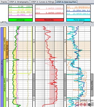
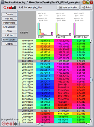
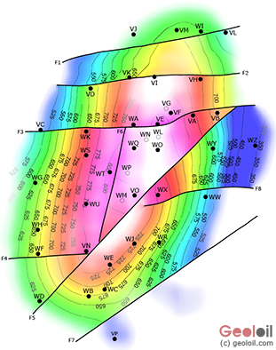
GeolOil Popular
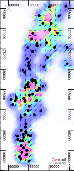
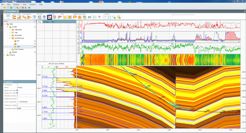
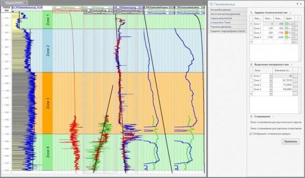
GeolOil is a software package suite for static reservoir modeling, providing solutions for petrophysics, geomechanics, upscaling, mapping, volumetrics, technology screening and Corner Point Simulation Gridding. The LAS well log reader and plotter module allows to read and visualize digital LAS files ...
Read More ...

Glass Popular
Designed from the ground-up with your exploration workflow in mind, Glass is a revolutionary advancement in Seismic Interpretation. Built on a foundation of tried and true science, Glass offers a modern user interface and compelling licensing options to maximize your exploration budget.
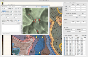
GeolMapDataExtractor is a program to extract information from a scan (raster image) of a geologic map or image of known scale. A huge assortment of maps are available for free online from the USGS and the GSC, or you can scan your own maps. StrikeDipThickness can read .jpg, .jp2, .png, .tif, and .pd ...
Read More ...
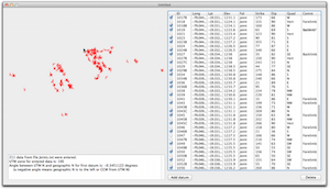
This program will take a table of orientation data, saved as tab-delimited text file, and reformat the data so that it can be read into v. 9-12 of Canvas GIS drafting software. Upon import, you will see all of your strikes and dips of bedding, cleavage, joints, or lineations plotted with their corre ...
Read More ...
Structural geology deals to a great extent with the operation of vectors and tensors. GeoKalk (previously GeoCalc) is a calculator for vectors (lines and planes), and tensors (strain and stress). GeoKalk is a document based application. Multiple calculators can be opened and saved as independent doc ...
Read More ...
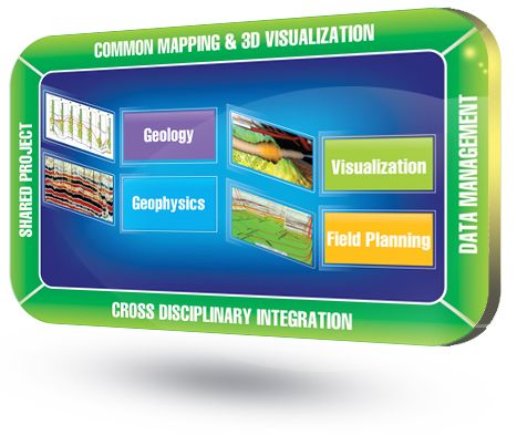
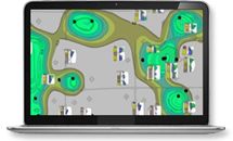
Complete, affordable, geoscience system offering leading edge mapping; geological, geophysical & petrophysical modeling; well and field planning; and, state-of-the-art 3D visualization. Its key strengths are found in the following:
It's a tightly-integrated geoscience suite that combines indu ...
Read More ...


“Geonaft” is a modular software package intended for comprehensive engineering support for directional and horizontal wells drilling aimed at the most successful bore positioning in a target horizon.
SP “Geonaft” allows determining the well stratigraphic position while drilling as well as to foreca ...
Read More ...
GAP Popular
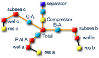
GAP is a multiphase oil and gas optimiser tool that models the surface gathering network of field production systems. When linked with the well models of PROSPER and reservoir models of MBAL a full field production optimisation and forecast can be achieved. GAP can model production systems containin ...
Read More ...

Landfill Gas Risk Assessment Tool GasSim was created and developed by Golder in 2002 for the Environment Agency of England and Wales as a tool to assess the risks to various receptors from landfill gas.

Sustainability decision support tool GoldSET - created and owned by Golder - is a multi-criteria analytical tool to evaluate the strengths and weaknesses of engineering projects with respect to the environmental, social, and economic dimensions of sustainable development. It allows for the compariso ...
Read More ...


GASTAR is the most flexible, user-driven software solution for managing natural gas transactions. From wellhead to burner tip, GASTAR gives our clients the power to manage information from all points of the natural gas life cycle. From any pipelines system, through any midstream function, to the loc ...
Read More ...
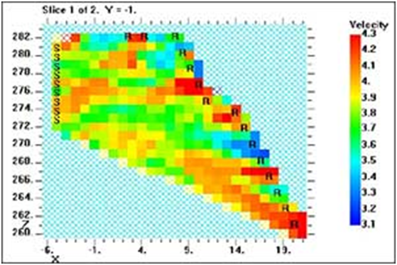
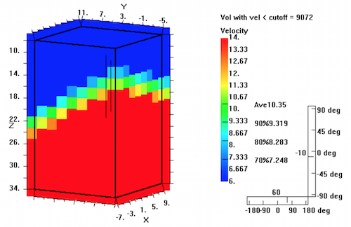
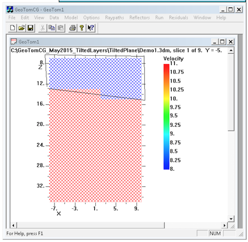
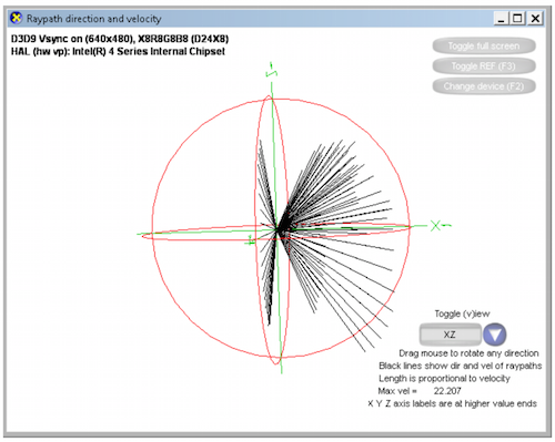
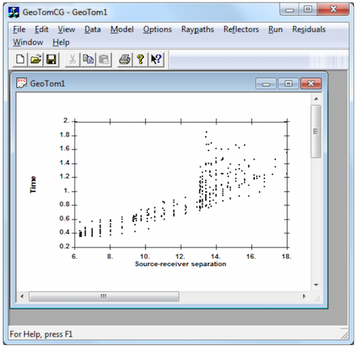
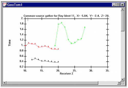
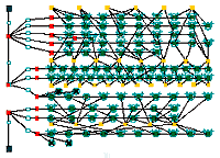
GeoTomCG performs 3D tomographic analyses. Source-to-receiver traveltimes can be analyzed to calculate velocities, or amplitudes can be analyzed to calculate attenuation coefficients. Source and receiver positions can be in any configuration within a 3D grid. The tomographic analysis calculates velo ...
Read More ...
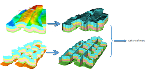
GridWorld DepthInsight® Express Edition is mainly designed for people who are satisfying with their current geological modeling and simulation software but the ability to model very complex geological geometries. Therefore, it enables you to efficiently, effectively and stably build complex flexible ...
Read More ...
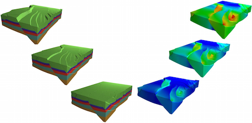
Structural Restoration can be used to verify the geological understandings of geologists through the structural restoration and give more reasonable interpretation data which follows geological principles to a large extent. Through a constant correction of understandings with the trial of structural ...
Read More ...
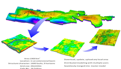
There are many oil fields which are very large and have fine data, such as Daqing oil field and Heidrun oil Field. It would be very helpful for the exploration and production of these kind of oil fields to have a piece of model of the entire reservoirs. Usually, there are two ways to achieve it. One ...
Read More ...
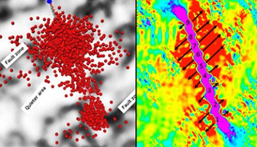
Reservoir geomechanics using the Material Point Method (MPM) to model interaction between hydraulic and natural fractures, predict differential stress and strain validated with microseismicity. Includes elastic and poroelastic modeling for modeling well interferences.
Features:
FracGeo advanced ge ...
Read More ...
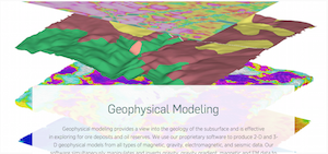
Geophysical modeling provides a view into the geology of the subsurface and is effective in exploring for ore deposits and oil reserves. We use our proprietary software to produce 2-D and 3-D geophysical models from all types of magnetic, gravity, electromagnetic, and seismic data. Our software simu ...
Read More ...
Excel based software
geoSCOUT is the industry leading decision-support tool, providing comprehensive data for all disciplines within the Oil and Gas industry. By integrating public and proprietary data in wells, well logs, land, pipelines and facilities, fields and pools and seismic studies, geoSCOUT gives you access to ...
Read More ...