smartSTRAT®
Plan more wells, drill more wells, and do so faster, and with greater accuracy. Geoscientists today are tasked with this challenge as horizontal well drilling and "factory production" development methodologies increase in popularity. As they seek to tackle this seemingly daunting challenge, these same geoscientists are also responsible for developing new plays and drilling locations. Needless to say, it is imperative that the geosteering process remain efficient; as new drilling data arrives, the geoscientist can interpret and integrate it into the geomodel quickly, all in an effort to keep the drilling on target.
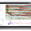
Such efficiency is achieved with smartSTRAT®, an add-on module to GeoGraphix® smartSECTION® . It enables fast,easy, and accurate horizontal well geosteering with instantaneous geomodel updates. The module offers easy-to-use, geosteering tools with the capacity to view depth-converted seismic backdrops and formations and faults. It also offers direct integration with mapped, geologic surfaces within the 3D geomodel. This unique ability affords the geoscientist greater efficiency and accurate, geologic correlations and predictions. This additional level of quality assurance allows the geoscientist to stay ahead of the drill bit, avoid faults and other geohazards, and keep the borehole in-zone.
During the geosteering process, geoscientists interactively update their geologic models in smartSECTION® with new picks, inter-well points, and revised drilling targets. The resulting interpretations are displayed seamlessly in GeoGraphix® advanced 3D visualization, allowing for effortless problem identification and avoidance.
smartSTRAT integrates directly with GVERSE WebSteering, light-weight web based geosteering tool, to update the geomodel from remotely steered wells. Together, smartSTRAT and WebSteering provide the best light-weight, fast, and powerful remote geosteering solution.


